Just outside the east entrance to Big Bend Ranch State Park, Lajitas has become quite a popular location for winter vacations, offering a scenic golf course and various lodging options. There are no (paved) side roads into the rocky land north of the river; instead the only onward route is Farm Road 170, which continues east towards Study Butte and Big Bend National Park through the semi ghost town of Terlingua.
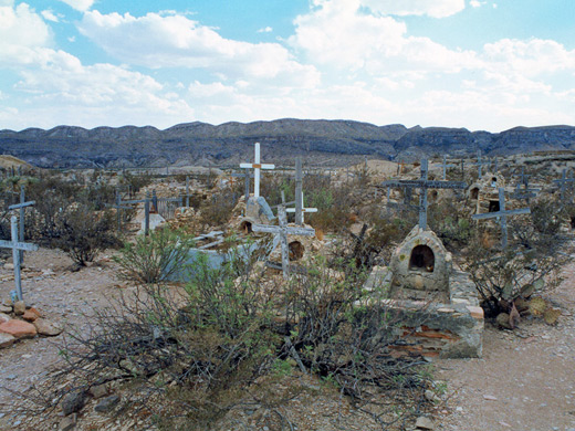
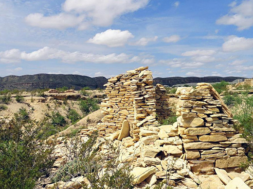
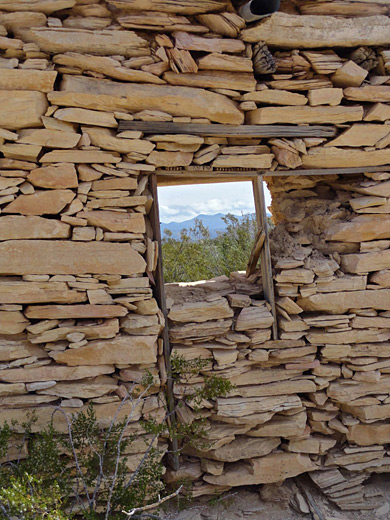
Terlingua was once a thriving mining center where cinnabar (mercury ore) was excavated around the end of the nineteenth century, then became gradually deserted following exhaustion of the deposits, but has now become popular once more in recent years - a collection of retired folk, artists and escapees from city life mix with regular visitors to create a lively community. Many abandoned stone buildings and mine relics remain, and the town has an interesting old cemetery. Colourful hills surround the town, good for mountain biking and rock collecting - distinctive orange/red cinnabar crystals are commonly found, plus various other types of minerals.
In the other direction, FM 170 continues past the Big Bend Ranch State Park boundary to Presidio, and beyond to the little town of Ruidosa, across land which is flatter and less scenic. There are distant mountains to the north and several other small, sleepy settlements but no points of major interest. An unpaved section extends even further, 13 miles along the Rio Grande to Candelaria, then there are no roads or villages for another 100 barren miles, until I-10 comes close to the river.
Presidio is a large, spread-out town with a high Spanish-speaking population and few tourist facilities, but quite busy as it has the only official border crossing from USA into Mexico for 450 miles between El Paso and Del Rio. The main road north, US 67, is a well-travelled four-lane highway that crosses the edge of the Chinati Mountains which offer some good views over the desert to the east but there is little else of interest along the long journey to the next town, Marfa on US 90.
Terlingua
Terlingua was once a thriving mining center where cinnabar (mercury ore) was excavated around the end of the nineteenth century, then became gradually deserted following exhaustion of the deposits, but has now become popular once more in recent years - a collection of retired folk, artists and escapees from city life mix with regular visitors to create a lively community. Many abandoned stone buildings and mine relics remain, and the town has an interesting old cemetery. Colourful hills surround the town, good for mountain biking and rock collecting - distinctive orange/red cinnabar crystals are commonly found, plus various other types of minerals.
The Northwest
In the other direction, FM 170 continues past the Big Bend Ranch State Park boundary to Presidio, and beyond to the little town of Ruidosa, across land which is flatter and less scenic. There are distant mountains to the north and several other small, sleepy settlements but no points of major interest. An unpaved section extends even further, 13 miles along the Rio Grande to Candelaria, then there are no roads or villages for another 100 barren miles, until I-10 comes close to the river.
Presidio
Presidio is a large, spread-out town with a high Spanish-speaking population and few tourist facilities, but quite busy as it has the only official border crossing from USA into Mexico for 450 miles between El Paso and Del Rio. The main road north, US 67, is a well-travelled four-lane highway that crosses the edge of the Chinati Mountains which offer some good views over the desert to the east but there is little else of interest along the long journey to the next town, Marfa on US 90.
All Contents © Copyright The American Southwest | Comments and Questions | Contribute | Affiliate Marketing Disclosure | Site Map