Highlights:
Narrow, thickly wooded canyon containing the Cimarron River, bordered in some places by sheer granite cliffs. Hiking, camping and fishing are the main activities, but for many people the attraction is the road itself, one of the most scenic drives in New Mexico
Nearby town:
Eagle Nest, 4 miles
Management:
Location:
Seasons:
All year
Rating (1-5):
★★★★★

The Cimarron Range is a part of New Mexico's Rocky Mountains, west of the quiet town of Cimarron and northeast of the higher, more extensive Sangre de Cristo Mountains. From the town, highway US 64 follows the valley of the Cimarron River, through land that changes from arid prairie to chaparral to forest as the elevation increases.
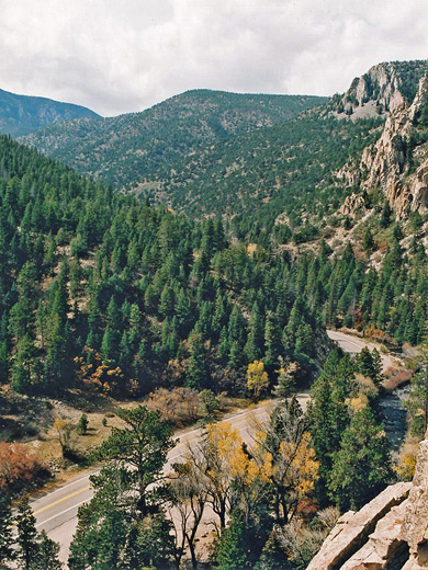
After Ute Park village, the valley narrows, the scenery becomes more dramatic and the river enters Cimarron Canyon, 8 miles of which is contained within a 33,000 acre state park (part of the Colin Neblett Wildlife Area); besides the ravine itself, the park includes several miles of the mountains to the north and south, though this is rather inaccessible and most visitation is confined to the river corridor.
After Ute Park village, the valley narrows, the scenery becomes more dramatic and the river enters Cimarron Canyon, 8 miles of which is contained within a 33,000 acre state park (part of the Colin Neblett Wildlife Area); besides the ravine itself, the park includes several miles of the mountains to the north and south, though this is rather inaccessible and most visitation is confined to the river corridor.
Photographs
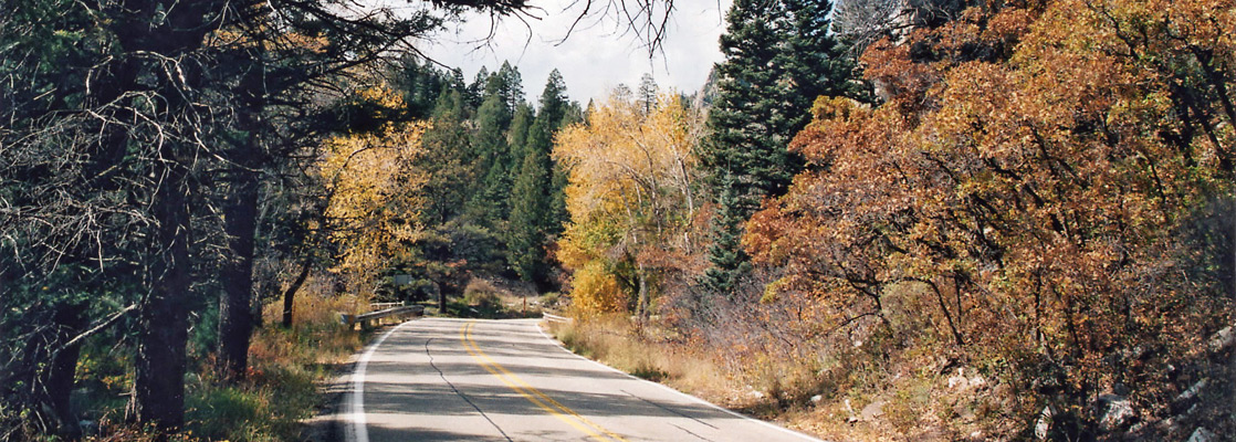
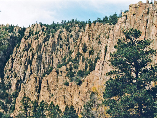
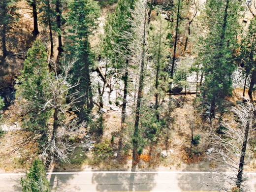
5 views of Cimarron Canyon State Park.
Activities in the State Park
Since a main road runs through the valley, there is no charge to enter Cimarron Canyon State Park, though fees are due for many of the parking spots. The highway passes plenty of pullouts and picnic areas, and several campgrounds, the largest near the tranquil Gravel Pit Lakes. The western part of the canyon is wider and the sides less steep, and at the end the land opens out to a high mountain valley, site of Eagle Nest Lake (elevation 8,167 feet), which was formed in 1918 by damming the Cimarron River, and is popular for boating and fishing. Another campsite is found near the dam, and more facilities are available at the nearby town of Eagle Nest, where the main highway turns south towards Taos, and a lesser road to the north crosses more mountainous terrain to Red Rivers and Questa. Fishing is also one of the main activities along Cimarron River, through the canyon, as the waters are especially plentiful for rainbow and brown trout - though not for some months during winter as the flow is cut off at the dam, to build up lake levels. Rafting and canoeing along the river are possible most of the year.
Scenery
Much of Cimarron Canyon is quite narrow, so the road runs right next to the creek, crossing it several times. Aspen trees grow on the river banks and in occasional patches higher up though most trees are pine. Some parts of the walls form sheer cliffs, especially the Palisades, a 400 foot tall jagged granite outcrop. Climbing the valley sides at either side gives a much better view of the rocks, though in general, easy routes up into the mountains are limited because of steep slopes and dense forest. There are however several official trails - two heading south along Tolby Creek and Clear Creek, and two leading into the hills on the north side (the Maverick Canyon and Jasper/Agate trails). The river is fast flowing but quite shallow, and is home to a sizeable population of beaver, while other less common animals in the state park include black bear, elk and mule deer.
Cimarron Canyon - Nearby Places
- Capulin Volcano National Monument (85 miles) - ancient volcano, rising 1,000 feet above the surroundings
- Wild Rivers Recreation Area (41 miles) - the Red River and the Rio Grande, flowing through deep, volcanic canyons
Cimarron Canyon - Similar Places
- Oak Creek Canyon, Sedona, Arizona - deep, wooded canyon with a stream flowing through
- San Juan Mountains, Colorado - superb mountain scenery
All Contents © Copyright The American Southwest | Comments and Questions | Contribute | Affiliate Marketing Disclosure | Site Map