Zabriskie Point, Death Valley National Park
California > Death Valley National Park > The South > Zabriskie Point
Zabriskie Point
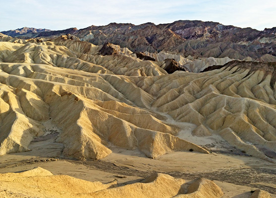
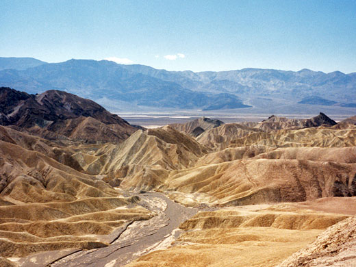
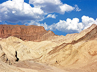
Perhaps the most famous Death Valley viewpoint; an elevated overlook of a huge area of yellow-brown-black badlands, with the white salt flats in the main valley beyond. The landscape can be seen from short walks near the viewpoint, or a longer hike towards Golden Canyon
Season: All year, since little or no hiking is required at the overlook. The trail to Golden Canyon is best avoided in summer
Location: Parking area along Hwy 190
Rating (1-5): ★★★★★
Location: Parking area along Hwy 190
Rating (1-5): ★★★★★

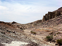
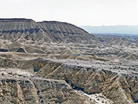
Zabriskie Point is an elevated overlook of a colorful, undulating landscape of gullies and mud hills at the edge of the Black Mountains, just a few miles east of Death Valley - from the viewpoint, the flat salt plains on the valley floor are visible in the distance. In the past it was possible to drive right to the edge of the overlook, and several minutes of the famous Zabriskie Point movie (1970, Antonioni) was set there, but since then a new larger car-park has been constructed lower down and visitors now have a short walk uphill.
Most people do little more than briefly admire the scenery, which is best at sunrise, but it is easy to climb some of the adjacent hills to get a better overall view, or wander down amongst the variegated dunes. A hiking trail leads through the mounds, down a ravine and into Gower Gulch after 2 miles, while another branch veers north into Golden Canyon.
Map of Death Valley National Park and surroundings.
14 views of the Golden Canyon/Gower Gulch/Zabriskie Point area.
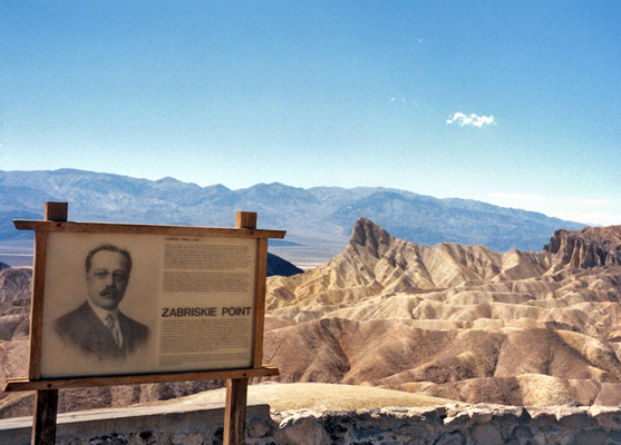
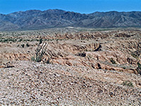
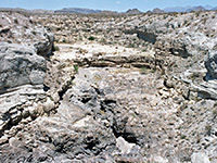
The overlook is named in recognition of Christian Brevoort Zabriskie (1864-1936), president of the Pacific Coast Borax Company, who have been active in the Death Valley region since the 1890s. More of the same landscape can be viewed along the unpaved 2.7 mile, one-way Twenty Mule Team Road which leads into Twenty Mule Team Canyon, past colorful rocks, badlands and desolate mud hills, formed by evaporation of an ancient lake. The name of the road is a reference to the teams of mules that once pulled wagons loaded with borax from mines on the valley floor.
Most people do little more than briefly admire the scenery, which is best at sunrise, but it is easy to climb some of the adjacent hills to get a better overall view, or wander down amongst the variegated dunes. A hiking trail leads through the mounds, down a ravine and into Gower Gulch after 2 miles, while another branch veers north into Golden Canyon.
Location
Map of Death Valley National Park and surroundings.
Photographs
14 views of the Golden Canyon/Gower Gulch/Zabriskie Point area.
Twenty Mule Team Canyon
The overlook is named in recognition of Christian Brevoort Zabriskie (1864-1936), president of the Pacific Coast Borax Company, who have been active in the Death Valley region since the 1890s. More of the same landscape can be viewed along the unpaved 2.7 mile, one-way Twenty Mule Team Road which leads into Twenty Mule Team Canyon, past colorful rocks, badlands and desolate mud hills, formed by evaporation of an ancient lake. The name of the road is a reference to the teams of mules that once pulled wagons loaded with borax from mines on the valley floor.

Zabriskie Point - Similar Hikes
All Contents © Copyright The American Southwest | Comments and Questions | Contribute | Affiliate Marketing Disclosure | Site Map