Highlights:
Large protected expanse of the Sonoran Desert southwest of Phoenix, almost completely undeveloped but crossed by a few unpaved tracks; contains isolated mountain ranges separated by wide, flat, cactus-covered plains
Nearby town:
Management:
Location:
32.841, -112.254 (I-8, Vekol Valley exit)
Seasons:
All year, but best avoided in summer owing to the extreme heat
Rating (1-5):
★★★★★

Sonodan Desert NM is part of the Arizona Deserts itinerary
Featured Hotel
Best Western Space Age Lodge
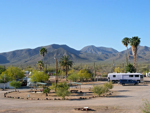
 Space-themed hotel in the center of Gila Bend, walking distance from shopping and dining. The western boundary of the national monument is 8 miles away
Check Rates
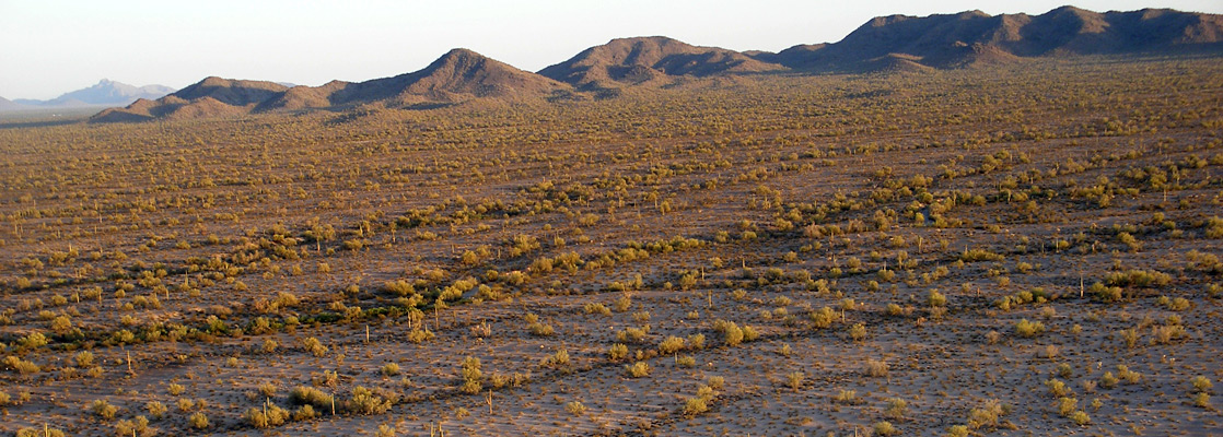
496,600 acres of cactus plains and rugged mountain ranges southwest of Phoenix became, in 2001, the Sonoran Desert National Monument, one of four new BLM-administered zones in Arizona. Unlike NPS national monuments, the Sonoran Desert has very few facilities and no central attraction; its purpose is mainly to protect the historic sites, Indian relics, native habitats, vegetation and wildlife rather than attract visitors.
The designated area spans 25 miles of land either side of interstate 8 (see map), with about half to the south, comprising the Table Top Wilderness, Vekol Valley and part of the Sand Tank Mountains, and half to the north, centered on the North and South Maricopa Mountains Wilderness.
Hence, almost all of the Arizona desert south of I-8 is now protected or used in some way, either within Indian Reservations, the Luke Air Force Base, or preserves of the NPS and BLM. There is however plenty of empty Sonoran desert in the state that still has no special protection beyond existing wilderness areas, between I-8 and I-10, and between the Colorado River and US 95, land which is just as scenic as this new monument.
Sonoran Desert Table of Contents
- Map of the national monument
- Photographs
- Access routes, I-8 and Maricopa Road
- The South - Vekol Valley Road
- The South - Freeman Road
- The North - Maricopa Mountains
- Nearby places
- Similar places
Location
Map of Sonoran Desert National Monument.
Photographs
20 views of Sonoran Desert National Monument.
Video
Desert tortoise on Lost Horse Peak (mp4; 1:11 min).

Roads of Sonoran Desert NM
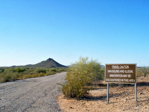
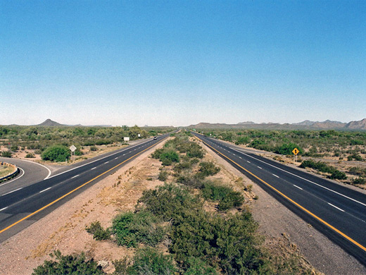
Interstate 8 is the main highway through the Sonoran Desert National Monument, and exits 151, 144 and 140 allow access to the backcountry via a network of rough tracks. Another entrance route is the little traveled Maricopa Road (AZ 238) between Maricopa and Gila Bend, which parallels a railway, running between the two sections of the Maricopa Mountains. Apart from these two, only dirt roads cross the desert, all of which may require 4WD in some places or at some times of year. Besides the obvious dangers due to the remoteness, rough terrain, spiky plants and extreme summer temperatures, the area is also affected smuggling and illegal immigration, but despite the emptiness, the desert is not completely undeveloped as there are several maintained trailheads in the pre-existing wilderness areas, and BLM rangers now patrol the back roads quite regularly.
The South - Vekol Valley Road
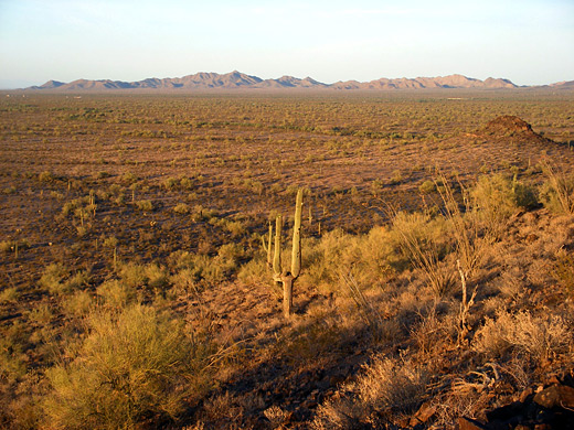
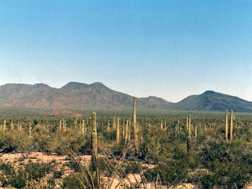
Exit 144 of I-8 is the main entrance to the national monument, and from here quite a good gravel track (Vekol Valley Road) heads south, past a BLM welcome sign, and along the wide plains of Vekol Valley - sandy, level land bearing scattered bushes, palo verde trees and cacti. To the east are the Table Top Mountains, rising to a high point of 4,374 feet at Table Top itself, a flat topped volcanic summit, and one of the few locations with a recognised trail. The trailhead is reached by taking a left turn 6.8 miles from the interstate then driving another 4.5 miles along a rather rougher track, and has a small parking area plus a three site primitive campground. The trail is 3.5 miles (one-way), climbs over 2,000 feet and has panoramic views over the surrounding desert. One other maintained path (Lava Flow Trail) traverses the western slopes of the mountains, in places over basalt rocks and lava, though mostly over dry washes and through bushy flatland. It has three trailheads, one along the Table Top road, the other two reached from side tracks of Vekol Valley road. On west side of Vekol Valley are the cactus-covered White Hills, which are quite close to the road and so are good for short off-trail explorations, then beyond are the much larger Sand Tank Mountains, most of which are owned by the military and require a permit to explore.
The South - Freeman Road
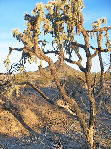
A little further west, I-8 exit 140 is the start of another long, rough route (Freeman Road) into the monument backcountry, leading to various sites in the White Hills and the Sand Tank Mountains. There is also a short, disused gravel track running parallel to the interstate and about half a mile from it, which makes a perfect place to camp - out of direct sight from the highway, and overlooking large areas of roadless saguaro forest. The land nearby is flat apart from a small solitary summit (Lost Horse Peak) one mile south, reachable by an easy walk across the open, stony ground followed by a short climb up the rocky slopes. The top of the peak is well defined so there is nothing to block the 360-degree view over the surrounding mountains and plains.
The North
The section of Sonoran Desert National Monument north of the interstate encloses the two ranges of the Maricopa Mountains, and is bordered by AZ 85 to the west and Little Rainbow Valley in the northeast. Besides the desert and mountain scenery, this contains a section of the Anza National Historic Trail, and like the southern portion, has two recognised paths (the 6 mile Brittlebush Trail and the 9 mile Margie's Cove Trail), both in the Northern Maricopa Mountains Wilderness. The Southern Maricopa Mountains Wilderness is the most remote in the national monument, with no trails or 4WD tracks.
Sonoran Desert - Nearby Places
- Picacho Peak State Park - volcanic mountain in the Sonoran Desert
- South Mountain Park - saguaro-covered mountains within Phoenix city limits
Sonoran Desert - Similar Places
- Kofa Wildlife Refuge, Arizona - desert region with a distinct sense of isolation
- Saguaro National Park, Arizona - mountainous area near Tucson with many large cacti
All Contents © Copyright The American Southwest | Comments and Questions | Contribute | Affiliate Marketing Disclosure | Site Map