Tuwa Canyon, Natural Bridges National Monument
Utah > Natural Bridges National Monument > Tuwa Canyon
Tuwa Canyon
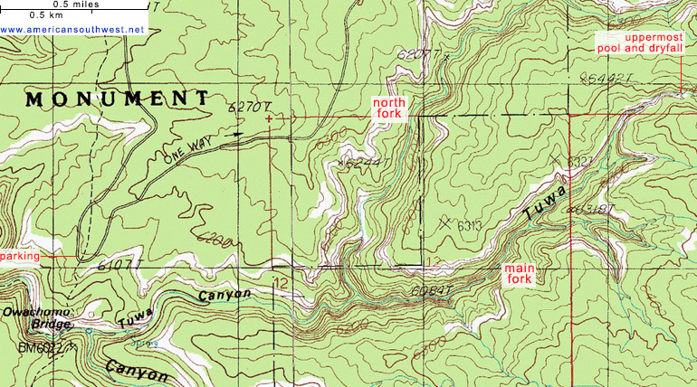
Relatively shallow tributary of Armstrong Canyon, joining just below Owochomo Bridge; upstream it splits into two forks, extending outside the national monument. Both contain pools and pour-offs, and may be explored via an off-trail hike
Length: 6.5 miles (round trip)
Elevation change: 560 feet
Difficulty: Moderate; various pools and dryfalls to pass
Type: Partial loop, off-trail
Usage: Low
Season: All year, apart from after heavy rainfall
Trailhead: Pullout along the loop road, for Owochomo Bridge
Rating (1-5): ★★★★★
Elevation change: 560 feet
Difficulty: Moderate; various pools and dryfalls to pass
Type: Partial loop, off-trail
Usage: Low
Season: All year, apart from after heavy rainfall
Trailhead: Pullout along the loop road, for Owochomo Bridge
Rating (1-5): ★★★★★

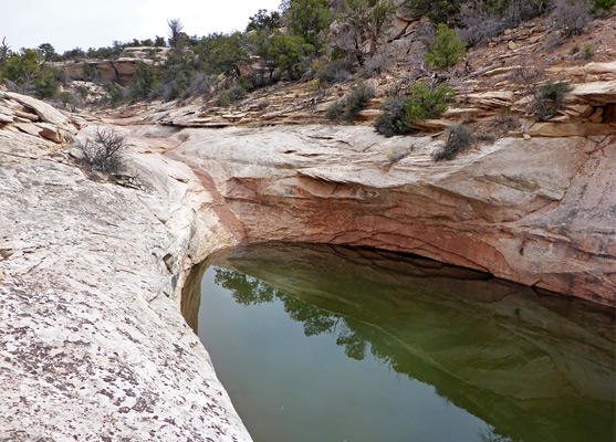
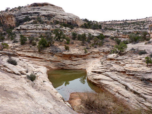
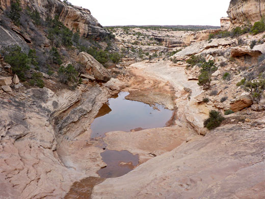
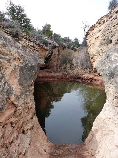
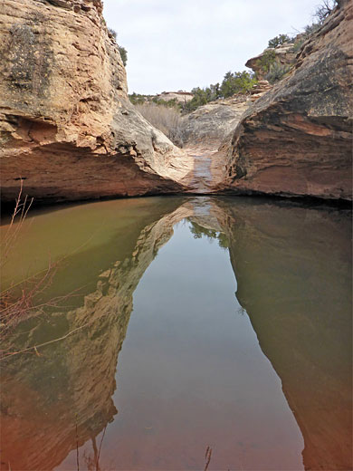
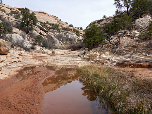
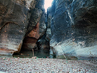
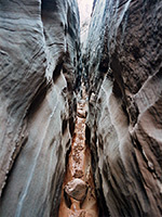
Tuwa Canyon is a relatively shallow, branched tributary of Armstrong Canyon, joining just upstream of Owachomo Bridge near the south edge of Natural Bridges National Monument, where the canyon sides are only about 150 feet high. The confluence is marked by a large, permanent pool, and after rains the main fork of Tuwa Canyon contains up to a dozen more large pools and various watery potholes, separated by flat, open sections and interrupted by small dryalls, and while there is no trail through the canyon, it can be explored quite easily, leaving the streambed in only a couple of places, for short bypasses of pour-offs.
A 6.5 mile loop hike can be made by leaving the canyon as it becomes shallow, walking northwest over a sandy ridge and descending into the only slightly smaller north fork, which leads back to main ravine one mile before Armstrong Canyon. Both branches of the drainage are pleasant rather than spectacular, and are best explored after rainy spells since there is less to see if the pools and potholes are dry.
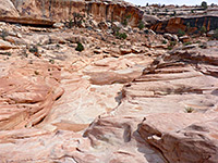
The canyon sides are mostly composed of thin-layered strata, with benches and slopes rather than sheer cliffs, and all rocks are from the Cedar Mesa formation. Parking for the hike is the Owachomo Bridge trailhead, 4.3 miles along the one-way loop road, and the round-trip through both forks can be completed in about three hours.
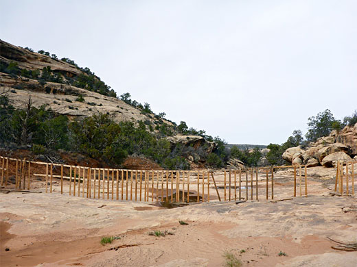
The Armstrong - Tuwa confluence is reached by walking down the 0.2 mile Owachomo Bridge Trail, to the south side of the bridge, followed by a short eastwards traverse on a bench. The big pool below is fed by a spring just upstream, the waters flowing down a bare rock channel. Another big pool is just beyond, at the foot of a steep pour-off, passed by scrambling up the sand and boulder slope to the left, into to a bushy, overgrown section of the streambed, where walking is easier up on a bench to the right. The vegetation soon lessens and the canyon floor becomes mostly flat rock, providing very easy walking. A shallow pool is closely followed by a wooden fence that marks the national monument boundary, and then, after two tighter bends, the other fork joins from the north.
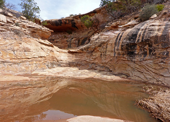
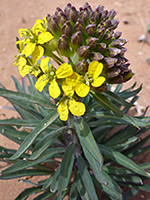
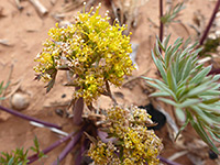
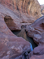
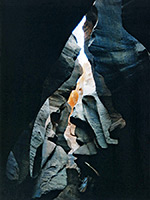
Next are some more rocky flats, a patch of trees and boulders, several more pretty pools and a short, twisty channel, where a tiny stream may be flowing. The drainage becomes bushier again, preceding a more enclosed pool beneath a pour-off, passed by a short climb to the left. Above here is a longer pool, right after a deep overhang on the right. A bushy channel leads to a deeper, oval-shaped pool between overhanging rocks, requiring a slightly longer bypass, via a bench to the left. Just beyond is a junction with a south-side tributary, then some more small pools amidst stripy rocks, now generally reddish unlike the white of downstream. The canyon is now rather wide, with sloping sides, though cliffs form a little way ahead, just after another tiny south-side tributary, and the drainage narrows. Progress is blocked after a while by a pool beneath an overhanging pour-off, with no obvious climb up route, however this is right at the upper end of the enclosed part of the drainage, and there doesn't seem to be anything of interest beyond.
The north fork of Tuwa Canyon may be reached by walking back a few hundred feet, just beyond the second minor tributary, and asending the slopes to the northwest, starting just east of a little ravine, then crossing a flat ridgetop and descending more gently to the wide, less steep-sided drainage. The park road is visible beyond, on the north rim. The canyon floor is flat, either grassy or sandy, and stays like this all the way to a big pour-off near the end, passed by climbing down the right side - this has a big drop to a pool closely followed by a slanted chute to a lower pool. The floor is flat again beyond, and the confluence with the main fork is just 1,000 feet further.
A 6.5 mile loop hike can be made by leaving the canyon as it becomes shallow, walking northwest over a sandy ridge and descending into the only slightly smaller north fork, which leads back to main ravine one mile before Armstrong Canyon. Both branches of the drainage are pleasant rather than spectacular, and are best explored after rainy spells since there is less to see if the pools and potholes are dry.
The canyon sides are mostly composed of thin-layered strata, with benches and slopes rather than sheer cliffs, and all rocks are from the Cedar Mesa formation. Parking for the hike is the Owachomo Bridge trailhead, 4.3 miles along the one-way loop road, and the round-trip through both forks can be completed in about three hours.

Lower End of Tuwa Canyon
The Armstrong - Tuwa confluence is reached by walking down the 0.2 mile Owachomo Bridge Trail, to the south side of the bridge, followed by a short eastwards traverse on a bench. The big pool below is fed by a spring just upstream, the waters flowing down a bare rock channel. Another big pool is just beyond, at the foot of a steep pour-off, passed by scrambling up the sand and boulder slope to the left, into to a bushy, overgrown section of the streambed, where walking is easier up on a bench to the right. The vegetation soon lessens and the canyon floor becomes mostly flat rock, providing very easy walking. A shallow pool is closely followed by a wooden fence that marks the national monument boundary, and then, after two tighter bends, the other fork joins from the north.
Pools and Pour-offs
Next are some more rocky flats, a patch of trees and boulders, several more pretty pools and a short, twisty channel, where a tiny stream may be flowing. The drainage becomes bushier again, preceding a more enclosed pool beneath a pour-off, passed by a short climb to the left. Above here is a longer pool, right after a deep overhang on the right. A bushy channel leads to a deeper, oval-shaped pool between overhanging rocks, requiring a slightly longer bypass, via a bench to the left. Just beyond is a junction with a south-side tributary, then some more small pools amidst stripy rocks, now generally reddish unlike the white of downstream. The canyon is now rather wide, with sloping sides, though cliffs form a little way ahead, just after another tiny south-side tributary, and the drainage narrows. Progress is blocked after a while by a pool beneath an overhanging pour-off, with no obvious climb up route, however this is right at the upper end of the enclosed part of the drainage, and there doesn't seem to be anything of interest beyond.

Tuwa Canyon North Fork
The north fork of Tuwa Canyon may be reached by walking back a few hundred feet, just beyond the second minor tributary, and asending the slopes to the northwest, starting just east of a little ravine, then crossing a flat ridgetop and descending more gently to the wide, less steep-sided drainage. The park road is visible beyond, on the north rim. The canyon floor is flat, either grassy or sandy, and stays like this all the way to a big pour-off near the end, passed by climbing down the right side - this has a big drop to a pool closely followed by a slanted chute to a lower pool. The floor is flat again beyond, and the confluence with the main fork is just 1,000 feet further.
Topo Map

Tuwa Canyon - Similar Hikes
All Contents © Copyright The American Southwest | Comments and Questions | Contribute | Affiliate Marketing Disclosure | Site Map