Guadalupe Mountains National Park - Nearby Places
Texas > Guadalupe Mountains National Park > Nearby Places
A turning leads to Sitting Bull Falls - a small waterfall, flowing over a 40 foot high cliff, stained black and covered with green moss and other vegetation, completely dry at some times but with water most of the year. The stream is enough to fill several large pools in the creek below, suitable for swimming.
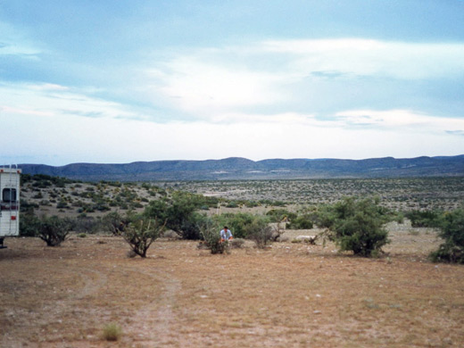
The main road passes through Lincoln National Forest - a mixture of trees, cacti and grasslands, extending over 60 miles north and covering the majority of the Guadalupe range, characterised here by a long, steep west-facing cliff face with gentler slopes to the east. There are no facilities, just a network of rough tracks with the usual opportunities for hiking, wildlife observation and free camping.
El Paso is 110 miles west of the park on US 62/180, a typically barren west Texas road that passes by two points of interest:
- Hueco Tanks State Historical Park - an unusual state park named for the natural water pools that collect in rock cavities, and which is famous for two reasons; abundant prehistoric Indian rock art and the excellent short-route rock climbing. To protect the former, new regulations require all visitors for whatever purpose to be accompanied by a park-appointed guide.
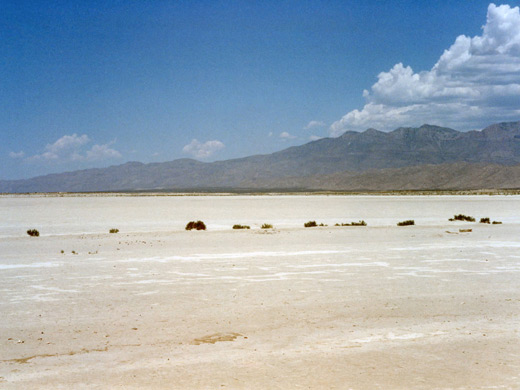
- Salt Flat - a large dry lake bed extending both sides of the highway, colored white by salt and gypsum deposits left by seasonal streams that flow from the Guadalupe Mountains.
An interesting drive, and a short-cut to Alamogordo and other towns in New Mexico, starts by taking one of two roads to Dell City, a sleepy town near the salt flat from where several gravel tracks head across a large unpopulated region of desert and hills for over 60 miles.
TX 54 is a scenic road that heads due south from the Guadalupe Mountains across a wide valley, and later past more salt flats and alongside a mountain ridge to Van Horn - an important stopping point, being a crossroads on the Guadalupe-Big Bend route and the trans-country interstate 80. This 55 mile drive passes no towns or side-roads.
All Contents © Copyright The American Southwest | Comments and Questions | Contribute | Affiliate Marketing Disclosure | Site Map