Lower Water Holes Canyon - West of US 89 (Downstream)
Slot Canyons > Page > Water Holes Canyon > West of US 89
Lower Water Holes Canyon
The lowest section of Water Holes Canyon, west of the US 89 bridge - deep narrows containing boulders and dryfalls, requiring rappelling to explore fully. Rim walking leads to a fine view of the Colorado River
Length: About 1 mile to the first rappel point; 2 miles rim-walk to the Colorado
Trailhead: Parking area on the east side of US 89
Rating (1-5): ★★★★★
Trailhead: Parking area on the east side of US 89
Rating (1-5): ★★★★★

The following description relates to the time when unaccompained hiking to Water Holes Canyon was permitted after purchase of a $5 permit, but following the May 2018 requirement that all parts of the drainage can only be seen as part of a guided tour, it would seem that the narrows west of US 89 are now no longer accessible.
Topographic map of Water Holes Canyon.
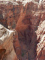
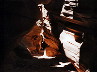
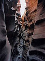
Views of lower and middle Water Holes Canyon.
One way to access the lower reaches of Water Holes Canyon is to use the entrance route down the north side of the cliffs just west of the US 89 road bridge, as described in the upstream section. However, after only a minute's walk along the canyon floor, at this point wide and quite flat, the watercourse drops through a narrow V-shaped opening in the streambed, not visible until close ahead, and continues 15 feet below, through a dark passageway with a series of boulders and pools. It is not easy to climb down unaided, so those without ropes are advised to use a different route into the canyon below the dryfall - one possibility is on the south side, a few hundred meters from the road, where the cliffs become less steep for a while as the canyon curves northwards.
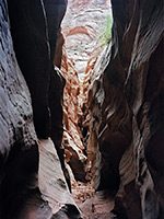
Once on the canyon floor at this point, walking upstream soon leads to an enclosed, spooky section of narrows that has good rock formations but which is quite hard to explore, especially after a recent flood as there are pools several feet deep, extensive patches of soft mud and some steepish rock surfaces to climb. After only 10 minutes one arrives at the foot of the dryfall mentioned above and turning back is the only option.
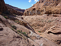
Much more of the canyon is accessible downstream of the alternative entrance point. Short slot-like passages are separated by longer open sections, as the canyon deepens steadily. After another half mile, a second curving drop of 25 feet blocks the way forward, and as there are other larger falls between here and the Colorado River, and no more narrows, this is a sensible point to turn back for those without ropes.
See the narrows on a Navajo guided tour - the only way to visit the canyon.
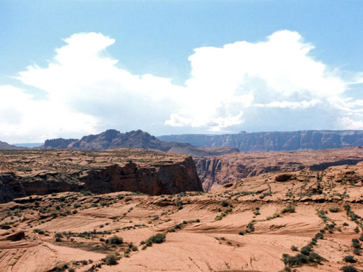
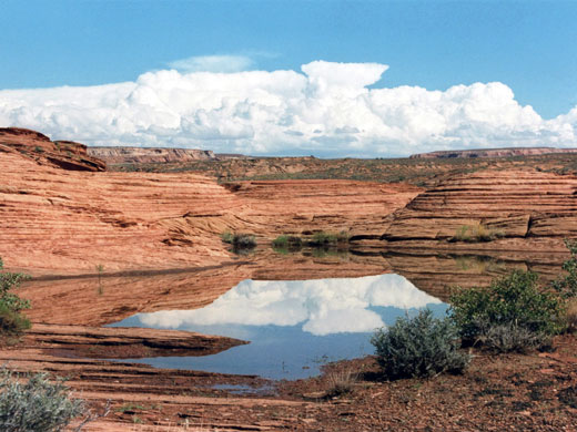
A walk along the desert plateau above not only gives a good overview of the canyon and the dramatic junction with the main river, where the muddy streambed twists through a jumble of large eroded domes and meets with the clear waters of the Colorado, but also passes a variety of erosional rock features, occasional clear rainwater pools and various species of cacti. It takes about 80 minutes to walk from the highway across exposed rock to the edge of Glen Canyon, which at the junction with Water Holes makes a graceful sweep through 180 degrees (known as Water Holes Bend, similar to Horseshoe Bend a little way upstream) and turns northwest. Just around the next bend, past the big dryfall at the end of Echo Creek, the cliffs open out quite abruptly at Lees Ferry.
Map
Topographic map of Water Holes Canyon.
Photographs
Views of lower and middle Water Holes Canyon.
Route Description
One way to access the lower reaches of Water Holes Canyon is to use the entrance route down the north side of the cliffs just west of the US 89 road bridge, as described in the upstream section. However, after only a minute's walk along the canyon floor, at this point wide and quite flat, the watercourse drops through a narrow V-shaped opening in the streambed, not visible until close ahead, and continues 15 feet below, through a dark passageway with a series of boulders and pools. It is not easy to climb down unaided, so those without ropes are advised to use a different route into the canyon below the dryfall - one possibility is on the south side, a few hundred meters from the road, where the cliffs become less steep for a while as the canyon curves northwards.
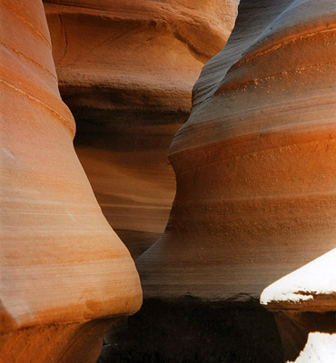
Narrows
Once on the canyon floor at this point, walking upstream soon leads to an enclosed, spooky section of narrows that has good rock formations but which is quite hard to explore, especially after a recent flood as there are pools several feet deep, extensive patches of soft mud and some steepish rock surfaces to climb. After only 10 minutes one arrives at the foot of the dryfall mentioned above and turning back is the only option.
Lower Slots
Much more of the canyon is accessible downstream of the alternative entrance point. Short slot-like passages are separated by longer open sections, as the canyon deepens steadily. After another half mile, a second curving drop of 25 feet blocks the way forward, and as there are other larger falls between here and the Colorado River, and no more narrows, this is a sensible point to turn back for those without ropes.
Tours of Secret Canyon
See the narrows on a Navajo guided tour - the only way to visit the canyon.
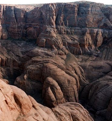
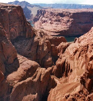
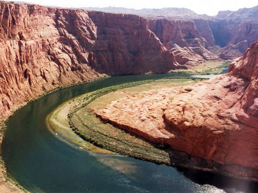
The Canyon Rim
A walk along the desert plateau above not only gives a good overview of the canyon and the dramatic junction with the main river, where the muddy streambed twists through a jumble of large eroded domes and meets with the clear waters of the Colorado, but also passes a variety of erosional rock features, occasional clear rainwater pools and various species of cacti. It takes about 80 minutes to walk from the highway across exposed rock to the edge of Glen Canyon, which at the junction with Water Holes makes a graceful sweep through 180 degrees (known as Water Holes Bend, similar to Horseshoe Bend a little way upstream) and turns northwest. Just around the next bend, past the big dryfall at the end of Echo Creek, the cliffs open out quite abruptly at Lees Ferry.
Lower Water Holes Canyon - Similar Hikes
All Contents © Copyright The American Southwest | Comments and Questions | Contribute | Affiliate Marketing Disclosure | Site Map