The American Southwest
Home | Parks | Trails | Plants | Canyons
Maps | Landscapes | Site Map | Whats New? |
More...
Follow americansouthwest.net on Facebook
×
General Pages
Home
Parks
Trails
Plants
Slot Canyons
Maps
Landscapes
Itineraries
Site Map
What's New?
More pages...

States
Arizona
California
Colorado
Idaho
Nevada
New Mexico
Oregon
Texas
Utah
Wyoming


ARIZONA
CALIFORNIA
COLORADO
IDAHO
NEVADA
NEW MEXICO
OREGON
TEXAS
UTAH
WYOMING
NEW MEXICO
MAPS | PARKS | TRAILS | HOTELS

Map of White Sands National Park


New Mexico > White Sands National Park > Map
White Sands National Park

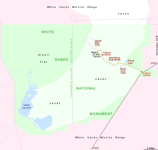
The entrance to White Sands National Park along US 70 is 15 miles from Alamogordo and 52 miles from Las Cruces; from here an 8 mile scenic drive leads into the middle of the dunes.

PDFPDF format map of White Sands National Park, from the National Park Service (184 kb).

Back to Top
Arizona | California | Colorado | Idaho | Nevada | New Mexico | Oregon | Texas | Utah | Wyoming | Slot Canyons | Travelogue | SOUTHWEST

All Contents © Copyright The American Southwest | Comments and Questions | Contribute | Affiliate Marketing Disclosure | Site Map