The American Southwest
Home | Parks | Trails | Plants | Canyons
Maps | Landscapes | Site Map | Whats New? |
More...
Follow americansouthwest.net on Facebook
×
General Pages
Home
Parks
Trails
Plants
Slot Canyons
Maps
Landscapes
Itineraries
Site Map
What's New?
More pages...

States
Arizona
California
Colorado
Idaho
Nevada
New Mexico
Oregon
Texas
Utah
Wyoming


ARIZONA
CALIFORNIA
COLORADO
IDAHO
NEVADA
NEW MEXICO
OREGON
TEXAS
UTAH
WYOMING
NEW MEXICO
MAPS | PARKS | TRAILS | HOTELS

Topographic Map of the Bisti Wilderness Area


New Mexico > Bisti Wilderness Area > Topographic Map
Map of the Bisti Wilderness Area

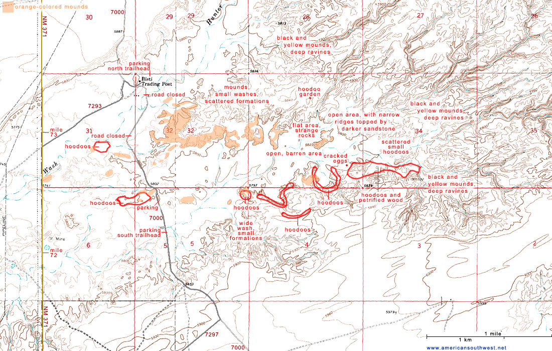
The main (south) entrance to the Bisti Wilderness Area is between mileposts 70 and 71 along NM 371 - 36 miles south of Farmington and 57 miles north of Thoreau, on I-40.

Back to Top
Arizona | California | Colorado | Idaho | Nevada | New Mexico | Oregon | Texas | Utah | Wyoming | Slot Canyons | Travelogue | SOUTHWEST

All Contents © Copyright The American Southwest | Comments and Questions | Contribute | Affiliate Marketing Disclosure | Site Map