Big Bend of the Colorado State Recreation Area
Nevada > Big Bend of the Colorado State Recreation Area
Highlights:
Beaches, wetlands, rocky hills and sandy desert beside the Colorado River in far southern Nevada, downstream of Davis Dam; primarily a recreation site, popular for picnicking, swimming and camping
Nearby town:
Bullhead City, 12 miles
Management:
Location:
Seasons:
All year, though very hot in the summer
Rating (1-5):
★★★★★

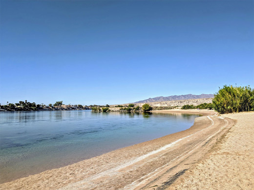
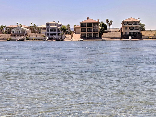
Established in 1996, Big Bend of the Colorado State Recreation Area contains 2,100 acres of low hills, sandy washes, bush-covered flats and patches of marshland alongside the Colorado River in far south Nevada - 7 miles from Laughlin and directly opposite Bullhead City in Arizona, in an otherwise undeveloped region bordered by extensive empty desert to the west.
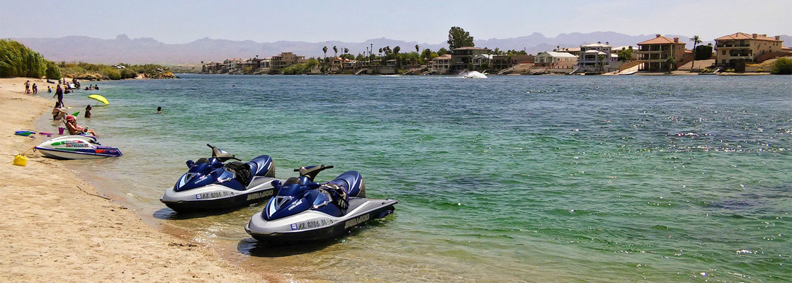
The place is not particularly scenic, not really a destination for hiking or photography, but instead is very popular for recreation, year round, principally picnicking, boating, jetskiing, swimming, sunbathing, fishing and bird watching. Avian species resident here include geese, mallards, quail, coots and herons.
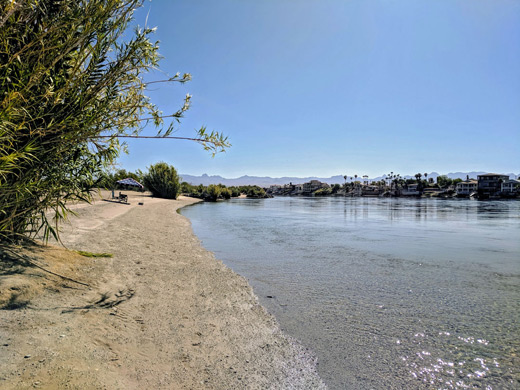
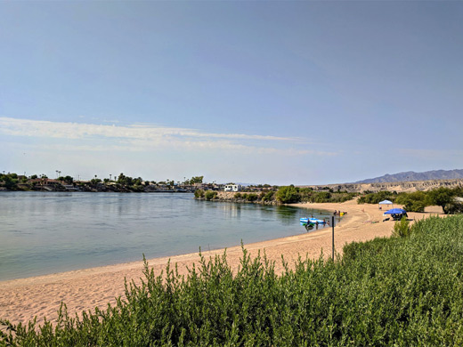
Most of the river shoreline (2 miles) is sandy, and the water is clean and clear since it originates from the lower reaches of Lake Mojave beyond Davis Dam, 8 miles upstream, and the park is equally busy in summer as in winter even though the temperatures regularly exceed 110°F. The park has a campground and is crossed by several not-so-interesting trails through the bushy areas close to the river.
The place is not particularly scenic, not really a destination for hiking or photography, but instead is very popular for recreation, year round, principally picnicking, boating, jetskiing, swimming, sunbathing, fishing and bird watching. Avian species resident here include geese, mallards, quail, coots and herons.
Most of the river shoreline (2 miles) is sandy, and the water is clean and clear since it originates from the lower reaches of Lake Mojave beyond Davis Dam, 8 miles upstream, and the park is equally busy in summer as in winter even though the temperatures regularly exceed 110°F. The park has a campground and is crossed by several not-so-interesting trails through the bushy areas close to the river.
Big Bend of the Colorado Table of Contents
Location
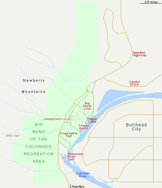
The recreation area is reached by the Needles Highway, between Hwy 163 near Laughlin (5 miles) and Needles in California (21 miles). The majority of the preserve lies inland, west of the road, in the foothills of the Newberry Mountains; a sizeable expanse of rocky ridges split by branched, dry washes, lacking any trails though open to cross-country exploration. All facilities though are in the narrower strip of land to the east, between the road and river. A paved road (Flager Lane) leads to the main parking area, and a promontory, while three lesser roads reach other parts of the shoreline. The two most popular sandy sections of the shore are either side of the parking area; that to the south is named Savage Beach.
Big Bend of the Colorado Facilities
The park entrance fee is $10 per vehicle. The campground, quite near the road and out-of-sight of the river, has 24 full-hookup sites, suitable for any size of RV; fees $20 per night. There are five trails in the park; the Sandy Loop (0.4 miles) and Big Sandy Loop (1.4 miles) circle bushy land away from the river, the Conservation Trail (0.9 miles) crosses similar terrain between the campground and an alternative parking area to the south, the 0.6 mile Fishermans Point Trail leads to the end of a narrow promontory beside a wetland area, while the Swift Water Trail follows a track to another wetland. The latter two are open to ATVs, the others are for foot travel only.
Big Bend of the Colorado - Nearby Places
- Grapevine Canyon, 10 miles - shallow ravine lined by many petroglyphs
- Lake Mohave, 10 miles - the smaller, southern lake within Lake Mead NRA
Big Bend of the Colorado - Similar Places
- Lake Havasu, Arizona - artificial lake on the Colorado River, enclosed by barren mountains
- Elephant Butte Lake - New Mexico's largest artificial lake, a major year-round center for recreation
All Contents © Copyright The American Southwest | Comments and Questions | Contribute | Affiliate Marketing Disclosure | Site Map