Highlights:
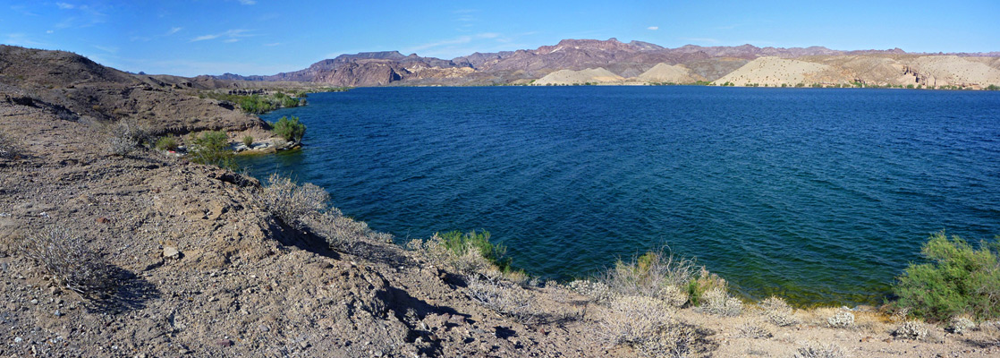
The smaller, southern lake within Lake Mead NRA, formed by Davis Dam across the Colorado River. Most of the shoreline is formed of low, gravelly hills, generally far from any road; the main center for visitor activities is at the downstream end, near the dam
Seasons:
All year

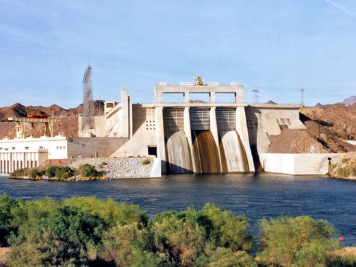
Sixty miles below Hoover Dam, the smaller Davis Dam (200 feet high) was completed in 1955 forming Lake Mohave, and this also lies within the Lake Mead National Recreation Area, together with large areas of barren, roadless desert at either side.
The only part that receives much visitation is the southern tip, around the dam, which is just north of the adjacent, fast growing riverside towns of Bullhead City in Arizona and Laughlin, a gambling resort in Nevada. The low elevation and sheltered location at the bottom of a steep-sided valley often make one or other the hottest place in the whole US.
The only part that receives much visitation is the southern tip, around the dam, which is just north of the adjacent, fast growing riverside towns of Bullhead City in Arizona and Laughlin, a gambling resort in Nevada. The low elevation and sheltered location at the bottom of a steep-sided valley often make one or other the hottest place in the whole US.
Lake Mohave of Contents
Telephone Cove
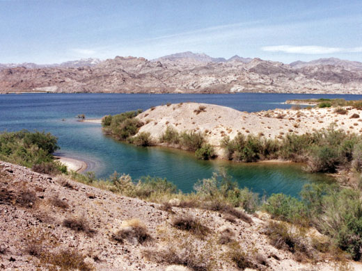
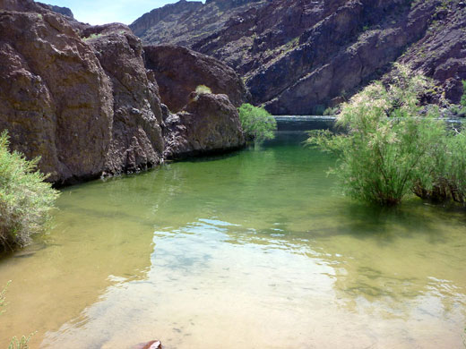
A short road winds across sandy hills and dry washes for a few miles along the southeast shore of Lake Mohave offering access to various beaches and coves. Katherine Landing is the main location, with shops, a camp site, the lake visitor center and a marina, while a quieter alternative is Telephone Cove, a little further north. This has two wide, clean beaches, and free camping, though only in an featureless gravel area set back from the water. Footpaths lead away from the main beach to small, private coves and inlets.
Lake Mohave - Other Access
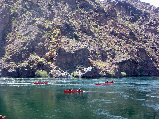
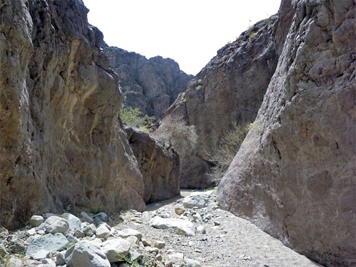
Away from the dam there are only two other roads to the lake; Cottonwood Cove on the Nevada side and Willow Beach on the Arizona side - this has a fish hatchery, a small beach and a picnic area but no camping. It also tends to have rather unpleasant smelly water. The steep slopes of the Black and Eldorado mountain ranges prevent any other vehicular access to the lake, which north of Cottonwood Basin is quite narrow, little different in appearance to a rather wide river. The lakeside can be reached by several trails, however, of which the easiest and most popular is along White Rock Canyon, a route which continues south along the shoreline a little way and into a narrower ravine, location of the beautiful Arizona Hot Springs. From the main highway (US 93), the lake is visible at just one location, a west-side overlook near the turn-off for Willow Beach.
Downstream
Downstream of Davis Dam the Colorado continues south forming the Arizona/California border, passing through several other dams and irrigation systems; the water is controlled and removed to such an extent that it no longer reaches the Gulf of California - instead the mighty Colorado ends as a sandy trickle in the Mexican desert, many miles from the sea.
Trails of Lake Mohave
Arizona Hot Springs
★★★★★
★★★★★
3.1 miles, 760 feet
Warm springs in a short, unusually colorful slot canyon bordering Lake Mohave along the Colorado River, reached by the White Rock Canyon Trail starting from US 93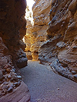
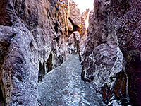
Lake Mohave slot canyons
★★★★★
★★★★★
3 miles, 100 feet (loop)
Two narrow, branched ravines through light-colored conglomerate rocks on the west side of Lake MohaveAll Contents © Copyright The American Southwest | Comments and Questions | Contribute | Affiliate Marketing Disclosure | Site Map