Box Canyon Falls
Dramatic, partly enclosed waterfall in a narrow quartzite gorge, the lower end of Canyon Creek, on the west edge of Ouray. Reached by a very short trail, which descends a metal stairway to a viewpoint
Length: 500 feet to the falls, or 0.3 miles to the bridge above
Elevation change: 50 feet, 200 feet
Difficulty: Easy
Type: One way
Entry: $7 per adult (2024)
Usage: High
Season: All year
Trailhead: Box Canyon Road, Ouray
Rating (1-5): ★★★★★
Elevation change: 50 feet, 200 feet
Difficulty: Easy
Type: One way
Entry: $7 per adult (2024)
Usage: High
Season: All year
Trailhead: Box Canyon Road, Ouray
Rating (1-5): ★★★★★

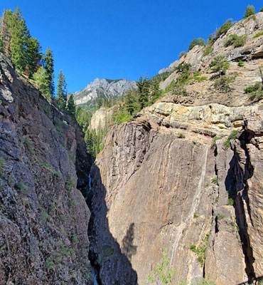
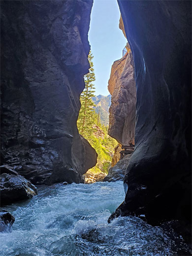
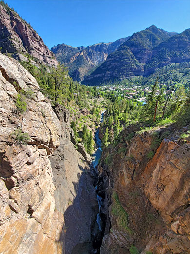
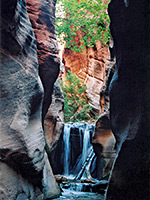
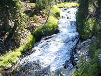
Canyon Creek is a 6 mile-long drainage in the San Juan Mountains, southwest of Ouray, arising at the confluence of two tributaries, Sneffels Creek and Imogene Creek, and meeting the Uncompahgre River on the west edge of town. Most is followed by a road, the creek flowing through a deep but relatively wide valley, though towards the lower end the stream becomes more enclosed, descending steeply, and for the final few hundred feet the waters are confined within a very narrow gorge, framed by dark quartzite cliffs, up to 200 feet tall.
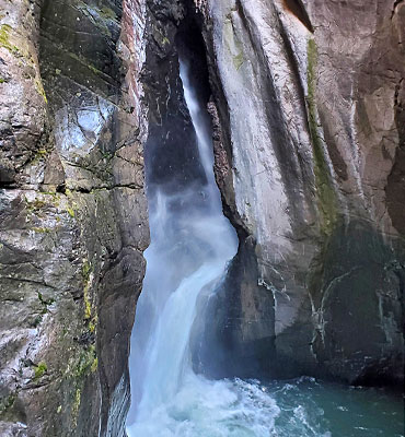
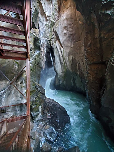
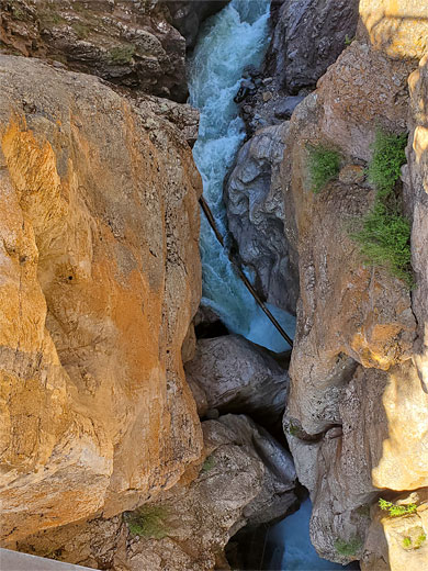
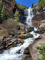
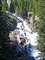
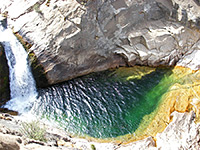
The enclosed section is named Box Canyon (or Box Canon), and it contains a spectacular waterfall where the creek tumbles 85 feet into a huge pothole, cascades out to one side into a deep pool, and continues through a slot-like gorge for another 500 feet until the cliffs open out abruptly and Canyon Creek meets the river, now in open terrain.
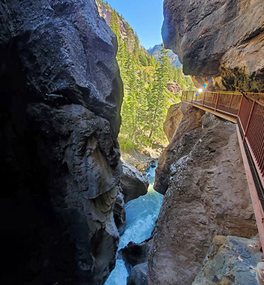
The falls would be quite inaccessible were it not for a metal walkway, constructed by the town, allowing visitors a close up view of the base of the cascade and the huge plunge pool beneath; this is reached by a 500 foot path, and is the highlight of a small city park that also has a 0.3 mile trail to a bridge over the canyon just above the fall, and a longer path through the adjacent pine woods.
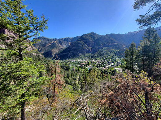
Box Canyon Falls Park is located at the southwest corner of Ouray, along Box Canyon Road, a half mile unpaved route, one way (south to north), starting on US 550, crossing the Uncompahgre River, passing the park entrance, later recrossing the river and meeting a city street, 3rd Avenue. The park has a visitor center and gift store, where fees are collected for the path to the falls ($7 per adult, $5 per child, in 2024); behind is a garden area planted with a selection of native species, and equipped with several bird feeding stations; one local species of note, often spotted, is the black swift. The visitor center, and the access road, close between November and March but the park and its trails remain open, all year.
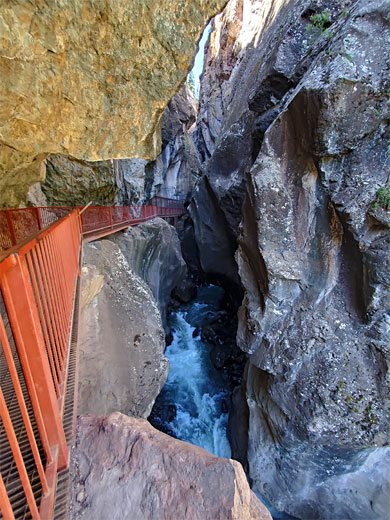
A short nature trail, looping through the garden, links with the path to the falls; this leads through a gate, down to the mouth of the canyon, upstream via a suspended metal walkway then down some stairs to the viewpoint at the base of the falls. Another path (High Bridge Trail) forks off, before the gate, climbing through woodland to the footbridge over the canyon, on the far side which is a short tunnel, and another path (now the Perimeter Trail) which winds down the hillside a short distance and meets a road, thus allowing a loop, of 0.9 miles. In the other direction, the southern segment of the Perimeter Trail crosses a larger section of woodland and descends to a trailhead along road 361, near the south end of Box Canyon Road.
The enclosed section is named Box Canyon (or Box Canon), and it contains a spectacular waterfall where the creek tumbles 85 feet into a huge pothole, cascades out to one side into a deep pool, and continues through a slot-like gorge for another 500 feet until the cliffs open out abruptly and Canyon Creek meets the river, now in open terrain.
The falls would be quite inaccessible were it not for a metal walkway, constructed by the town, allowing visitors a close up view of the base of the cascade and the huge plunge pool beneath; this is reached by a 500 foot path, and is the highlight of a small city park that also has a 0.3 mile trail to a bridge over the canyon just above the fall, and a longer path through the adjacent pine woods.
The Park
Box Canyon Falls Park is located at the southwest corner of Ouray, along Box Canyon Road, a half mile unpaved route, one way (south to north), starting on US 550, crossing the Uncompahgre River, passing the park entrance, later recrossing the river and meeting a city street, 3rd Avenue. The park has a visitor center and gift store, where fees are collected for the path to the falls ($7 per adult, $5 per child, in 2024); behind is a garden area planted with a selection of native species, and equipped with several bird feeding stations; one local species of note, often spotted, is the black swift. The visitor center, and the access road, close between November and March but the park and its trails remain open, all year.
Trails
A short nature trail, looping through the garden, links with the path to the falls; this leads through a gate, down to the mouth of the canyon, upstream via a suspended metal walkway then down some stairs to the viewpoint at the base of the falls. Another path (High Bridge Trail) forks off, before the gate, climbing through woodland to the footbridge over the canyon, on the far side which is a short tunnel, and another path (now the Perimeter Trail) which winds down the hillside a short distance and meets a road, thus allowing a loop, of 0.9 miles. In the other direction, the southern segment of the Perimeter Trail crosses a larger section of woodland and descends to a trailhead along road 361, near the south end of Box Canyon Road.
Box Canyon Wildflower
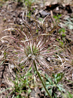 American pasqueflower |
Box Canyon Falls - Similar Hikes
All Contents © Copyright The American Southwest | Comments and Questions | Contribute | Affiliate Marketing Disclosure | Site Map