Highlights:
Large, remote area, much of it a wilderness, either side of the Colorado River in far western Colorado; contains red rock buttes, desert plateaus, branched canyons and innumerable eroded formations including the world's second largest concentration of natural arches
Nearest city with chain hotels:
Fruita, 2 miles
Management:
Location:
39.139, -108.755 (east entrance, Devils Canyon)
Seasons:
Late spring, summer, fall
Rating (1-5):
★★★★★
Weather:


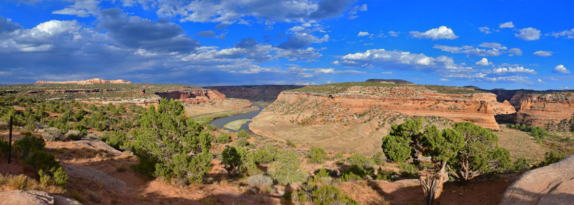
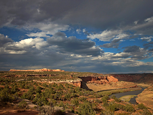
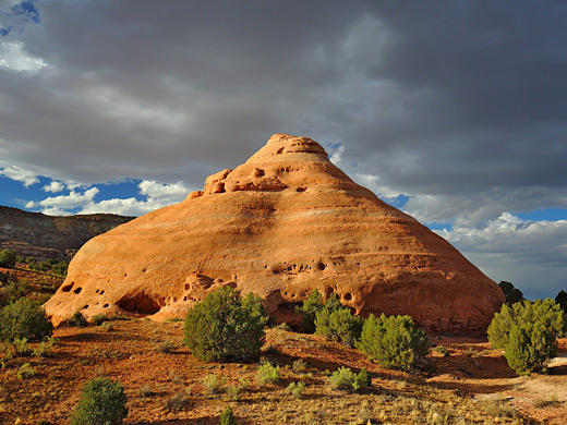
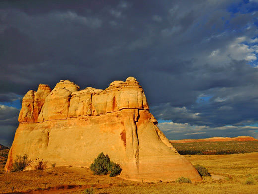
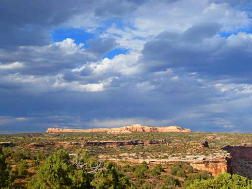
McInnis Canyons National Conservation Area occupies a large region of far western Colorado, extending a little way into Utah, just west of Grand Junction and Colorado National Monument, centered on a 24 mile section of the Colorado River. All this land is within the Colorado Plateau, near its eastern edge, and contains typical sedimentary landscapes of red rock buttes, desert plateaus, branched canyons and innumerable eroded formations including the second largest concentration of natural arches in the world, second only to the nearby national park.
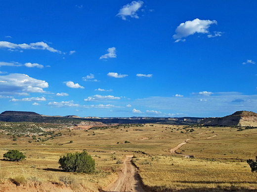
Some locations, north of the Colorado, are quite easy accessed via tracks off Interstate 70, one leading to a fine overlook of the river, but the majority, on the south side, is completely roadless, part of a large wilderness area (Black Ridge Canyons), however the natural arches themselves, the Rattlesnake Arches, are quite close to the eastern boundary, and can be reached by a day hike. There are no bridges across the Colorado within the NCA and no road alongside, though the river is followed by a working railroad, the main line between Grand Junction and Green River.
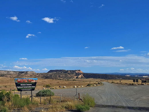
The National Conservation Area, 123,400 acres in size, is named after Colorado Congressman Scott McInnis; it was formerly known as the Colorado Canyons NCA and was created in 2000. Elevations range from 4,200 feet along the river to 7,120 feet on top of Black Ridge, a five mile-long mesa in the southeast.
Some locations, north of the Colorado, are quite easy accessed via tracks off Interstate 70, one leading to a fine overlook of the river, but the majority, on the south side, is completely roadless, part of a large wilderness area (Black Ridge Canyons), however the natural arches themselves, the Rattlesnake Arches, are quite close to the eastern boundary, and can be reached by a day hike. There are no bridges across the Colorado within the NCA and no road alongside, though the river is followed by a working railroad, the main line between Grand Junction and Green River.
The National Conservation Area, 123,400 acres in size, is named after Colorado Congressman Scott McInnis; it was formerly known as the Colorado Canyons NCA and was created in 2000. Elevations range from 4,200 feet along the river to 7,120 feet on top of Black Ridge, a five mile-long mesa in the southeast.
McInnis Canyons Table of Contents
- Map of the McInnis Canyons
- Sites north of the Colorado River
- Sites south of the Colorado River
- Nearby places
- Similar places
Map of McInnis Canyons NCA
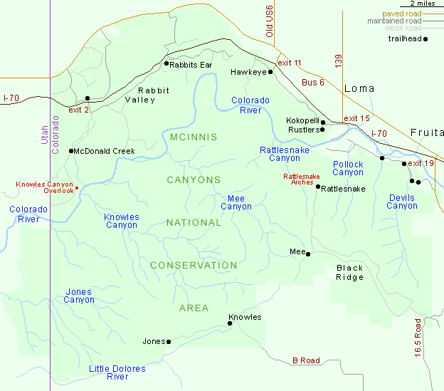
North of the Colorado River
The principal entrance to the north section of the NCA is I-70 exit 2, Rabbit Valley, where a good quality track heads south for 5 miles past one trailhead (McDonald Creek) and two red rock outcrops (the Castle Rocks) to a campground and viewpoint right on the rim of the Colorado River canyon, here around 300 feet deep; this is Knowles Canyon Overlook, named after a long drainage on the far side of the river. There are two other primitive campgrounds along the road, while RVs have a designated area further northeast in the valley, close to the interstate, reached by another unpaved road, better maintained, which ends a few miles further beyond the Rabbit's Ear trailhead, start of a 5.6 mile path that loops around a block of elevated land, giving views of the Colorado and Grand Mesa. Further east, accessed from exits 11 and 15, are many more trails, mostly for mountain bikes - across Mack Ridge, the northeast edge of which is straight and steep, while the opposite side slopes more gently and is split by a number of canyons.
South of the Colorado River
Black Ridge Canyons Wilderness makes up nearly all the land south of the Colorado, and this section of the NCA has road access in just three places. One track follows the southern edge to trailheads for Knowles Canyon and Jones Canyon, while in the northeast, the most used entrance is along Kingsview/Pollock Bench Road, which forks off the western route into Colorado National Monument. Again there are many intersecting trails here, open to hikers and horses, including a 7 mile route to the Rattlesnake Arches, along Rattlesnake Canyon. This location may also be approached from the south via a much shorter hike (2 miles) though 4WD is required to reach the trailhead. This road also passes the trailhead for Mee Canyon, which like Knowles and Jones contains alcoves, overhangs, pinnacles, arches and another formations, though not any major ancient ruins or rock art sites.
McInnis Canyons - Nearby Places
- Cisco, 24 miles - abandoned railroad town in eastern Utah
- Colorado National Monument (adjacent) - sheer walled red rock canyons south of the Colorado River
McInnis Canyons - Similar Places
- Dinosaur National Monument, Colorado/Utah - canyons and fossils, centered on the Green and Yampa rivers
- San Rafael Swell, Utah - canyons, ridges and prairie
All Contents © Copyright The American Southwest | Comments and Questions | Contribute | Affiliate Marketing Disclosure | Site Map