Dillon Pinnacles Trail, Curecanti National Recreation Area
Colorado > Curecanti National Recreation Area > Hiking > Dillon Pinnacles Trail
Dillon Pinnacles Trail
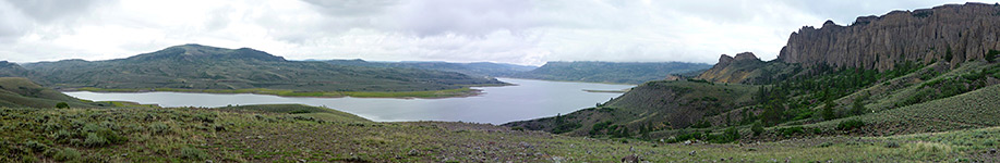
Path across sagebrush slopes on the north shore of Blue Mesa Reservoir to the base of a line of volcanic spires along the south edge of Dillon Mesa. Trail also has good views over the lake
Length: 2 miles
Elevation change: 300 feet
Difficulty: Easy
Type: One way
Usage: Low to medium
Season: Spring, summer, fall
Trailhead: Parking area along US 50, by the north end of Middle Bridge
Rating (1-5): ★★★★★
Elevation change: 300 feet
Difficulty: Easy
Type: One way
Usage: Low to medium
Season: Spring, summer, fall
Trailhead: Parking area along US 50, by the north end of Middle Bridge
Rating (1-5): ★★★★★

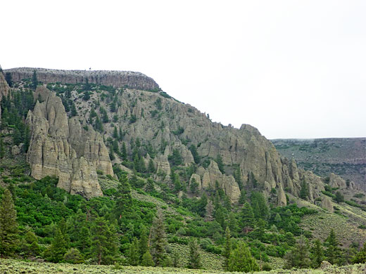
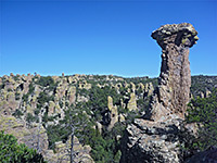
Hiking is not a major reason to visit Curecanti National Recreation Area, since the park, while large in area, has few trails, and away from the water the scenery is not so special. Of the seven maintained routes, four descend to the edge of Morrow Point Reservoir, one explores a riparian area at the upper end of the Gunnison River, one leads to two viewpoints high above Crystal Reservoir while the other, the Dillon Pinnacles Trail, crosses a fairly flat section of the north shore of Blue Mesa Reservoir to the base of a line of volcanic spires, formed by erosion of the steep south face of Dillon Mesa.
The 2 mile hike is probably the most popular in the NRA, giving good views of the lake as well as the formations. The path starts from a parking/picnic area on the north side of Middle Bridge, where US 50 crosses the reservoir; 6 miles west of the Elk Creek visitor center.
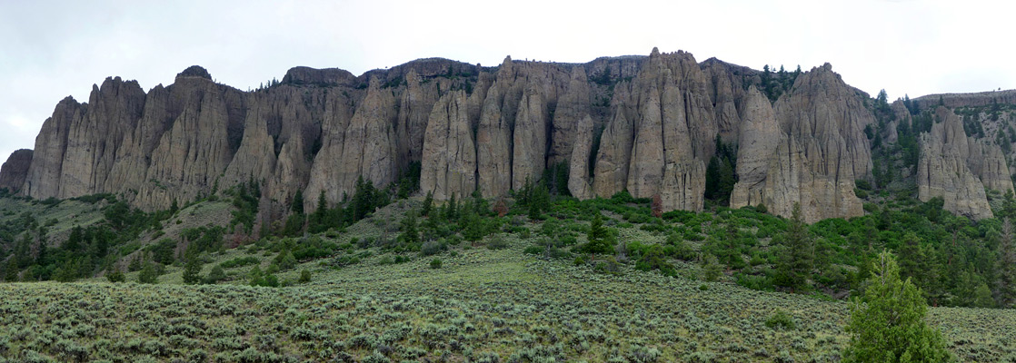
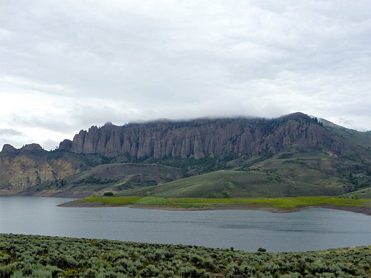
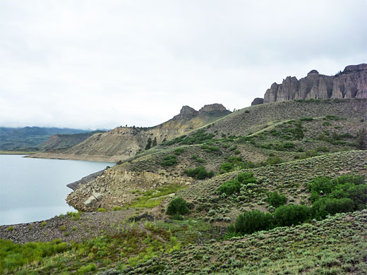
The pinnacles are clearly visible when driving along US 50, especially from the south side of the reservoir; they extend about two thirds of a mile east to west and are several hundred feet high. The rocks are uniformly dark grey in color, arranged along the edge of the flat-topped mesa, with some more colorful outcrops to the west. Similar grey pinnacles, a little higher in elevation, can be seen in the distance further west, on the far side of a deep valley and not easily accessible.
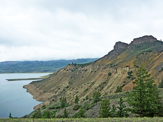
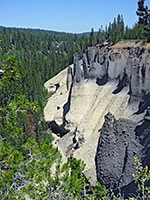
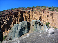
The Dillon Pinnacles Trail follows a road to a boat launch ramp for a short distance then crosses sagebrush slopes above the lake, close to the high water mark, which is often some distance from the actual shoreline. It rounds a corner, turning away from the lake into the bushy, tree-lined drainage of Dillon Gulch, heading upstream for half a mile before climbing above on the far side, over some mounds to a viewpoint, bench and NPS notice, the pinnacles now close by to the north. The route continues in and out of several smaller gullies after which the land becomes partly wooded (ponderosa pine), and the hike ends by climbing slightly, moving away from the pinnacles to a small hill, where a short loop gives varying views of the spires, the lake, the far-away San Juan Mountains to the south and some reddish outcrops close by to the west. The trail stays about 200 feet below and 500 feet distant from the cliffs and although it is easy to climb to the base of the pinnacles, they are not so interesting close-up; the best perspective is from a distance, where the whole array can be seen.
The 2 mile hike is probably the most popular in the NRA, giving good views of the lake as well as the formations. The path starts from a parking/picnic area on the north side of Middle Bridge, where US 50 crosses the reservoir; 6 miles west of the Elk Creek visitor center.
The pinnacles are clearly visible when driving along US 50, especially from the south side of the reservoir; they extend about two thirds of a mile east to west and are several hundred feet high. The rocks are uniformly dark grey in color, arranged along the edge of the flat-topped mesa, with some more colorful outcrops to the west. Similar grey pinnacles, a little higher in elevation, can be seen in the distance further west, on the far side of a deep valley and not easily accessible.
The Trail
The Dillon Pinnacles Trail follows a road to a boat launch ramp for a short distance then crosses sagebrush slopes above the lake, close to the high water mark, which is often some distance from the actual shoreline. It rounds a corner, turning away from the lake into the bushy, tree-lined drainage of Dillon Gulch, heading upstream for half a mile before climbing above on the far side, over some mounds to a viewpoint, bench and NPS notice, the pinnacles now close by to the north. The route continues in and out of several smaller gullies after which the land becomes partly wooded (ponderosa pine), and the hike ends by climbing slightly, moving away from the pinnacles to a small hill, where a short loop gives varying views of the spires, the lake, the far-away San Juan Mountains to the south and some reddish outcrops close by to the west. The trail stays about 200 feet below and 500 feet distant from the cliffs and although it is easy to climb to the base of the pinnacles, they are not so interesting close-up; the best perspective is from a distance, where the whole array can be seen.
Dillon Pinnacles Trail - Similar Hikes
All Contents © Copyright The American Southwest | Comments and Questions | Contribute | Affiliate Marketing Disclosure | Site Map