The American Southwest
Home | Parks | Trails | Plants | Canyons
Maps | Landscapes | Site Map | Whats New? |
More...
Follow americansouthwest.net on Facebook
×
General Pages
Home
Parks
Trails
Plants
Slot Canyons
Maps
Landscapes
Itineraries
Site Map
What's New?
More pages...

States
Arizona
California
Colorado
Idaho
Nevada
New Mexico
Oregon
Texas
Utah
Wyoming


ARIZONA
CALIFORNIA
COLORADO
IDAHO
NEVADA
NEW MEXICO
OREGON
TEXAS
UTAH
WYOMING
COLORADO
MAPS | PARKS | TRAILS | HOTELS

Map of Curecanti National Recreation Area


Colorado > Curecanti National Recreation Area > Map
Map of Curecanti National Recreation Area


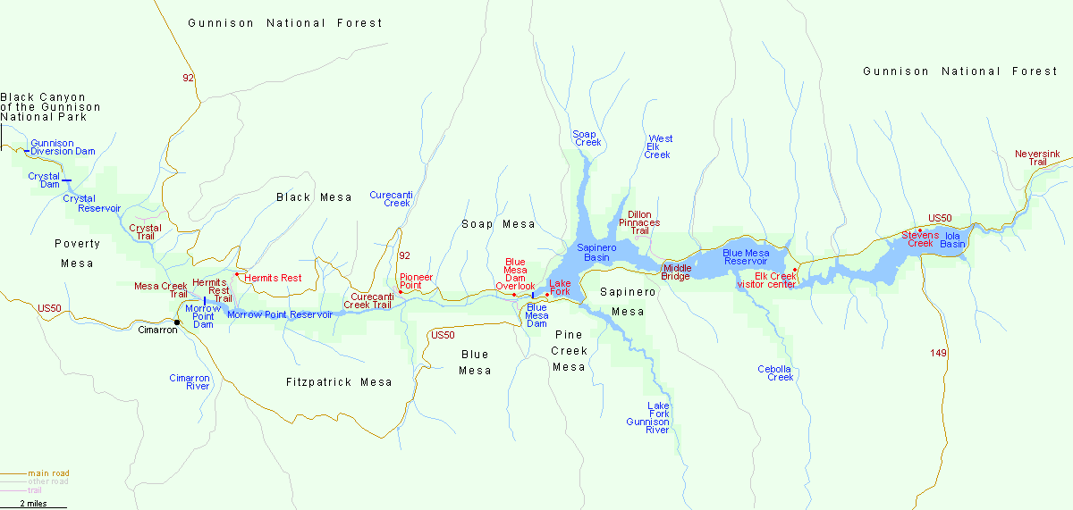
Curecanti National Recreation Area is reached from the north by Hwy 92 from Delta and Hotchkiss, from the west by US 50 from Montrose, and from the east via US 50 from Salida. US 50 runs along the south and north edge of Blue Mesa Reservoir for 20 miles; the other two lakes in the NRA (Morrow Point Reservoir and Crystal Reservoir) are accessible only by boat or trail.

Back to Top
Arizona | California | Colorado | Idaho | Nevada | New Mexico | Oregon | Texas | Utah | Wyoming | Slot Canyons | Travelogue | SOUTHWEST

All Contents © Copyright The American Southwest | Comments and Questions | Contribute | Affiliate Marketing Disclosure | Site Map