Echo Canyon Trail, Colorado National Monument
Colorado > Colorado National Monument > Hiking > Echo Canyon Trail
Echo Canyon Trail
Route over slickrock and a shallow drainage then down into a shady, tree-lined box canyon that contains a permanent stream, ending beneath a seasonal waterfall
Length: 1.3 miles
Elevation change: 300 feet
Difficulty: Easy to moderate, exposed at the beginning, so hot in summer
Type: One-way
Usage: Low
Season: All year
Trailhead: Along the park road just inside the east entrance
Rating (1-5): ★★★★★
Elevation change: 300 feet
Difficulty: Easy to moderate, exposed at the beginning, so hot in summer
Type: One-way
Usage: Low
Season: All year
Trailhead: Along the park road just inside the east entrance
Rating (1-5): ★★★★★

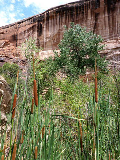
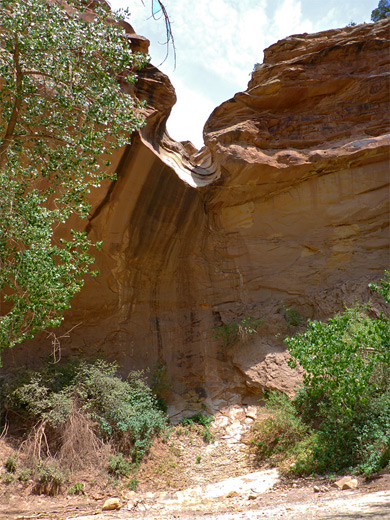
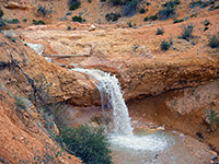
For most of the year all canyons in Colorado National Monument are dry, and there are no major streams in this area, however permanent water can be found in Echo Canyon, a tributary of No Thoroughfare Canyon, right at the east edge of the preserve. This is a shallow, shady box canyon, containing cottonwood trees and clumps of reeds, sustained by a spring that produces a short section of flowing water, extending at least a quarter of a mile; more in wetter times. Above the riparian section is another quarter of a mile of less overgrown ravine, before a dryfall of around 100 feet, site of a seasonal waterfall after rain.
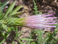
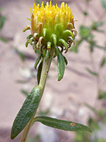
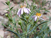
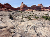
The hike to the canyon is not so well known but quite easy, crossing a shallow drainage and a slickrock slope, before descending into the box canyon and following this to the base of the dryfall. The canyon is one of the best places in the national monument to see wildflowers, including the rare Mancos columbine, and there are usually plants in bloom all the way through summer, unlike those in most other areas which are withered by late spring.
Map of Colorado National Monument.
The Echo Canyon trailhead is just inside the eastern park entrance, on the east side of the road, and is also used for the short hike to Devils Kitchen (an area of pinnacles and other rock formations), for the long path up No Thoroughfare Canyon, and for the Old Gordon Trail, a rarely visited route that climbs the increasingly wooded slopes on the south side of the canyon. If full, additional parking is available close by at the Devils Kitchen picnic area.
From the parking area, the route to Echo Canyon descends slightly then turns left at a junction, (right is to Devils Kitchen) and drops down a little further to the flat, usually dry floor of the drainage from No Thoroughfare Canyon, lined by a few large cottonwood trees. It then climbs the slickrock slope on the far side while running due south, right along the monument boundary to another junction, where the Old Gordon Trail continues south, and the Echo Canyon Trail goes east, now descending the slope to the target drainage. The land to the north is fenced off, and privately owned, after a recent purchase which caused one section of the trail to be rerouted.
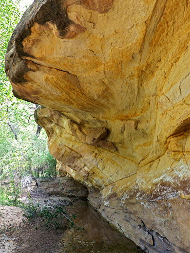
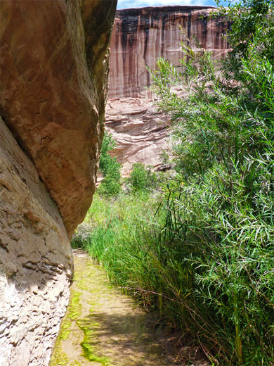
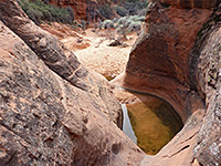
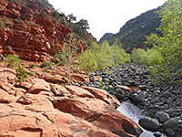
The ravine at this point is bordered by steep or sheer walls up to 50 feet high, and contains tall cottonwood trees, clumps of willow, extensive grassy patches and many other types of plant, with the stream, or at least residual pools, along the west side. The creek is chanelled through a narrow gap at one point, formed by the cliffs and a big fallen boulder, creating a pretty, enclosed section, while another stretch flows alongside a vertical cliff next to a thicket of bulrushes and other tall plants. Just beyond here the path climbs a grassy slope to avoid a particularly overgrown section around the spring, and a small pour-off, before descending to the drier, less vegetated streambed above; this is followed a short distance further to the end of the box canyon, beneath the big dryfall, which has a tiny slot-like section above and more large trees below. The Mancos columbines grow in alcoves at the base of the cliffs, and bloom in late spring; other unusual plants in the canyon include epipactis gigantea, the stream orchid.
The hike to the canyon is not so well known but quite easy, crossing a shallow drainage and a slickrock slope, before descending into the box canyon and following this to the base of the dryfall. The canyon is one of the best places in the national monument to see wildflowers, including the rare Mancos columbine, and there are usually plants in bloom all the way through summer, unlike those in most other areas which are withered by late spring.
Location
Map of Colorado National Monument.
Trailhead for Echo Canyon
The Echo Canyon trailhead is just inside the eastern park entrance, on the east side of the road, and is also used for the short hike to Devils Kitchen (an area of pinnacles and other rock formations), for the long path up No Thoroughfare Canyon, and for the Old Gordon Trail, a rarely visited route that climbs the increasingly wooded slopes on the south side of the canyon. If full, additional parking is available close by at the Devils Kitchen picnic area.

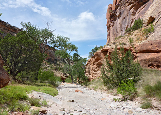
Path to Echo Canyon
From the parking area, the route to Echo Canyon descends slightly then turns left at a junction, (right is to Devils Kitchen) and drops down a little further to the flat, usually dry floor of the drainage from No Thoroughfare Canyon, lined by a few large cottonwood trees. It then climbs the slickrock slope on the far side while running due south, right along the monument boundary to another junction, where the Old Gordon Trail continues south, and the Echo Canyon Trail goes east, now descending the slope to the target drainage. The land to the north is fenced off, and privately owned, after a recent purchase which caused one section of the trail to be rerouted.
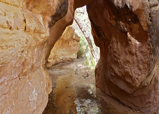
The Ravine
The ravine at this point is bordered by steep or sheer walls up to 50 feet high, and contains tall cottonwood trees, clumps of willow, extensive grassy patches and many other types of plant, with the stream, or at least residual pools, along the west side. The creek is chanelled through a narrow gap at one point, formed by the cliffs and a big fallen boulder, creating a pretty, enclosed section, while another stretch flows alongside a vertical cliff next to a thicket of bulrushes and other tall plants. Just beyond here the path climbs a grassy slope to avoid a particularly overgrown section around the spring, and a small pour-off, before descending to the drier, less vegetated streambed above; this is followed a short distance further to the end of the box canyon, beneath the big dryfall, which has a tiny slot-like section above and more large trees below. The Mancos columbines grow in alcoves at the base of the cliffs, and bloom in late spring; other unusual plants in the canyon include epipactis gigantea, the stream orchid.
Echo Canyon Trail - Similar Hikes
All Contents © Copyright The American Southwest | Comments and Questions | Contribute | Affiliate Marketing Disclosure | Site Map