The American Southwest
Home | Parks | Trails | Plants | Canyons
Maps | Landscapes | Site Map | Whats New? |
More...
Follow americansouthwest.net on Facebook
×
General Pages
Home
Parks
Trails
Plants
Slot Canyons
Maps
Landscapes
Itineraries
Site Map
What's New?
More pages...

States
Arizona
California
Colorado
Idaho
Nevada
New Mexico
Oregon
Texas
Utah
Wyoming


ARIZONA
CALIFORNIA
COLORADO
IDAHO
NEVADA
NEW MEXICO
OREGON
TEXAS
UTAH
WYOMING
COLORADO
MAPS | PARKS | TRAILS | HOTELS

Map of Black Canyon of the Gunnison National Park


Colorado > Black Canyon of the Gunnison National Park > Map
Map of Black Canyon of the Gunnison National Park

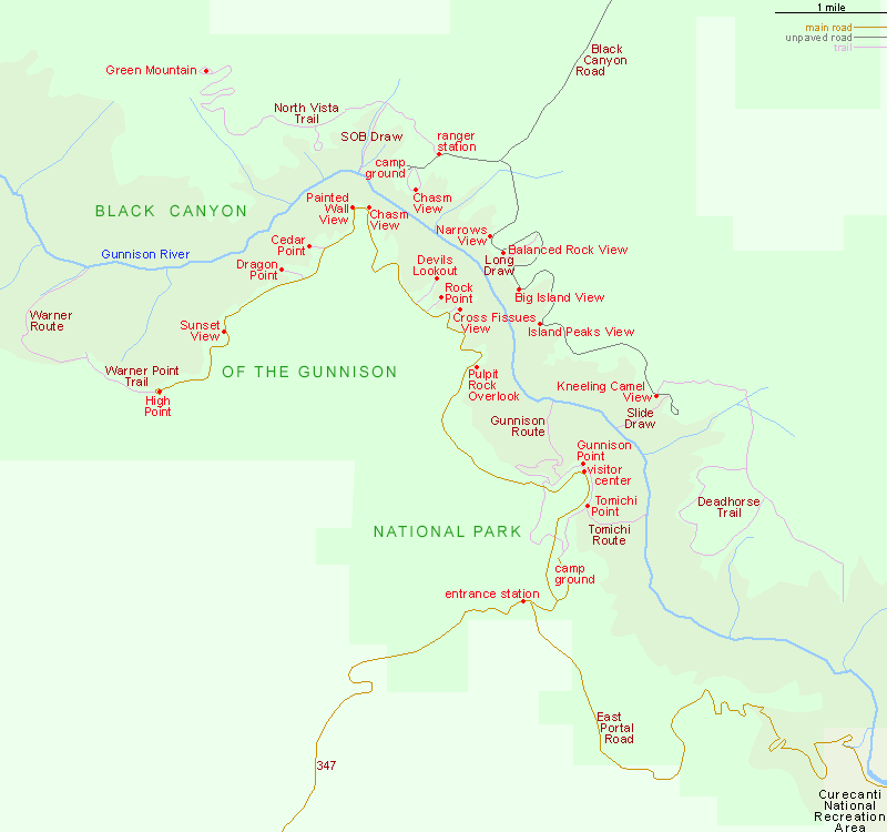
The main (south) entrance to Black Canyon of the Gunnison National Park is along US 50 then Hwy 347, 13 miles from Montrose. The much less visited North Rim is reached by several miles of unpaved roads, starting from Crawford along Hwy 92.

The distance between the two entrances is 86 miles in the east, via Curecanti National Recreation Area, or 78 miles in the west, via Delta.

Trail descriptions for the national park.

Back to Top
Arizona | California | Colorado | Idaho | Nevada | New Mexico | Oregon | Texas | Utah | Wyoming | Slot Canyons | Travelogue | SOUTHWEST

All Contents © Copyright The American Southwest | Comments and Questions | Contribute | Affiliate Marketing Disclosure | Site Map