The American Southwest
Home | Parks | Trails | Plants | Canyons
Maps | Landscapes | Site Map | Whats New? |
More...
Follow americansouthwest.net on Facebook
×
General Pages
Home
Parks
Trails
Plants
Slot Canyons
Maps
Landscapes
Itineraries
Site Map
What's New?
More pages...

States
Arizona
California
Colorado
Idaho
Nevada
New Mexico
Oregon
Texas
Utah
Wyoming


ARIZONA
CALIFORNIA
COLORADO
IDAHO
NEVADA
NEW MEXICO
OREGON
TEXAS
UTAH
WYOMING
CALIFORNIA
MAPS | PARKS | TRAILS | HOTELS

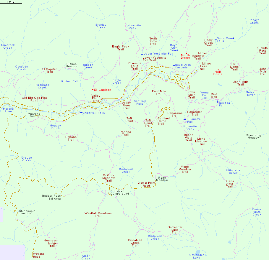
Hiking Map for Yosemite Valley and the Glacier Point Road


California > Yosemite National Park > Yosemite Valley/Glacier Point Road > Hiking Map
Hiking Map for Yosemite Valley and Glacier Point Road

For trail descriptions, see the listings pages for Yosemite Valley and the Glacier Point Road.

Other Yosemite maps:
East end of Yosemite Valley
Trails around Tuolumne Meadows and the Tioga Road

Yosemite National Park

Mp of east Yosemite Valley
Back to Top
Arizona | California | Colorado | Idaho | Nevada | New Mexico | Oregon | Texas | Utah | Wyoming | Slot Canyons | Travelogue | SOUTHWEST

All Contents © Copyright The American Southwest | Comments and Questions | Contribute | Affiliate Marketing Disclosure | Site Map