Wawona Meadow Loop, Yosemite National Park
California > Yosemite National Park > Mariposa Grove & Wawona > Hiking > Wawona Meadow Loop
Wawona Meadow Loop
Hike along an old vehicle track around a long, thin, grassy meadow along a tributary of the South Fork of the Merced River. The north end of the meadow has been made into a golf course for the Wawona Hotel but the remainder is largely unspoilt, although the main road runs just to the east, and the path is shared with horses
Length: 3.5 miles, loop
Elevation change: 200 feet
Difficulty: Easy
Type: Loop, wide trail
Usage: Medium
Season: Spring, summer, fall
Trailhead: Wawona general store
Rating (1-5): ★★★★★
Elevation change: 200 feet
Difficulty: Easy
Type: Loop, wide trail
Usage: Medium
Season: Spring, summer, fall
Trailhead: Wawona general store
Rating (1-5): ★★★★★

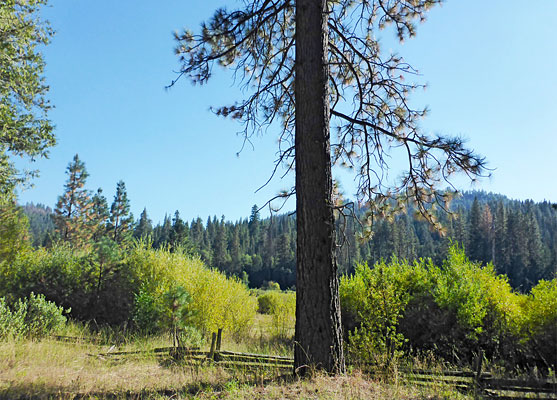
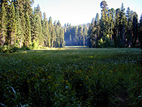
Wawona Meadow is a long (1.7 miles), narrow strip of moist grassland beside a tributary of the South Fork of the Merced River, next to the settlement of Wawona, which is a residential community entirely within Yosemite National Park, and also a long established tourist center - a guest ranch was built here by Galen Clark in 1856, 34 years before the creation of the park.
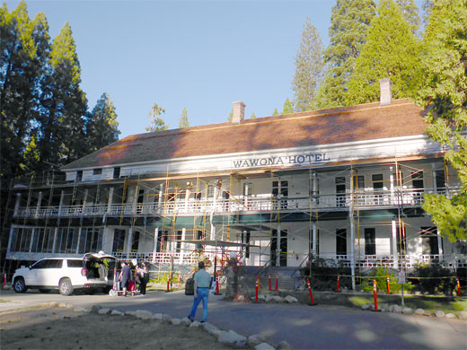
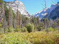
The historic, Victorian-style Wawona Hotel was constructed in 1856, overlooking the meadow, and is still in use today, albeit temporarily closed due to problems with the roof structure, and in 1918 this was accompanied by a nine hole golf course, occupying the northern end of the meadow. The remainder of the meadow is still in a natural state, however, and may be seen from all angles along the 3.6 mile Wawona Meadow Loop, a mostly level trail that runs through the edge of the surrounding pine forest, also giving fleeting views of the surrounding mountains.
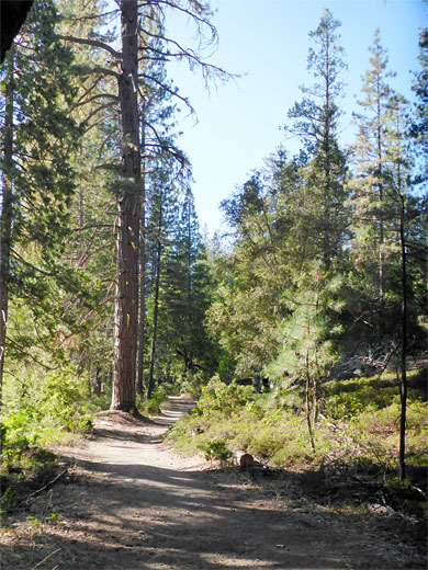
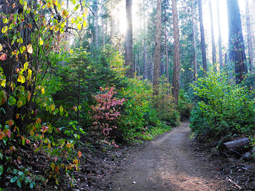
The meadow itself is marshy, and filled with tall vegetation in the summer, so the path keeps away from the grassland. Wildflowers are plentiful, along the path, especially on the sunnier northeast side where the trees are more well separated, and the land receives more sunshine; the woods along the southwest side are thicker and shadier. The entire hike is along an old vehicle road; the trail is wide, and the gradients gentle. The track intersects several little-used routes into the wooded hills to the south.
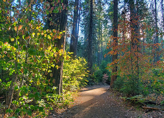
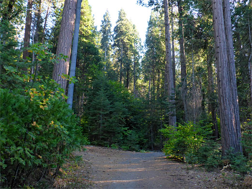
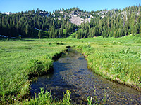
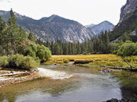
The Wawona Meadow hike may be started from several places, including near Wawona general store, along a short road that crosses the golf course, or at a pull-out on the main road, just east of Wawona hotel. From this latter place, the route is north a short distance then right at an intersection, left being a connecting path from the hotel, back to the road and crossing it, to the start of the old vehicle track, which is still partly paved in some places, in others gravel or earth. The trail is initially straight, passing many large trees, staying close to the edge of the meadow. After about half a mile it moves away, climbing a little, then later descending, now at the far south end of the meadow, and crossing the first of three branches of the creek - a good wildflower location. The second stream follows soon after, beside a junction with two paths that climb the slopes to the south, and then the third, by which time the woods are noticeably thicker and darker.
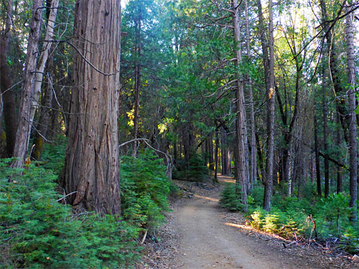
The return section of the loop, along the southeast side of the meadow, runs generally further away from the grassland and some distance above, all through the thick conifer forest, and the views are little-changing for 1.5 miles until the track ends, at a junction with Chowchilla Mountain Road, one of the alternative trailheads. This road crosses the golf course and meets the main highway just opposite Wawona Hotel.
The historic, Victorian-style Wawona Hotel was constructed in 1856, overlooking the meadow, and is still in use today, albeit temporarily closed due to problems with the roof structure, and in 1918 this was accompanied by a nine hole golf course, occupying the northern end of the meadow. The remainder of the meadow is still in a natural state, however, and may be seen from all angles along the 3.6 mile Wawona Meadow Loop, a mostly level trail that runs through the edge of the surrounding pine forest, also giving fleeting views of the surrounding mountains.
The meadow itself is marshy, and filled with tall vegetation in the summer, so the path keeps away from the grassland. Wildflowers are plentiful, along the path, especially on the sunnier northeast side where the trees are more well separated, and the land receives more sunshine; the woods along the southwest side are thicker and shadier. The entire hike is along an old vehicle road; the trail is wide, and the gradients gentle. The track intersects several little-used routes into the wooded hills to the south.
North Side of the Loop
The Wawona Meadow hike may be started from several places, including near Wawona general store, along a short road that crosses the golf course, or at a pull-out on the main road, just east of Wawona hotel. From this latter place, the route is north a short distance then right at an intersection, left being a connecting path from the hotel, back to the road and crossing it, to the start of the old vehicle track, which is still partly paved in some places, in others gravel or earth. The trail is initially straight, passing many large trees, staying close to the edge of the meadow. After about half a mile it moves away, climbing a little, then later descending, now at the far south end of the meadow, and crossing the first of three branches of the creek - a good wildflower location. The second stream follows soon after, beside a junction with two paths that climb the slopes to the south, and then the third, by which time the woods are noticeably thicker and darker.
South Side of the Loop
The return section of the loop, along the southeast side of the meadow, runs generally further away from the grassland and some distance above, all through the thick conifer forest, and the views are little-changing for 1.5 miles until the track ends, at a junction with Chowchilla Mountain Road, one of the alternative trailheads. This road crosses the golf course and meets the main highway just opposite Wawona Hotel.

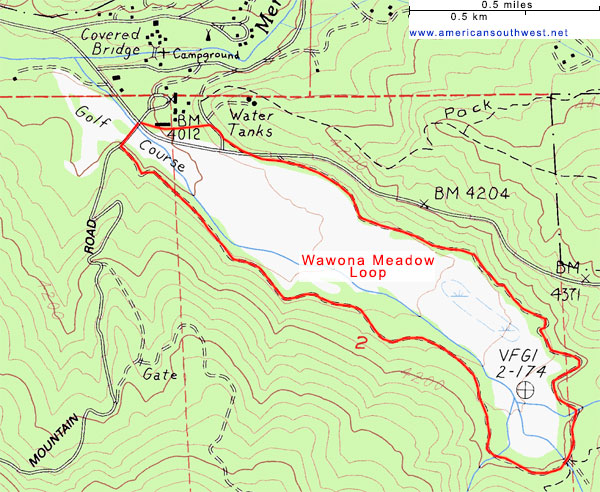
Topographic Map of the Wawona Meadow Loop
Wawona Meadow Wildflowers
More flowers along the loop
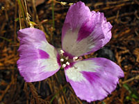 Fort Miller clarkia |
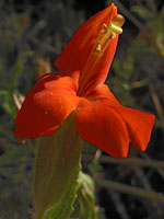 Scarlet monkeyflower |
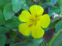 Musk monkeyflower |
More flowers along the loop
Wawona Meadow Loop - Similar Hikes

All Contents © Copyright The American Southwest | Comments and Questions | Contribute | Affiliate Marketing Disclosure | Site Map