The American Southwest
Home | Parks | Trails | Plants | Canyons
Maps | Landscapes | Site Map | Whats New? |
More...
Follow americansouthwest.net on Facebook
×
General Pages
Home
Parks
Trails
Plants
Slot Canyons
Maps
Landscapes
Itineraries
Site Map
What's New?
More pages...

States
Arizona
California
Colorado
Idaho
Nevada
New Mexico
Oregon
Texas
Utah
Wyoming


ARIZONA
CALIFORNIA
COLORADO
IDAHO
NEVADA
NEW MEXICO
OREGON
TEXAS
UTAH
WYOMING
CALIFORNIA
MAPS | PARKS | TRAILS | HOTELS

Topographic Map of the Miners Ridge and James Irvine Trails, Prairie Creek Redwoods State Park


California > Redwood National and State Parks > Prairie Creek Redwoods State Park > Hiking > Miners Ridge and James Irvine Trails > Topo Map
Map of the Miners Ridge and James Irvine Trails

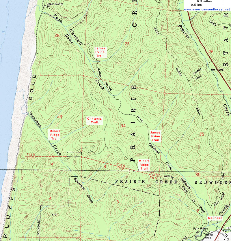
The south end of the James Irvine Trail follows a slightly different course to that shown on most maps; a new route was established a little way up the west side of Godwood Creek valley, to avoid damage to the delicate creekside envirnonment.

Back to Top
Arizona | California | Colorado | Idaho | Nevada | New Mexico | Oregon | Texas | Utah | Wyoming | Slot Canyons | Travelogue | SOUTHWEST

All Contents © Copyright The American Southwest | Comments and Questions | Contribute | Affiliate Marketing Disclosure | Site Map