The American Southwest
Home | Parks | Trails | Plants | Canyons
Maps | Landscapes | Site Map | Whats New? |
More...
Follow americansouthwest.net on Facebook
×
General Pages
Home
Parks
Trails
Plants
Slot Canyons
Maps
Landscapes
Itineraries
Site Map
What's New?
More pages...

States
Arizona
California
Colorado
Idaho
Nevada
New Mexico
Oregon
Texas
Utah
Wyoming


ARIZONA
CALIFORNIA
COLORADO
IDAHO
NEVADA
NEW MEXICO
OREGON
TEXAS
UTAH
WYOMING
CALIFORNIA
MAPS | PARKS | TRAILS | HOTELS

Map of Pinnacles National Park


California > Pinnacles National Park > Map
Map of Pinnacles National Park

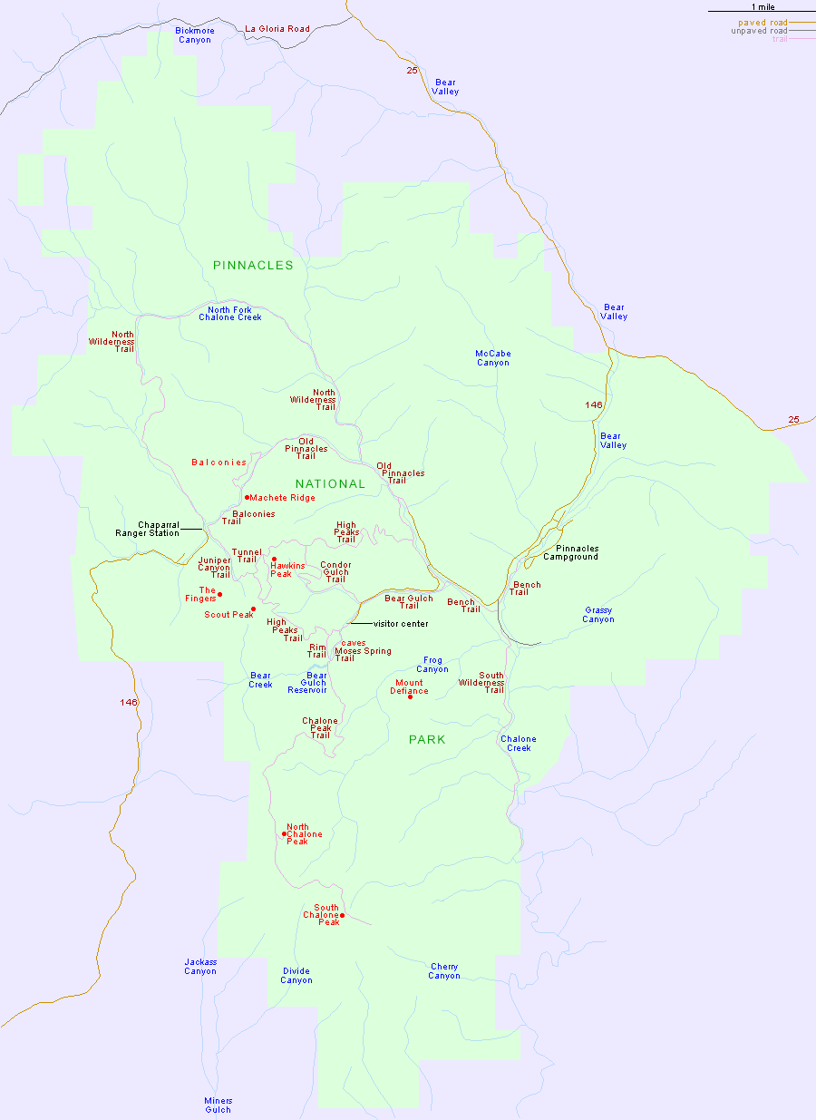
There is no through road across Pinnacles National Park, as the two sections of Highway 146 terminate either side of the central mountains, about 2 miles apart; a drive from the west entrance at the Chaparral Ranger Station to the (main) east visitor center in Bear Gulch is 60 miles along sometimes narrow, winding roads.

For trail descriptions, see the Pinnacles National Park hiking index.

Nearby towns (with distances to Bear Gulch) include Coalinga (72 miles), King City (34 miles), Monterey (75 miles), Paso Robles (85 miles), and Salinas (61 miles).

PDF format maps of Pinnacles National Park, from the National Park Service:
PDFPark map (624 kb); detail map - High Peaks (172 kb)

Back to Top
Arizona | California | Colorado | Idaho | Nevada | New Mexico | Oregon | Texas | Utah | Wyoming | Slot Canyons | Travelogue | SOUTHWEST

All Contents © Copyright The American Southwest | Comments and Questions | Contribute | Affiliate Marketing Disclosure | Site Map