The American Southwest
Home | Parks | Trails | Plants | Canyons
Maps | Landscapes | Site Map | Whats New? |
More...
Follow americansouthwest.net on Facebook
×
General Pages
Home
Parks
Trails
Plants
Slot Canyons
Maps
Landscapes
Itineraries
Site Map
What's New?
More pages...

States
Arizona
California
Colorado
Idaho
Nevada
New Mexico
Oregon
Texas
Utah
Wyoming


ARIZONA
CALIFORNIA
COLORADO
IDAHO
NEVADA
NEW MEXICO
OREGON
TEXAS
UTAH
WYOMING
CALIFORNIA
MAPS | PARKS | TRAILS | HOTELS

Map of Lava Beds National Monument


California > Lava Beds National Monument > Map
Map of Lava Beds National Monument


The one major highway near Lava Beds National Monument is CA 139 to the east, from where two lesser roads enter the preserve from the north and south. Access from the west is also possible, along partly unpaved routes through the Modoc National Forest, such as Red Rock Road from Macdoel.

PDF format maps of Lava Beds National Monument, from the National Park Service:
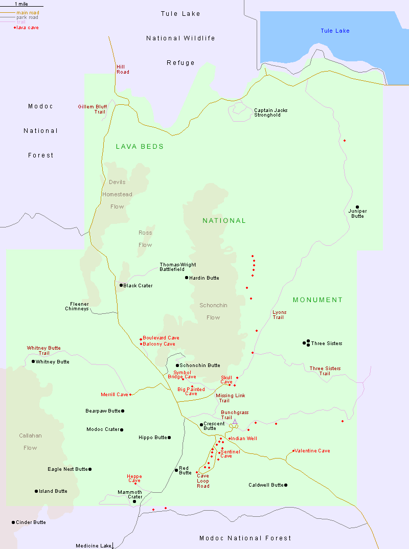
PDFArea map (56 kb)
Detail map (228 kb)

Back to Top
Arizona | California | Colorado | Idaho | Nevada | New Mexico | Oregon | Texas | Utah | Wyoming | Slot Canyons | Travelogue | SOUTHWEST

All Contents © Copyright The American Southwest | Comments and Questions | Contribute | Affiliate Marketing Disclosure | Site Map