Highlights:
Scattered giant sequoia groves, north and south of the more well known national park. Most are quite easily accessed by unpaved tracks, including Converse Basin, site of many large stumps and the 6th largest living sequoia in the state
Nearby towns:
Management:
Location:
Seasons:
Spring, summer, fall - access roads are closed by snow in winter
Rating (1-5):
★★★★★

Giant Sequoia NM is part of the Sierra Nevada itinerary
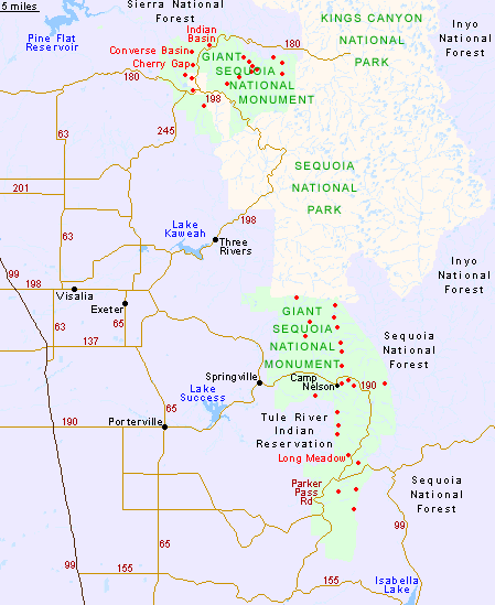
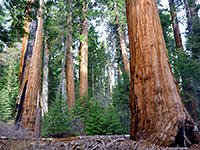
Although the largest and most well known groups of sequoiadendron giganteum are contained within Sequoia National Park and the Grant Grove unit of Kings Canyon National Park, 38 other groves of the huge trees are found along a 70 mile stretch of the western slopes of the southern Sierra Nevada, the majority rather inaccessible. All are part of the Sequoia National Forest, but received extra protection in 2000 after the creation, by outgoing president Bill Clinton, of the Giant Sequoia National Monument, a BLM-administered preserve of over 300,000 acres, in two sections 25 miles apart.
The northern portion is the smaller, enclosing 16 groves quite close together, and is visited more often since the forest is crossed by busy CA 180 to Kings Canyon. Most of the groves are quite readily accessed, being just a mile or two from the highway, and one (Converse Basin) includes the Boole Tree, the sixth largest in California. The southern section of the monument partially surrounds the Tule River Indian Reservation and contains 22 groves plus a more diverse range of habitats, reflecting the wide variation in elevations, from chaparral at 2,500 feet through the extensive coniferous forest to granite summits at nearly 10,000 feet. The bendy, little traveled route CA 190 passes through the center, while less good tracks penetrate deeper into the woods, though some of the more remote sequoias need long distance hiking to reach.
The northern portion is the smaller, enclosing 16 groves quite close together, and is visited more often since the forest is crossed by busy CA 180 to Kings Canyon. Most of the groves are quite readily accessed, being just a mile or two from the highway, and one (Converse Basin) includes the Boole Tree, the sixth largest in California. The southern section of the monument partially surrounds the Tule River Indian Reservation and contains 22 groves plus a more diverse range of habitats, reflecting the wide variation in elevations, from chaparral at 2,500 feet through the extensive coniferous forest to granite summits at nearly 10,000 feet. The bendy, little traveled route CA 190 passes through the center, while less good tracks penetrate deeper into the woods, though some of the more remote sequoias need long distance hiking to reach.
Giant Sequoia Table of Contents

Map of Giant Sequoia National Monument
Red dots indicate the location of the 38 sequoia groves.
North Section of Giant Sequoia NM
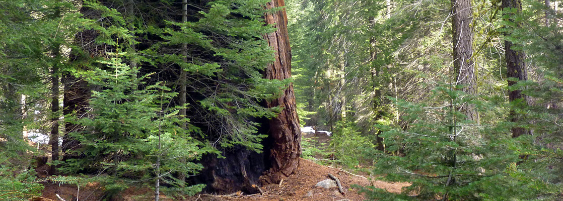
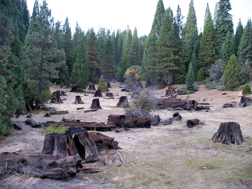
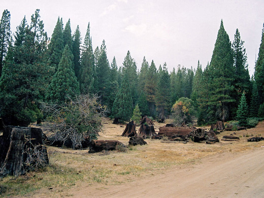
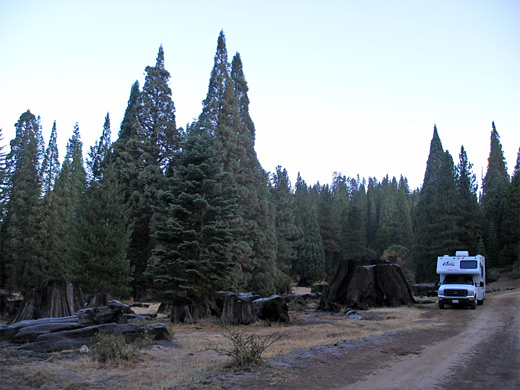
Highlight of the north section of the national monument is Converse Basin, site of extensive logging in the early 20th century but still home to several surviving old growth sequoias including the 269 foot Boole Tree, plus many huge stumps and fallen trunks, mixed with healthy young trees. The area is reached by a good quality dirt track that leaves Highway 180 1.7 miles north of the Kings Canyon National Park boundary and winds down a hillside into the basin, and on to nearby Stump Meadow - both are open, grassy clearings in the forest, filled with old sequoia remnants. There are several nice places for free camping en route, more peaceful alternatives to the official USFS and NPS sites nearby. Other easily accessed groves include Indian Basin, on the north side of Hwy 180 just opposite the turn-off for Hulme Lake, and the smaller group at Cherry Gap, also close to CA 180 (west side), reached by a track starting from McGee Overlook.
South Section of Giant Sequoia NM
The larger southern part of Giant Sequoia National Monument has one main center for visitors, at Long Meadow Grove, next to Hwy 190 just north of the junction with Parker Pass Road. The trees may be seen along an easy, 1.4 mile interpretive path - Trail of 100 Giants, which actually passes rather fewer than a hundred giant sequoias, the largest 20 foot in diameter and 220 feet tall. Camping is available just opposite at the Redwood Meadow USFS campground. The next most easily reached giant sequoias are a few miles further north, near the village of Camp Nelson. Three groves (Belknap Camp, McIntyre, Wheel Meadow) grow quite close together, either side of the South Fork of the Middle Fork of the Tule River, and can be visited by hiking short trails starting from one of three locations: the Belknap campsite, Cedar Slope (the next small village to the east), or from a parking area along the highway near Quaking Aspen, a little further up in the mountains.
Trails of Giant Sequoia National Monument
Camp Nelson Trail
★★★★★
★★★★★
3.6 miles, 1,650 feet
Tranquil path alongside the Middle Fork of the Tule River through two unspoilt sequoia groves (Wheel Meadow and McIntyre), passing a good selection of living and fallen trees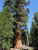
Trail of 100 Giants
★★★★★
★★★★★
1.4 miles, 120 feet (loop)
Paved loop through the giant trees of the Long Meadow Grove, easily reached from Hwy 107Giant Sequoia - Similar Places
- Humboldt Redwoods State Park - coastal redwoods in north California
- Mariposa Grove, Yosemite National Park - large collection of sequoia trees
- Muir Woods National Monument - popular redwood grove near San Francisco
All Contents © Copyright The American Southwest | Comments and Questions | Contribute | Affiliate Marketing Disclosure | Site Map