Home
|
Parks
|
Trails
|
Plants
|
Canyons
Maps
|
Landscapes
|
Site Map
|
Whats New?
|
More...
×
General Pages
Home
Parks
Trails
Plants
Slot Canyons
Maps
Landscapes
Itineraries
Site Map
What's New?
More pages...
States
Arizona
California
Colorado
Idaho
Nevada
New Mexico
Oregon
Texas
Utah
Wyoming
MENU
ARIZONA
CALIFORNIA
COLORADO
IDAHO
NEVADA
NEW MEXICO
OREGON
TEXAS
UTAH
WYOMING
ARIZONA
MAPS
|
PARKS
|
TRAILS
|
PHOTOS
|
HOTELS
All Arizona Locations...
NPS - LANDSCAPES
Canyon de Chelly
Chiricahua
Grand Canyon
Lake Mead
Organ Pipe
Petrified Forest
Saguaro
Sunset Crater
NPS - HISTORIC SITES
Casa Grande Ruins
Coronado
Fort Bowie
Hubbell Trading Post
Montezuma Castle
Navajo
Pipe Spring
Tonto
Tumacacori
Tuzigoot
Walnut Canyon
Wupatki
Yuma Crossing
OTHER PLACES
Agua Fria National Monument
Alamo Lake State Park
Apache Trail
Aravaipa Canyon
Arizona-Sonora Desert Museum
Bartlett Reservoir
Beaver Dam Mountains
Bill Williams River
Black Canyon
Blue Canyon
Boyce Thompson Arboretum
Cabeza Prieta National Wildlife Refuge
Catalina State Park
Coal Mine Canyon
Cochise Stronghold
Copper Creek
Coronado Trail
Coyote Buttes
Dead Horse Ranch State Park
Estrella Mountain Regional Park
Granite Mountain
Ha Ho No Geh Canyon
Havasupai Reservation
Homolovi State Park
Hualapai Reservation
Ironwood Forest National Monument
Jewel of the Creek
Kaiser Spring Canyon
Kofa National Wildlife Refuge
Lake Havasu
Lake Pleasant
Lees Ferry
Little Colorado River
Lost Dutchman State Park
Madera Canyon
Meteor Crater
Mission San Xavier del Bac
Mount Lemmon
Painted Rock Petroglyph Site
Patagonia Lake State Park
Pearce Ferry
Picacho Peak State Park
Picture Canyon
Ramsey Canyon
Red Mountain
Red Rock State Park
Route 66
Sabino Canyon
San Carlos Lake
San Francisco Peaks
San Tan Mountain
Sedona
Slide Rock State Park
Sonoran Desert National Monument
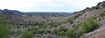
South Mountain Park
Spur Cross Ranch
Superstition Mountains
Sycamore Canyon
Theodore Roosevelt Lake
Tombstone
Tonto Creek
Tonto Natural Bridge State Park
Tonto National Forest
Tortolita Mountains
Tucson Mountain Park
Usery Mountain RP
Vermilion Cliffs National Monument
Watson Lake
West Clear Creek
White Tank Mountain RP
Arizona site map
Panoramic Photographs of Arizona
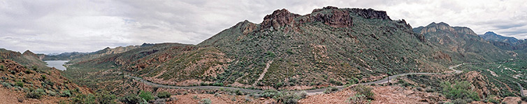
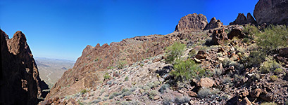
The highway, from Canyon Lake to Tortilla Flat, Apache Trail
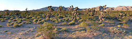
Joshua tree plain, Beaver Dam Mountains
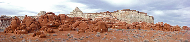
Red boulders and bluish-white cliffs, Blue Canyon
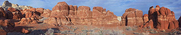
Red rocks at sunset, Blue Canyon
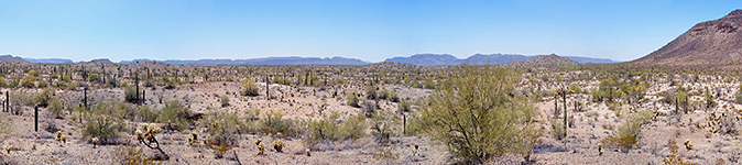
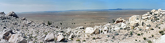
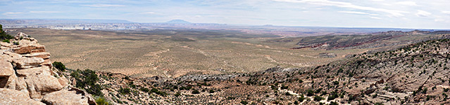
Sandy flats, Cabeza Prieta National Wildlife Refuge
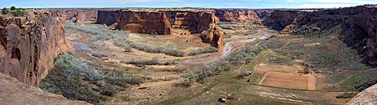
Face Rock Overlook, Canyon de Chelly National Monument
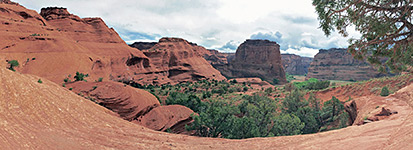
Rocks along the trail, Canyon de Chelly National Monument
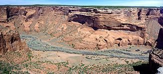
Tsegi Overlook, Canyon de Chelly National Monument
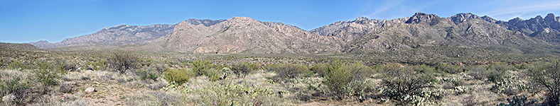
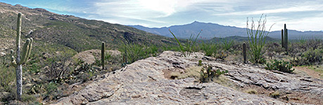
Panorama of the Santa Catalina Mountains, Catalina State Park
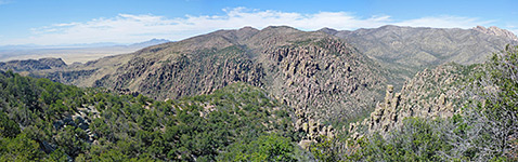
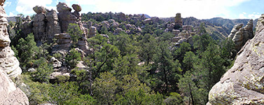
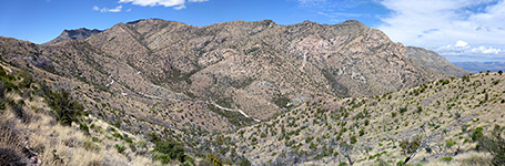
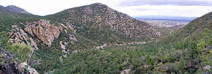
Panorama above Bonita Canyon, Chiricahua National Monument
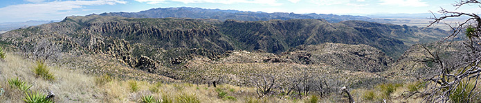
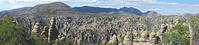
Panorama south from the summit, Chiricahua National Monument
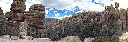
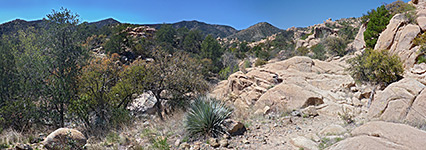
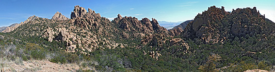
Pinnacles along the Echo Canyon Trail, Chiricahua National Monument
Pinnacles and trees, Chiricahua National Monument
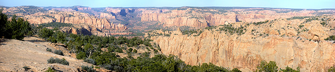
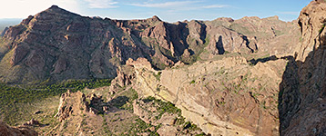
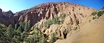
Rhyolite Canyon and Sugarloaf Mountain , Chiricahua National Monument
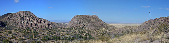
Valley to the northwest, Chiricahua National Monument
Bushes and flat rocks, Cochise Stronghold
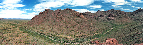
Panorama of Cochise Stronghold, Cochise Stronghold
Montezuma Canyon, Coronado National Memorial
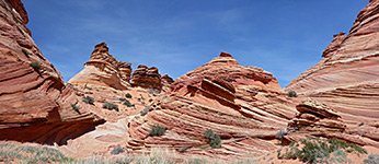
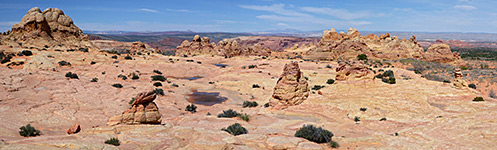
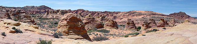
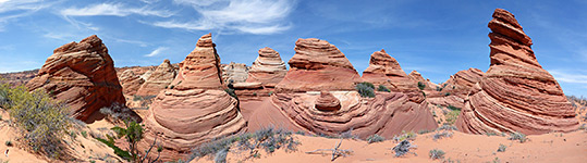
Group of teepees, Coyote Buttes
Large group of peaks and mounds, Coyote Buttes
Plateau and teepees, Coyote Buttes
Teepees to the east, Coyote Buttes
Teepees west of Cottonwood Spring, Coyote Buttes
Undulating hills, Coyote Buttes
Yellow stripes, Coyote Buttes
Panoramic view of Fort Bowie, Fort Bowie National Historic Site
Cliffs below Desert View, Grand Canyon National Park
Cliffs below Piute Point, Grand Canyon National Park
Colorado River - upstream, Grand Canyon National Park
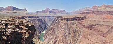
Colorado River, from Plateau Point, Grand Canyon National Park
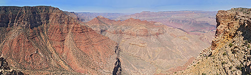
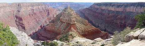
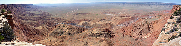
Comanche Point panorama, Grand Canyon National Park
Diana Temple, Grand Canyon National Park
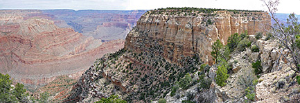
Edge of the cliffs at Mescalero Point, Grand Canyon National Park
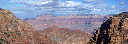
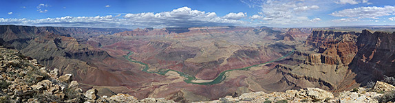
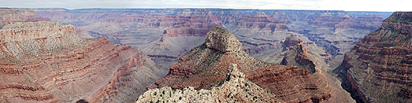
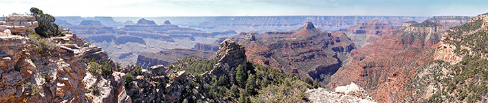
Grand Canyon panorama, Grand Canyon National Park
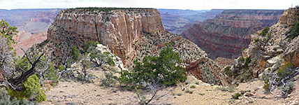
Jicarilla Point, Grand Canyon National Park
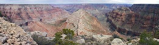
Panorama above Lookout Point, Grand Canyon National Park
Panorama near the start of the trail, Grand Canyon National Park
Panorama of Hance Rapids, Grand Canyon National Park
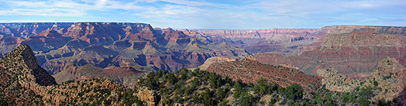
Panorama of the Grand Canyon, from Widforss Point, Grand Canyon National Park
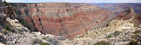
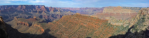
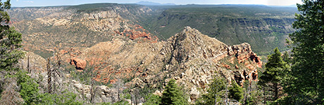
Panorama of the red ridge south of Horseshoe Mesa, Grand Canyon National Park
Piute Point, Grand Canyon National Park
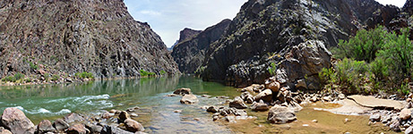
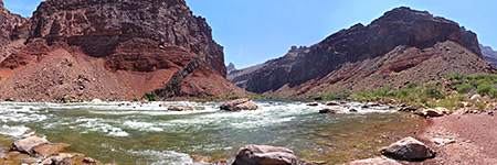
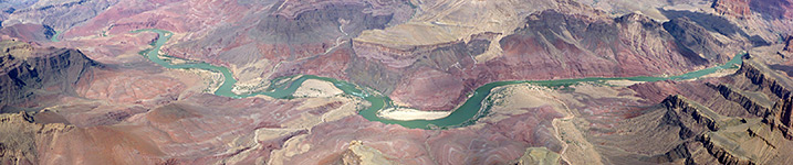
The Colorado River, Grand Canyon National Park
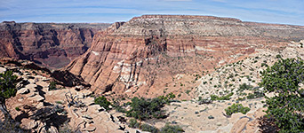
Topaz Canyon, Vesta Temple and Boucher Creek, Grand Canyon National Park
Bench above Palm Canyon, Kofa National Wildlife Refuge
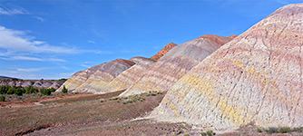
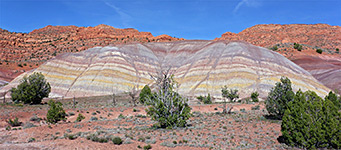
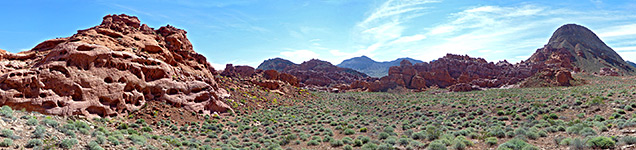
Red mounds and a sagebrush valley, Lake Mead National Recreation Area
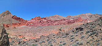
Southern edge of the formations, Lake Mead National Recreation Area
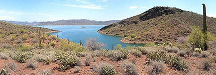
Cacti above Pipeline Cove, Lake Pleasant
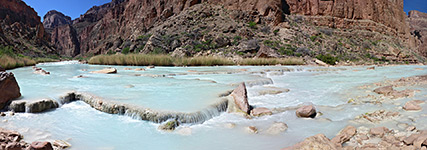
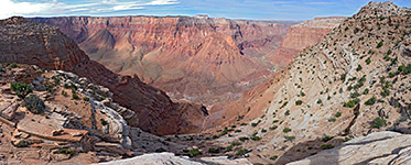
The river, near Big Canyon, Little Colorado River
View west from the crater's edge, Meteor Crater
Tsegi Overlook, Navajo National Monument
Lower end of Arch Canyon, Organ Pipe Cactus National Monument
Panorama of Alamo Canyon, Organ Pipe Cactus National Monument
Panorama to the east and south, Organ Pipe Cactus National Monument
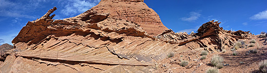
Multi-textured cliff face, Paria Canyon-Vermilion Cliffs Wilderness Area
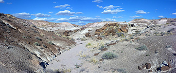
Dry wash, Petrified Forest National Park
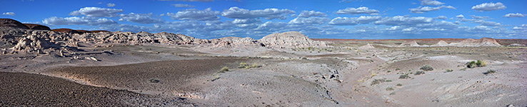
Panorama of badlands and eroded rocks, Petrified Forest National Park
Above the lower canyon, Ramsey Canyon Preserve
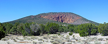
The mountain, along the approach trail, Red Mountain
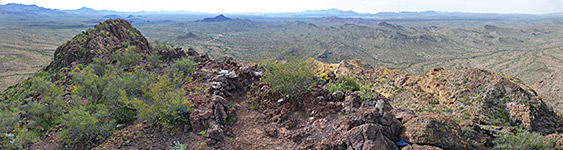
Wide view of the amphitheater, Red Mountain
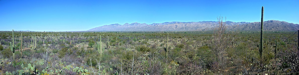
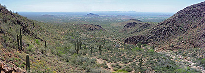
View east, Saguaro National Park
View from Pink Hill, Saguaro National Park
Hills to the northwest, San Tan Mountain Regional Park
Bushes and red rocks, Sedona
Cliffs at the upper end of the canyon, Sedona
Cliffs to the east, at the edge of Munds Mountain, Sedona
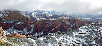
Munds Mountain, Sedona
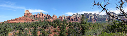
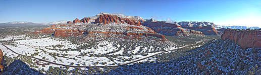
Panorama of upper Oak Creek, Sedona
Ridge bordering Fay Canyon, Sedona
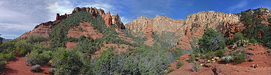
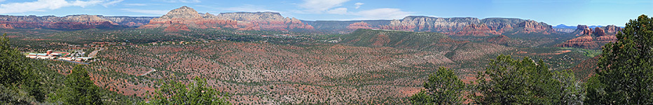
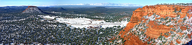
The red rocks of Sedona, Sedona
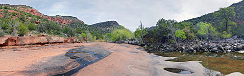
The streambed, Sedona
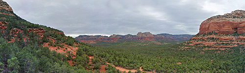
Valley northwest of the bridge, Sedona
View north from the summit, Sedona
View southwest from the summit, Sedona
Cinder Hills Overlook, Sunset Crater Volcano National Monument
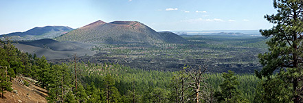
Panorama of Sunset Crater and the Bonito Lava Flow, Sunset Crater Volcano National Monument
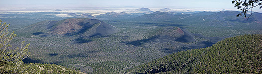
Panorama of wooded lands to the south, Sunset Crater Volcano National Monument
View down the canyon towards Gold Canyon, Superstition Mountains
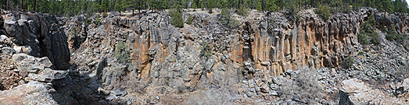
Orange-grey basalt, Sycamore Canyon
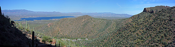
Chuckwalla Canyon, Theodore Roosevelt Lake
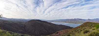
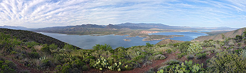
View east across the lake, Theodore Roosevelt Lake
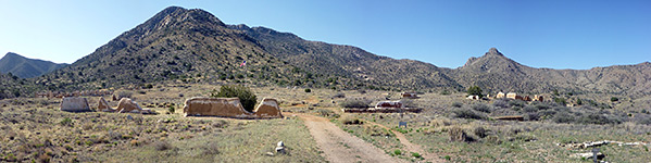
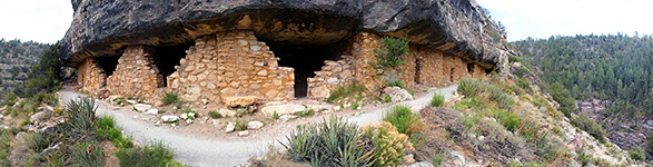
Panorama from the Lower Ruin, Tonto National Monument
Canyon rim, Vermilion Cliffs National Monument
Ferry Swale, Vermilion Cliffs National Monument
House Rock Valley, Vermilion Cliffs National Monument
Vermilion Cliffs at sunset, Vermilion Cliffs National Monument
Water Pockets, Vermilion Cliffs National Monument
Island Trail ruins, Walnut Canyon National Monument
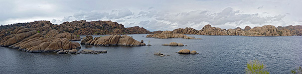
Panorama of Watson Lake, Watson Lake
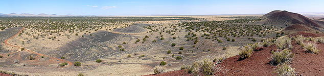
Panorama of Doney Mountain, Wupatki National Monument
Back to Top
All Contents © Copyright The American Southwest
|
Comments and Questions
|
Contribute
|
Affiliate Marketing Disclosure
|
Site Map