State Parks and State Natural Areas in Texas
Other Texas listings: national parks, monuments, recreation areas and historic sites.
| Park | Features | Location |
| Atlanta State Park | Small section of the tree-lined shore of Wright Patman Lake | Northeast Texas, near Texarkana |
| Balmorhea State Park | Outdoor, spring-fed swimming pool, up to 25 feet deep, plus an area of desert wetland | Balmorhea, near the I-10/I-20 intersection in west Texas |
| Barrington Living History Farm | Historical farm with period exhibits and interpretive demonstrations | Washington, 80 miles northwest of Houston |
| Barton Warnock Environmental Education Center | Gardens and historical exhibits about Big Bend country and the Chihuahuan Desert | Terlingua, near the east entrance to Big Bend Ranch SP |
| Bastrop State Park | Lake and forest, including groves of the loblolly pine, a species more common further east. 12 miles of trails | 30 miles southeast of Austin |
| Bentsen-Rio Grande Valley State Park | Riparian land next to the Rio Grande - popular for birding | South Texas, near McAllen |
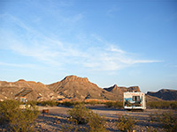
| Big Bend Ranch State Park | Largest state park in Texas - rugged desert wilderness bordering the Rio Grande | West of Big Bend National Park |
| Big Spring State Park | Urban park on a hill near the center of Big Spring - short trails and views of the city | FM 700, Big Spring |
| Blanco State Park | Riverside park in downtown Blanco | South side of Blanco, along the Blanco River |
| Bonham State Park | Lake with small areas of grassland and woods | 70 miles northeast of Dallas |
| Brazos Bend State Park | Prairie, forest, swamps and wetlands along the Brazos River - many different plants and animals | 40 miles south of Houston |
| Buescher State Park | Small lake and a wooded, hilly area crossed by an 8 mile trail | 40 miles southeast of Austin |
| Caddo Lake State Park | Swampy, wooded land on the west side of Caddo Lake - good for fishing and wildlife watching | Hwy 43, 16 miles from Marshall in east Texas |
| Caprock Canyons State Park & Trailway | Scenic red rock canyons and buttes at the edge of the High Plains, plus a 64 mile section of disused railroad | 100 miles southeast of Amarillo |
| Cedar Hill State Park | Lake in the Dallas suburbs, surrounded by wooded hills, popular for cycling | Southwest Dallas, near Grand Prairie |
| Choke Canyon State Park | Two sections along the south shore of Yarbrough Lake - boating and fishing are the main activities | Half way between San Antonio and Corpus Christi, near I-37 |
| Cleburne State Park | Small, spring-fed lake with scenic, wooded surroundings | 12 miles from Cleburne, south of Fort Worth |
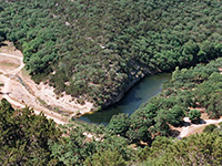
| Colorado Bend State Park | Hill Country park on the Colorado River - woods and creeks, caves and travertine formations, and a 65 foot waterfall | 28 miles west of Lampasas |
| Cooper Lake State Park | Typical countryside lake - fishing, camping and boating available | 80 miles northwest of Dallas |
| Copper Breaks State Park | Lakes and mesquite/juniper-covered mesas of richly colored sandstone, crossed by various trails | Along Hwy 6 south of Quanah - 90 miles from Wichita Falls |
| Daingerfield State Park | Lake enclosed by forest of tall pine, oak and maple trees | Northeast Texas, 2 miles from Daingerfield |
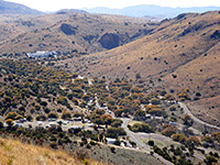
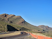
| Davis Mountains State Park | Rugged mountain range in the Chihuahuan Desert - park occupies a small area adjacent to Fort Davis NHS | Fort Davis, along Hwy 17 & 118 |
| Devils River State Natural Area | Remote, undeveloped park on desert land bordering the Devils River - accessed by unpaved roads | 22 miles from US 277, north of Del Rio |
| Devil's Sinkhole State Natural Area | Circular cavern on the Edwards Plateau up to 400 feet deep, open by advance reservation only | East of Rock Springs |
| Dinosaur Valley State Park | Popular park featuring dinosaur footprints alongside the Paluxy River | 80 miles southwest of Dallas |
| Eisenhower State Park | Section of the extensive shoreline of Lake Texoma, along the Oklahoma border | Near Denison, on US 69/75 |
| Enchanted Rock State Natural Area | Huge block of pinkish granite rising above the Texas Hill Country | FM 965, between Fredericksburg and Llano |
| Estero Llano Grande State Park | Birding area along a narrow lake in far south Texas | 4 miles from Westlaco on US 83 |
| Fairfield Lake State Park | Rural lake with wooded surroundings | Near Fairfield, 100 miles south of Dallas |
| Falcon State Park | Part of the east shore of Falcon International Reservoir along the Rio Grande - near the Mexican border | Just off US 83, south of Zapata |
| Fort Boggy State Park | Wetlands, wooded hills and a small lake | Next to I-45, half way between Dallas and Houston |
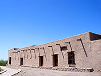
| Fort Leaton State Historic Site | Adobe fort built 1848, used for trading and occasional military expeditions | East edge of Presidio along FM 170 |
| Fort Parker State Park | 700 acre lake surrounded by low, wooded hills | Hwy 14, 40 miles east of Waco |
| Fort Richardson State Park, Historic Site & Lost Creek Reservoir Trailway | Restored fort (established 1867), grassland, woods, reservoir and multi-use creekside trail | South side of Jacksboro, along US 281/380 |
| Franklin Mountains State Park | Dramatic mountain range rising above El Paso - hiking and excellent vistas. Largest urban park in the USA | North edge of El Paso |
| Galveston Island State Park | Dunes, beach and marshland along the west side of the barrier island protecting Galveston from the Gulf of Mexico | Ten miles southwest of Galveston city center |
| Garner State Park | Forested land either side of the Frio River - good for swimming, and walking along nature trails through the woods | US 83, north of Uvalde |
| Goliad State Park and Historic Site | Several historic buildings on wooded land in a bend on the San Antonio River | South side of Goliad, along US 77/183 |
| Goose Island State Park | Small barrier island on Arkansas Bay; popular camping location. Includes a famous 1000 year old oak tree | 40 miles northeast of Corpus Christi along Hwy 35 |
| Government Canyon State Natural Area | Hiking and nature study in the wooded hills just outside San Antonio. Park open 2005; still being developed | West side of San Antonio, close to Loop 1604 |
| Guadalupe River State Park | Forested limestone bluffs adjoining the Guadalupe River in the Texas Hill Country | 40 miles north of San Antonio |
| Hill Country State Natural Area | Valleys, hills, grassland and streams on the Edwards Plateau; hiking is the main activity | Ten miles southwest of Bandera |
| Honey Creek State Natural Area | Diverse plantlife along a small stream - an undeveloped park, open to guided tours only | 40 miles north of San Antonio - next to Guadalupe River SP |
| Hueco Tanks State Park and Historic Site | Large boulders, good for climbing, and covered by many ancient pictographs. Entry restrictions apply | 25 miles east of El Paso |
| Huntsville State Park | Small, branched lake (Lake Raven) surrounded by thick pine woods - fishing, hiking and camping available | 8 miles south of Huntsville, near I-45 |
| Indian Lodge | Historic inn with expansive views, at the foot of the Davis Mountains | Fort Davis, west Texas |
| Inks Lake State Park | Scenic lake enclosed by granite hills, cedar/oak woods and grassland | 9 miles west of Burnet |
| Kickapoo Cavern State Park | Impressive formations in a quarter mile long cave - open by guided tours only | FM 674, 55 miles from Del Rio |
| Lake Arrowhead State Park | Developed, recreation-based park on the west shore of Lake Arrowhead | 14 miles southeast of Wichita Falls |
| Lake Bob Sandlin State Park | Wooded area adjoining a large lake - especially colorful in the fall | 11 miles southwest of Mt Pleasant |
| Lake Brownwood State Park | Camping, nature trails, fishing and boating on a 7,300 acre lake | 16 miles northwest of Brownwood, central Texas |
| Lake Casa Blanca International State Park | Urban park in Laredo, on the south shore of Lake Casa Blanca | East side of Laredo off US 59 |
| Lake Colorado City State Park | 5 miles of shoreline; park popular for camping and the usual water-based activities | Near Colorado City along I-20, half way between Abilene and Midland |
| Lake Corpus Christi State Park | Bays and inlets on the east side of a large lake | 4 miles from Mathis and 35 miles from Corpus Christi |
| Lake Livingston State Park | Wooded land adjoining Lake Livingston; developed shoreline with picnic areas, nature trails and boat ramps | FM 3126, 7 miles from Livingston |
| Lake Mineral Wells State Park & Trailway | Smallish lake with forested surroundings; campsites and trails, including a 19 mile trailway | East side of Mineral Wells, along US 180 |
| Lake Somerville State Park & Trailway | Several sections of the shoreline of Somerville Lake; 20 miles of trails through woods and grassland, and many recreation opportunities on the water | 80 miles northwest of Houston |
| Lake Tawakoni State Park | Small area of woodland and shoreline along Lake Tawakoni | 50 miles east of Dallas |
| Lake Texana State Park | Patch of oak woods on the west side of Lake Texana, surrounded by farmland | Hwy 111, 95 miles southwest of Houston |
| Lake Whitney State Park | Grassy land bordering Lake Whitney; activities concentrated on or beside the water | FM 1244, 15 miles from Hillsboro |
| Lockhart State Park | Stream, woodland and a 9-hole golf course | On the southwest edge of Lockhart |
| Longhorn Cavern State Park | Unusual, water-carved cave in the Texas Hill Country | Ten miles southwest of Burnet |
| Lost Maples State Natural Area | Steep limestone canyons and unusual trees - especially colorful during fall | Ranch Road 187, 50 miles from Kerrville |
| Lyndon B. Johnson State Park & Historic Site | Grasslands beside the Pedernales River with living history farm and several old buildings, plus visitor center with LBJ memorabilia | US 290, 16 miles east of Fredericksburg |
| Martin Creek Lake State Park | Fishing, camping and boating on the north shore of an artificial lake | Northeast Texas, near Longview |
| Martin Dies, Jr. State Park | Small park containing wooded swampland on the shores of an east Texas lake; abundant wildlife | US 190, half way between Jasper and Woodville |
| McKinney Falls State Park | Wide but shallow limestone falls along Onion Creek, in a fairly developed area | Ten miles south of Austin |
| Meridian State Park | 72 acre lake enclosed by low, wooded hills | 48 miles northwest of Waco |
| Mission Tejas State Park | Section of the east Texas pineywoods, with trails, campsites, fishing and two historic structures | Surrounded by the Davy Crockett National Forest, along Hwy 21 |
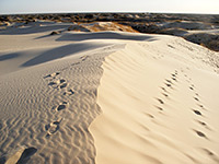
| Monahans Sandhills State Park | Whitish sand dunes, up to 70 feet high | Near I-20, a few miles from Monahans in west Texas |
| Mother Neff State Park | Thickly wooded land bordering the Leon River - base for camping, fishing and short hikes | Hwy 236, 30 miles from Waco |
| Mustang Island State Park | Beaches and sand dunes close to North Padre Island | Hwy 361, 20 miles from Corpus Christi |
| Palmetto State Park | Swampy environment along the San Marcos River, home to exotic plants and wildlife | 4 miles from I-10 between San Antonio and Houston |
| Palo Duro Canyon State Park | The largest canyon system in Texas, on the border between the High Plains and the Rolling Plains | 36 miles by road from Amarillo |
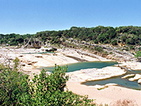
| Pedernales Falls State Park | Wide waterfall along a clear river in a scenic limestone canyon | 35 miles west of Austin |
| Possum Kingdom State Park | Wooded promontory on the west edge of a large, branched lake | 17 miles north of Caddo, 100 miles from Fort Worth |
| Purtis Creek State Park | Small lake with wooded surroundings | 60 miles southeast of Dallas |
| Ray Roberts Lake State Park | Several sites along the mostly undeveloped shoreline of a large, branched reservoir | 50 miles north of Dallas |
| Resaca de la Palma State Park | Birding location in far south Texas - tropical environment near the Rio Grande | Ten miles from Brownsville via US 281 |
| San Angelo State Park | Grassy land on the west side of OC Fisher Lake - park offers camping and water-based activities | Northwest edge of San Angelo |
| Sea Rim State Park | Marshland and beaches on the Gulf of Mexico, slowly recovering from hurricane damage | Southeast corner of Texas, adjoining the Louisiana border |
| Seminole Canyon State Park & Historic Site | Desert canyon beside the Rio Grande, with well preserved Indian pictographs (viewable only if accompanied by a guide) | Along US 90, 40 miles northwest of Del Rio |
| Sheldon Lake State Park | Marshland bordering a small reservoir - good for fishing and wildlife observation | 15 miles northeast of Houston |
| South Llano River State Park | Partly wooded land next to the South Llano River; park has quite varied wildlife, and offers recreation along the river. | 7 miles south of Junction and I-70. |
| Stephen F. Austin State Park | Peaceful, forested park on the west side of the Brazos River | Near Sealy, 50 miles west of Houston |
| Tyler State Park | Wooded, hilly area containing a small lake | 90 miles east of Dallas |
| Village Creek State Park | Swampy forest next to a meandering stream | 15 miles north of Beaumont, near the Louisiana border |
| Walter Umphrey State Park | Developed area at the south end of Pleasure Island, surrounded by Sabine Lake | A few miles south of Port Arthur |
| Wyler Aerial Tramway | Cable car tramway up the east side of the Franklin Mountains | El Paso |
All Contents © Copyright The American Southwest | Comments and Questions | Contribute | Affiliate Marketing Disclosure | Site Map