| OREGON | Index | Maps | Driving Distances | Introduction | National Parks | Hotels |
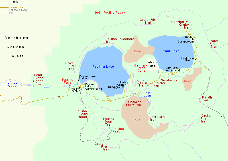
Map of the Paulina Lake Area, Newberry National Volcanic Monument | |
Sites in Oregon NPS Crater Lake John Day Fossil Beds Other Places Cape Arago SP Cape Sebastian SP Coquille Point Crook Point Floras Lake SP Harris Beach SP Newberry Volcanic Oregon Dunes Port Orford Heads Samuel Boardman SSC Shore Acres SP South Pacific Coast Southeast Oregon Sunset Bay SP Site Search Photograph Search |
Newberry National Volcanic Monument > Paulina Lake/Newberry Caldera > Map![]() The Paulina Lake section of Newberry National Volcanic Monument is reached by paved highway 21 through the Deschutes National Forest, leaving US 97 near La Pine and reaching the lake after 12.5 miles, and a climb of 2,100 feet. |
| Back to Top | |
Arizona | California | Colorado | Nevada | New Mexico | Oregon | Texas | Utah | Wyoming | Slot Canyons | Travelogue | SOUTHWEST |
|