Highlights:
Forested highway leading to a spectacular viewpoint 3,200 feet above Yosemite Valley, possibly the best easily-accessed, high-elevation overlook in the Sierra Nevada. Along the way are several trails and campgrounds
Location:
37.727, -119.574 (end of the road)
Seasons:
May to November, since the road is closed by snow during winter and spring

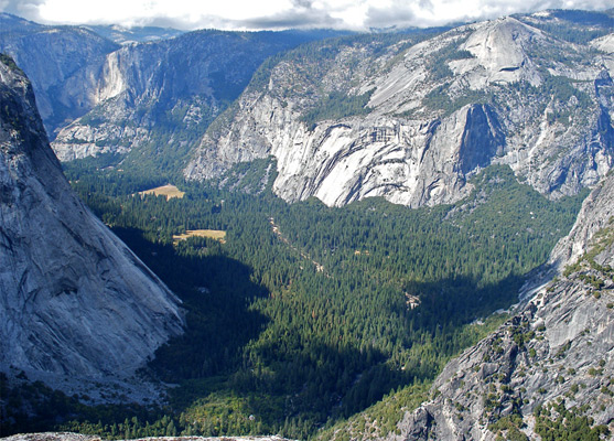
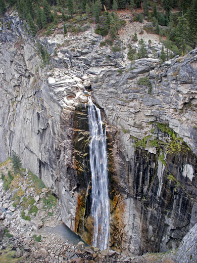
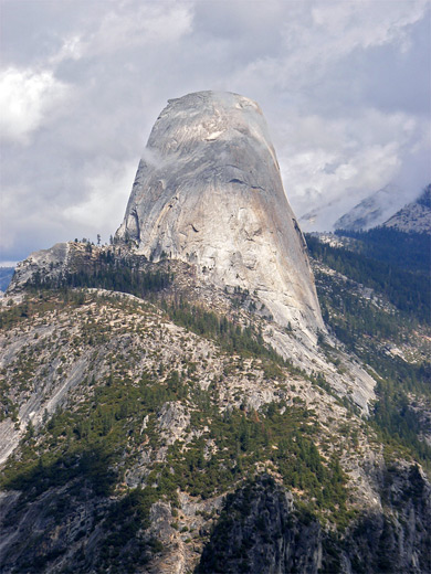
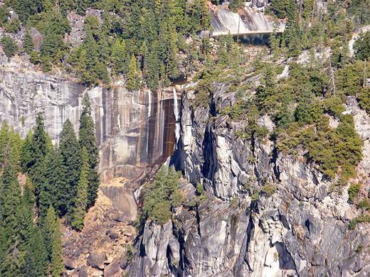
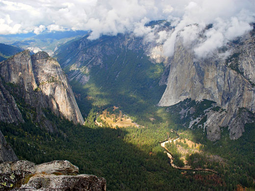
From Glacier Point, 3,200 feet above Yosemite Valley, a stupendous vista stretches out for many miles north and east, over the forests and meadows around the Merced river, the enclosing cliffs and lofty domes, and across the countless higher mountains in the distant wilderness areas of the national park. In one direction, Vernal and Nevada falls are clearly visible, along the course of Little Yosemite Valley. A little way north is the steep canyon of Tenaya Creek, the two separated by the distinctive shape of Half Dome. Opposite the viewpoint, Upper and Lower Yosemite Falls cascade 2,400 feet down the sheer cliffs, and far beneath cars and even people can be seen, moving slowly along.
In 2023 the road from Badger Pass to Glacier Point opened relatively late in the season, on July 15th.
In 2023 the road from Badger Pass to Glacier Point opened relatively late in the season, on July 15th.
Glacier Point Table of Contents
Photographs
Glacier Point Road, Taft Point, Panorama Trail.
Glacier Point Access
Glacier Point is probably the best easily-accessed, high-elevation viewpoint in the Sierra Nevada mountain range, and is reached by a paved, 16 mile road that forks west from CA 41 at Chinquapin Junction, 8 miles south of the Wawona Tunnel entrance to Yosemite Valley, and 18 miles north of the southern entrance to the national park at Mariposa Grove. The surrounding land is generally quite densely forested with ponderosa pine but also has scattered grassy meadows, small lakes, streams and granite outcrops.
The Road
The Glacier Point road is fully open from June to October but with limited access for skiers during winter, most of whom head for the Badger Pass Ski Area, 4.7 miles from the junction. The drive is busy during summer, but peaceful scenery is only a few minutes walk away along one of the trails, such as the steep Four Mile Trail that links Glacier Point with Southside Drive in the valley, 3,240 feet below. The other most popular paths are to Taft Point for great views of middle Yosemite Valley, Sentinel Dome for a 360° view over the surrounding mountains, and the Panorama Trail to Illilouette Fall and beyond; this has the best views of all.
Camping along Glacier Point Road
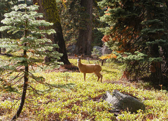
The road passes one very good official campground, at Bridalveil Creek, which is also the starting point for two of the main trails into the southern wilderness areas of the park. All 110 sites are well separated from each other, with fire grills, benches and tables; the camp is bordered by the clear, slow moving creek which, 10 miles downstream, falls spectacularly into Yosemite Valley and joins the Merced River. One hundred meters into the surrounding, boulder-strewn forest there is perfect silence with no sign of civilization, just trees and shadows in all directions; it is easy to imagine a bear or mountain lion emerging from the undergrowth. I did not see any, but there were some deer, pikas and squirrels. Bears are reported every week or so in the Bridalveil Creek campsite. For some reason the NPS close the campground a month or so before the actual road shuts, so then the nearest places for camping are at Wawona or Yosemite Valley.
Yosemite Firefall
For many years it was a weekly occurrence for a large bonfire to be lit at the top of the cliffs at Glacier Point and then tipped over the edge when in full blaze. The burning mass, known as a 'firefall', fell 3,000 feet onto the forests and meadows of Yosemite Valley below, a practice that was ended in 1968. There used to be a large hotel as well, but this has been removed, although there is still quite a cluster of buildings at the viewpoint.
Yosemite Tours
Explore the valley, and Glacier Point.
Trails along the Glacier Point Road
Trail Descriptions and map for 11 hikes along the road
Featured Glacier Point Trails

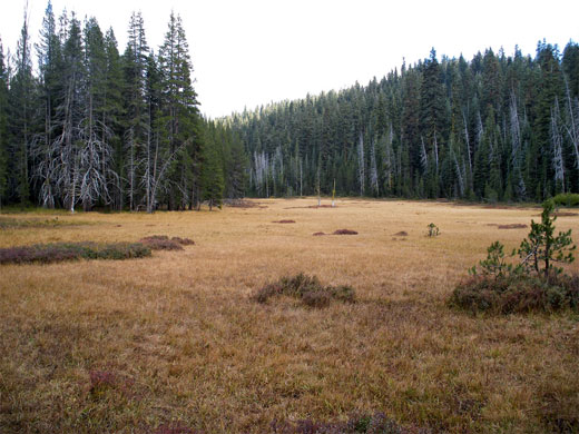
Mono Meadow
★★★★★
★★★★★
5 miles, 800 feet
Passing over varied terrain of thick forest, open slopes, rivers and meadows, with frequent views over distant granite mountains, the Mono Meadow Trail is a pleasant if little used route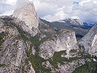
Panorama Trail
★★★★★
★★★★★
4 miles, 1200 feet
Spectacular hike descending steadily from Glacier Point to the rim of a beautiful hidden waterfall (Illilouette Fall), then along the edge of a cliff, which gives views many Yosemite landmarks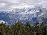
Sentinel Dome
★★★★★
★★★★★
1.1 miles, 400 feet
Sentinel Dome is a typical Yosemite summit of bare, rounded granite, rising above the trees near the end of the road to Glacier Point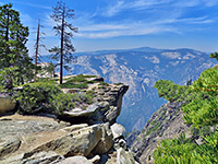
Taft Point
★★★★★
★★★★★
1.1 miles, 240 feet
Offering an alternative to the often overly busy Glacier Point, Taft Point has equally good views over Yosemite Valley, 3,500 feet below, and of some nearby rock formations known as the FissuresAll Contents © Copyright The American Southwest | Comments and Questions | Contribute | Affiliate Marketing Disclosure | Site Map