Highlights:
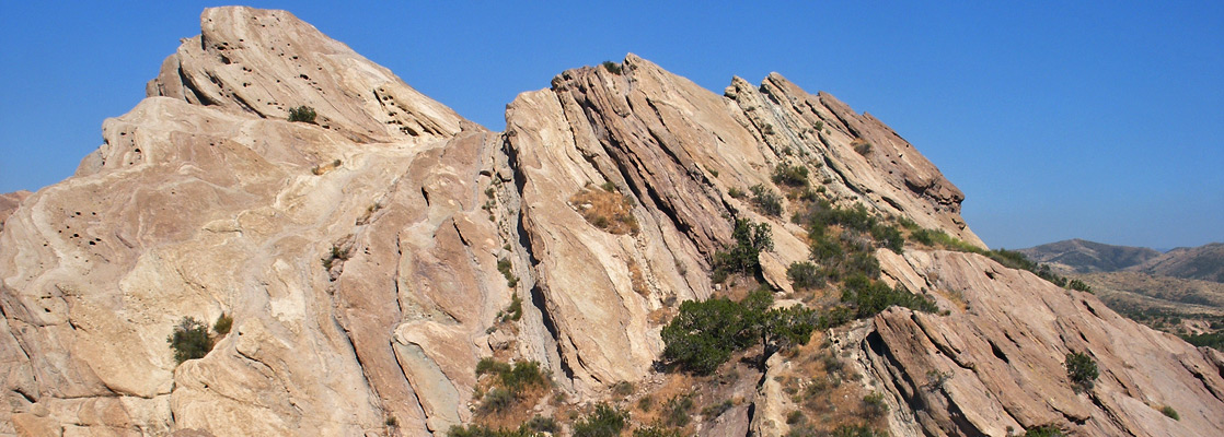
Series of parallel ridges formed by exposed, eroded sandstone strata, angled upwards at about 50°, surrounded by the arid foothills of the San Gabriel Mountains. Popular for hiking, horse riding and picnics
Nearby town:
Santa Clarita, 18 miles
Management:
Location:
Seasons:
All year, though this area is hot and dry in summer
Rating (1-5):
★★★★★

Alongside the Antelope Valley Freeway (Hwy 14) near the north edge of the San Gabriel Mountains, the normally rolling, grassy hills are replaced by an area of exposed, upturned sandstone strata - the Vasquez Rocks - resulting from ancient geological activity associated with the San Andreas Fault, and named after an outlaw (Tiburcio Vasquez), who took refuge in this location in the 1870s. The rocks would not merit much attention were they situated in the vast canyon country of Arizona or Utah, but their proximity to Los Angeles and the easy access ensures many visitors.
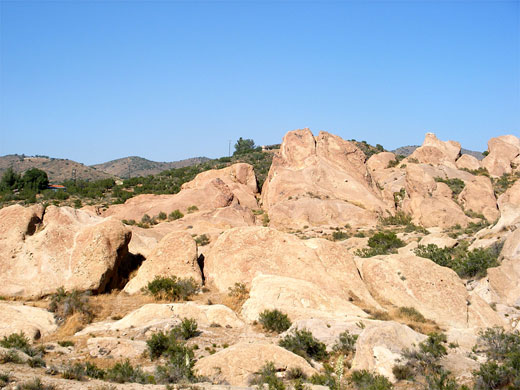
The formations are the centerpiece of a county park, free to enter and 1 by 1.5 miles in extent, and although the most prominent rocks can be seen in just 30 minutes or so, several hours could be spent hiking along the network of short trails that run between the angular ridges. The park is also popular for horseriding and wildlife-watching, and since the rocks are the closest Western-looking landscape to Hollywood, the location has been much used for commercials, movies and music videos.
The formations are the centerpiece of a county park, free to enter and 1 by 1.5 miles in extent, and although the most prominent rocks can be seen in just 30 minutes or so, several hours could be spent hiking along the network of short trails that run between the angular ridges. The park is also popular for horseriding and wildlife-watching, and since the rocks are the closest Western-looking landscape to Hollywood, the location has been much used for commercials, movies and music videos.
The Park
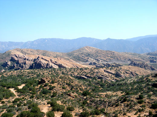
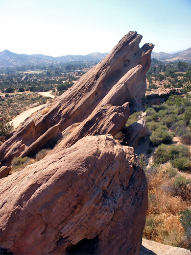
Vasquez Rocks County Park is signposted from the freeway, and reached by a 2 mile drive along local roads through the barren mountain foothills, country that is rather hot and dry much of the year, reflecting the proximity to the Mojave Desert a few miles north. A gravel track leads to a parking area between two of the tallest pinnacles, from where visitors can either take one of the trails or just scramble up along the rocks; they are easy and fun to climb, and the summits allow quite wide ranging views over Highway 14, Agua Dulce Valley and the nearby villages. Other parallel ridges extend to the north and south, separated by sandy scrubland, and harbor a few archaeological sites from the Tataviam Indians. The rocks are smooth-sided sandstone of the Vasquez Formation, cream or light brown in color, and angled at about 50 degrees - very similar, though on a smaller scale, to Garden of the Gods near Colorado Springs.
Vasquez Rocks - Nearby Places
- Antelope Valley California Poppy Reserve (42 miles) - low hills covered by orange poppy flowers in the spring
- Griffith Park (36 miles) - city park overlooking Hollywood and other north LA suburbs
- Saddleback Butte State Park (41 miles) - steep-sided peak at the south edge of the Mojave Desert
- San Gabriel Mountains (12 miles to Little Tujunga Road) - hilly area providing a refuge from Los Angeles
Vasquez Rocks - Similar Places
- Garden of the Gods, Colorado - jagged red rocks near Colorado Springs
- Ojito Wilderness Area, New Mexico - remote wilderness that includes the San Ysidro Anticline, a ridge of colorful, upturned strata
All Contents © Copyright The American Southwest | Comments and Questions | Contribute | Affiliate Marketing Disclosure | Site Map