CALIFORNIA


Map of Redwood National Park


Sites in California

NPS Units
Cabrillo
Death Valley
Devils Postpile
Golden Gate
Joshua Tree
Kings Canyon
Lassen Volcanic
Lava Beds
Mojave
Muir Woods
Pinnacles
Point Reyes
Redwood
Santa Monica Mnts
Sequoia
Whiskeytown-Shasta
Yosemite

Other Places
Anza-Borrego Desert
Big Basin Redwoods
Big Sur
Bodie SHP
Calaveras Big Trees
California Missions
Eastern Sierra
Humboldt Redwoods
Lake Tahoe
Palm Springs
Point Lobos

California Site Map

Follow americansouthwest.net on Facebook
Site Search

Photograph Search


Redwood National and State Parks > Redwood National Park > Map

Map of Redwood National Park

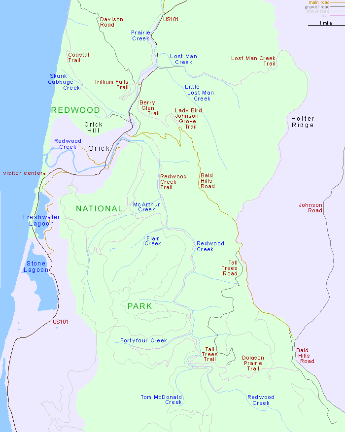
The small town of Orick provides basic services to Redwood National Park visitors, including motels, gas stations, a general store and a post office. Just north of town, Bald Hills Road climbs over 2,000 feet into the coastal hills, giving access to various trails and tracks to the redwood groves

Trail descriptions for Redwood National Park

Back to Top

All Contents © Copyright John Crossley | Comments and Questions | Site Map

Arizona California Colorado Nevada New Mexico Oregon Texas Utah Wyoming Slot Canyons Travelogue