CALIFORNIA


Map of the Lost Coast


Sites in California

NPS Units
Cabrillo
Death Valley
Devils Postpile
Golden Gate
Joshua Tree
Kings Canyon
Lassen Volcanic
Lava Beds
Mojave
Muir Woods
Pinnacles
Point Reyes
Redwood
Santa Monica Mnts
Sequoia
Whiskeytown-Shasta
Yosemite

Other Places
Anza-Borrego Desert
Big Basin Redwoods
Big Sur
Bodie SHP
Calaveras Big Trees
California Missions
Eastern Sierra
Humboldt Redwoods
Lake Tahoe
Palm Springs
Point Lobos

California Site Map

Follow americansouthwest.net on Facebook
Site Search

Photograph Search


Lost Coast > Map

Map of the Lost Coast

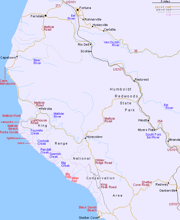
The steep and bendy access roads to the Lost Coast reduce average driving speeds to less than 30 mph, making the journey even longer than might be expected. Distances include Mattole Beach to Ferndale, 35 miles; Mattole Beach to Shelter Cove, 50 miles; Shelter Cove to US 101, 23 miles and Mattole Beach to US 101 (via Humboldt Redwoods State Park), 40 miles.

Back to Top

All Contents © Copyright John Crossley | Comments and Questions | Site Map

Arizona California Colorado Nevada New Mexico Oregon Texas Utah Wyoming Slot Canyons Travelogue