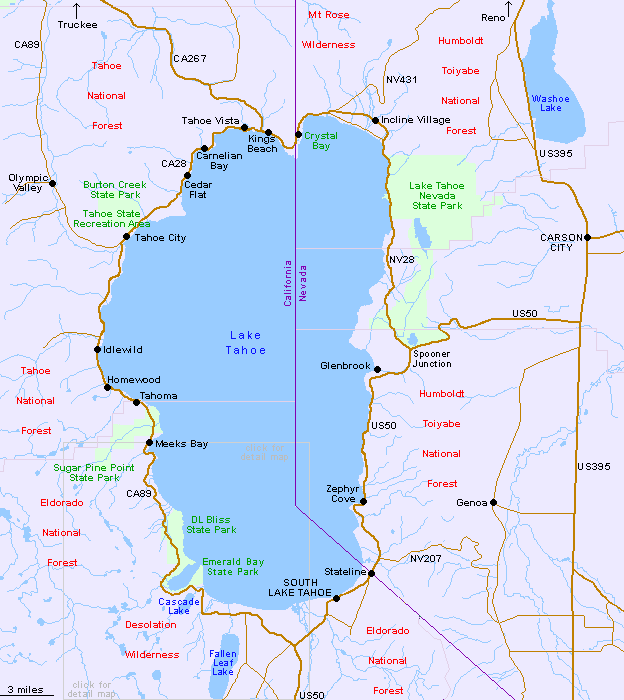
There are four main approaches by road to Lake Tahoe; CA 89 and CA 267 south from Truckee and interstate 80, US 50 from the south, or US 50 from the west, in Nevada. Two other routes that cross high mountains are NV 207 via the Dagett Pass at 7,334 feet, and the longer but equally winding NV 431 through the Humboldt Toiyabe National Forest, which passes over the Mt. Rose Summit at 8,933 feet. All are illustrated on the above Lake Tahoe map.
All Contents © Copyright The American Southwest | Comments and Questions | Contribute | Affiliate Marketing Disclosure | Site Map