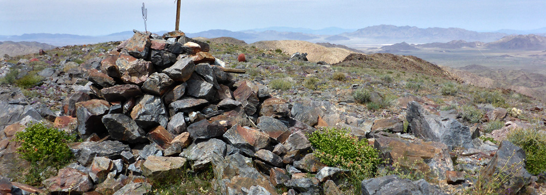
More challenging hiking is possible on many unmaintained trails, the majority through the northern mountains close to the park roads, though various longer paths penetrate the more remote ranges to the south and east.
Joshua Tree Hiking: Maintained Trails | Nature Trails | Unmaintained Trails
The Joshua Tree Hiking Map shows the location of each trail.

Joshua Tree Hiking - Maintained Trails
|
Boy Scout Length 8 miles (12.9 km) Elevation change 1340 feet (408 meters) Trailhead Along the road to Indian Cove Rating (1-5) ★★★★★ Starting in the north by the ranger station on the road to Indian Cove, the sometimes sandy Boy Scout Trail crosses open desert slopes dotted with cholla cacti and creosote bushes then follows a narrow canyon into the Wonderland of Rocks. Several miles of the path run right through the scenic boulders and cliffs, before it enters open country once more though now filled with Joshua trees, before ending at the southern trailhead along the main park road. A car shuttle would be useful here. |
|
California Riding and Hiking Length 36 miles (57.9 km) many shorter sections Elevation change feet ( meters) Trailhead Black Rock Canyon campground Rating (1-5) ★★★★★ One of many unconnected sections of the California Riding and Hiking Trail crosses the western half of Joshua Tree National Park, running from the Black Rock Canyon campground through mountainous terrain to Upper Covington Flat, then down into the Joshua trees and creosote bushes of Lost Horse Valley where the path crosses the road to Keys View. It next skirts Ryan Mountain, the Jumbo Rocks campground and Belle campground, ending with a descent past the edge of the Pinto Mountains alongside the main park drive to the northern entrance station. Various rewarding day-hikes are possible over sections of the path, or a several night backpacking trip along the whole length. |
Fortynine Palms Oasis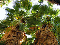 Length 1.6 miles (2.6 km) Elevation change 300 feet (91 meters) Trailhead South end of Canyon Road Rating (1-5) ★★★★★ This relatively easy and quite popular path climbs to the top of a barren ridge overlooking the town of Twentynine Palms then drops down to a sizeable group of California fan palms, growing at the junction of two rocky canyons. |
Lost Horse Mine Length 2 miles (3.2 km) Elevation change 480 feet (146 meters) Trailhead At the end of a short track forking off the road to Keys View Rating (1-5) ★★★★★ On the road to Keys View, a side track branches westwards ending after a mile at a small parking area at the edge of 5,178 foot Lost Horse Mountain, from where a trail (also once a vehicle track) ascends to the summit, en route passing several restored buildings from the Lost Horse Mine. One of these, the old ten-stamp mill, is particularly well preserved. Past the mine, a less used, unmaintained path continues along the mountain ridgetop for a while then descends a ravine and loops back to the start - total length 4 miles. |
Lost Palms Oasis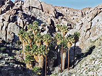 Length 3.6 miles (5.8 km) Elevation change 450 feet (137 meters) Trailhead Cottonwood Spring Rating (1-5) ★★★★★ Perhaps the best day hike in Joshua Tree National Park, the route to the fan palm trees and pools at Lost Palms Oasis encounters rocky ridges, sandy washes, many Sonoran desert cacti and granite boulders, with frequent impressive views over the surrounding mountains. The trailhead is close to the southern entrance to the park, at Cottonwood Spring. |
Lucky Boy Vista Loop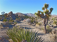 Length 3.5 miles (5.6 km) Elevation change 170 feet (52 meters) Trailhead Parking area along Desert Queen Mine Road Rating (1-5) ★★★★★ Traverse of flat land with occasional Joshua trees to a viewpoint and old mine site, returning via two shallow drainages, past clumps of boulders, low cliffs and scattered pine trees. |
|
Mastodon Peak Length 3 miles (4.8 km) (loop) Elevation change 300 feet (91 meters) Trailhead Cottonwood Spring Rating (1-5) ★★★★★ Forming a loop with the first part of the Lost Palms Oasis Trail past Cottonwood Spring, this path crosses a mixture of rocky slopes and dry sandy washes, reaching a highpoint at Mastodon Peak, near which is the remains of an old gold mine. The summit affords long distance views in all directions, especially south where the Salton Sea is clearly visible, 20 miles away. |
Ryan Mountain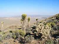 Length 1.5 miles (2.4 km) Elevation change 1060 feet (323 meters) Trailhead Pull out along the main park road Rating (1-5) ★★★★★ Ryan Mountain is a somewhat isolated yet easily reached peak surrounded by open plains so the views from its summit are some of the best in the park. The well used path to the top begins at a parking area along the main road, a mile west of the turn-off for the Sheep Pass group campground, and climbs steadily up the slopes, passing scattered vegetation of Joshua trees at first then pinyon/juniper pine at higher elevations. |
Joshua Tree Hiking - Nature Trails
|
Arch Rock Length 0.5 miles (0.8 km) (loop) Elevation change level Trailhead White Tank campground Rating (1-5) ★★★★★ From the White Tank campground (near site 9), this easy path leads to a small natural arch in the whitish granite rocks that are abundant in this section of the park. |
Barker Dam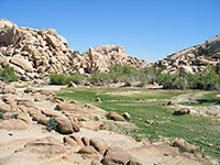 Length 1.2 miles (1.9 km) (loop) Elevation change 40 feet (12 meters) Trailhead East end of the paved road past Hidden Valley Campground Rating (1-5) ★★★★★ Built by cattle ranchers at the end of the nineteenth century, Barker Dam is a small construction that in wet times holds back a pool in the granite boulders just inside the south edge of the Wonderland of Rocks. The loop hike past the pool also encounters plenty of Joshua trees, and a petroglyph panel (defaced by a film crew); it starts from a side road near the Hidden Valley campground. |
|
Cap Rock Length 0.4 miles (0.6 km) (loop) Elevation change level Trailhead North end of the side road to Keys View Rating (1-5) ★★★★★ The paved, level Cap Rock nature trail winds past Joshua trees through piles of large, rounded monzonite boulders in the middle of Lost Horse Valley. The trailhead is along the main road by the junction with the side road south to Keys View. |
Cholla Cactus Garden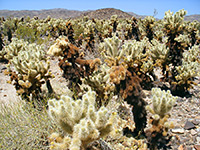 Length 0.25 miles (0.4 km) (loop) Elevation change level Trailhead Pinto Basin, along the main road Rating (1-5) ★★★★★ On the west side of Pinto Basin, the short Cholla Cactus Garden nature trail provides a close-up look at the densely-spined Opuntia Bigelovii (Teddy Bear Cholla), which in spring bears large, greenish white flowers. |
|
Hidden Valley Length 1 miles (1.6 km) (loop) Elevation change 40 feet (12 meters) Trailhead Hidden Valley picnic area Rating (1-5) ★★★★★ Hidden Valley is a small open area enclosed on most sides by tall boulder piles; the short path to the center begins at the end of the side road to the Hidden Valley picnic area. |
High View Trail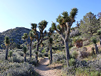 Length 1.3 miles (2.1 km) round trip Elevation change 400 feet (122 meters) Trailhead Side road near Black Rock Canyon campground Rating (1-5) ★★★★★ Loop path that climbs into the foothills of the Little San Bernardino Mountains, giving good views of the Black Rock Canyon area in the northwest of the park; passes plenty of Joshua trees and many other desert plants. |
|
Indian Cove Length 0.6 miles (1 km) (loop) Elevation change 50 feet (15 meters) Trailhead Indian Cove campground Rating (1-5) ★★★★★ Starting at the west edge of the Indian Cove campground, this well marked path encounters large boulders, dry washes and a variety of Mojave desert plants. |
Keys View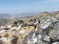 Length 0.2 miles (0.3 km) (loop) Elevation change 50 feet (15 meters) Trailhead Keys View Rating (1-5) ★★★★★ At the end of the paved Keys View Road, a path climbs to the top of a small peak just to the south for a 360 degree panorama over the Little San Bernardino Mountains, and many places to the south. A longer path (half a mile) heads north from the parking area up to an even better viewpoint, on the top of a summit at 5,558 feet. |
Oasis of Mara Trail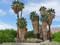 Length 0.5 miles (0.8 km) (loop) Elevation change level Trailhead Oasis Visitor Center Rating (1-5) ★★★★★ At the main Oasis Visitor Center in Twentynine Palms, a paved path reaches the most accessible of Joshua Tree's six California fan palm oases, though also the least natural, as the surroundings are relatively well developed. |
|
Skull Rock Length 1.5 miles (2.4 km) (loop) Elevation change level Trailhead Along the main road near Jumbo Rocks campground Rating (1-5) ★★★★★ This popular loop trail circles the large boulders either side of the Jumbo Rocks campground, including the distinctively-shaped Skull Rock (which can also be viewed from the main road). Interpretive signs along the way describe the plants and animals of the Mojave Desert. |
South Park Peak Trail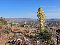 Length 0.6 miles (1 km) round trip Elevation change 230 feet (70 meters) Trailhead Side road near Black Rock Canyon campground Rating (1-5) ★★★★★ Loop path, just outside the park boundary, that climbs a shallow ravine to a minor summit overlooking the town of Yucca Valley; also has good views over the Black Rock Canyon area to the south. |
Joshua Tree Hiking - Unmaintained Trails
Contact Mine Trail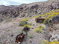 Length 1.8 miles (2.9 km) Elevation change 700 feet (213 meters) Trailhead Pullout south of the park headquarters Rating (1-5) ★★★★★ Mine relics including sealed shafts, spoil heaps and iron equipment, towards the upper end of a valley. Reached by an unmaintained trail, partly an old vehicle track, that leads up a sandy wash, beside a short ravine and over stony slopes. |
Panorama Trail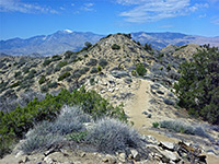 Length 8.6 miles (13.8 km) (loop, including the two spur trails) Elevation change 1070 feet (326 meters) Trailhead Campground at Black Rock Canyon Rating (1-5) ★★★★★ The Panorama Trail affords wide ranging views of the Little San Bernadino Mountains, passing Joshua trees at the start (near the Black Rock Canyon campground), then pinyon/juniper pine at higher elevations. Two side trails branch off; to 5,103 foot Warren Peak, and to a similar, nearby viewpoint. |
Pine City and Desert Queen Mine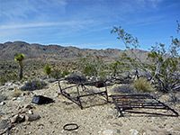 Length 4.4 miles (7.1 km) Elevation change 350 feet (107 meters) Trailhead Parking area at the end of the unpaved Desert Queen Mine Road Rating (1-5) ★★★★★ Varied loop, off-trail for a short section, past two groups of old mine relics, along a canyon and across open flats to a shallow basin with huge boulders and pine trees. The basin is good for exploring; other sites in the vicinity include an old townsite and a spring |
Pinto Mountain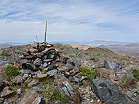 Length 4.5 miles (7.2 km) Elevation change 2200 feet (671 meters) Trailhead Parking area along the main road (Turkey Flats) Rating (1-5) ★★★★★ Isolated, 3,983 foot summit in the north-central area of the park, overlooking the vast, sandy flatlands of Pinto Basin, reached by a mostly off-trail hike across sandy flats and up a rocky ravine. Views from the top span an uninterrupted 360 degrees, as there are no higher points close by. |
Queen Mountain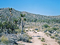 Length 2 miles (3.2 km) Elevation change 1100 feet (335 meters) Trailhead North side of Queen Valley Rating (1-5) ★★★★★ From the end of a side road across Queen Valley, a little-used trail climbs the steep southern slope of Queen Mountain, ending at an elevated viewpoint near the summit - one of the highest peaks in the park. |
Rattlesnake Canyon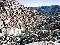 Length 1.2 miles (1.9 km) to where the canyon becomes blocked by large boulders Elevation change 400 feet (122 meters) Trailhead End of a short track heading east from Indian Cove Campground Rating (1-5) ★★★★★ A faint path enters the lower end of Rattlesnake Canyon, near the Indian Cove campground, and follows the narrow drainage into the north section of the Wonderland of Rocks, offering a quick introduction to this scenic area. |
Silver Bell and El Dorado Mines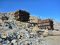 Length 4 miles (6.4 km) (loop) Elevation change 250 feet (76 meters) Trailhead Pull-out on the park road west of Cholla Cactus Garden Rating (1-5) ★★★★★ Two mines in the Hexie Mountains, one including two well preserved wooden tipples; both have shafts, adits, foundations, tanks and other remains. Hike also has good views and encounters a variety of cacti. |
|
Split Rock Length 2 miles (3.2 km) (loop) Elevation change 100 feet (30 meters) Trailhead Spur road near Jumbo Rocks campground Rating (1-5) ★★★★★ This easy path encounters similar scenery to the busier Skull Rock Trail, and starts close by, at the end of a short spur road on the north side of Park Boulevard. |
Victory Palms and Munsen Palms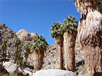 Length 5.4 miles (8.7 km) Elevation change 450 feet (137 meters) Trailhead Cottonwood Spring Rating (1-5) ★★★★★ Victory Palms and nearby Munsen Canyon are two rarely-visited fan palm oases east of the maintained trail to Lost Palms Oasis, reached by heading downcanyon after the end of the main path; the ravine becomes quite rough and narrow, and travel requires scrambling over boulders in places during a quite steep descent. The Victory Palms grow near sandy ground as the drainage becomes wider and more level. A side trip northwards leads to the even more remote oasis in Munsen Canyon. |
|
Willow Hole Length 3.5 miles (5.6 km) Elevation change level Trailhead Along the main road near Quail Springs, from where the trail starts 1.5 miles north Rating (1-5) ★★★★★ The main path into the heart of the Wonderland of Rocks begins 1.5 miles along the south section of the maintained Boy Scout Trail, crosses open Joshua tree flats then enters the rocks, tracking along narrow, sandy washes as the surrounding boulders become ever larger and more impressive. Easy travel ends at Willow Hole, a transient water source in a hollow beneath a willow tree. |
Wonderland Wash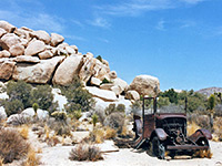 Length 1 miles (1.6 km) Elevation change level Trailhead East end of the paved road past Hidden Valley Campground Rating (1-5) ★★★★★ Starting at the same trailhead for Barker Dam, a well trodden path heads a little further north then follows a wide, sandy wash into the south edge of the Wonderland of Rocks. There are limitless opportunities for off trail exploration, both for regular hiking and rock climbing. |
All Contents © Copyright The American Southwest | Comments and Questions | Contribute | Affiliate Marketing Disclosure | Site Map