| ARIZONA | Index | Maps | Driving Distances | Introduction | National Parks | State Parks | Hiking | Weather | Photographs | QTVR | Hotels |
Map of Sedona | |
Sites in Arizona NPS - Landscapes Canyon de Chelly Chiricahua Grand Canyon Lake Mead Organ Pipe Petrified Forest Saguaro Sunset Crater NPS - Historic Sites Casa Grande Ruins Coronado Fort Bowie Hubbell Trading Post Montezuma Castle Navajo Pipe Spring Tonto Tumacacori Tuzigoot Walnut Canyon Wupatki Other Places Apache Trail Ironwood Forest NM Meteor Crater Route 66 Sedona Sonoran Desert NM Tonto NF Vermilion Cliffs NM Arizona Site Map Site Search Photograph Search |
Sedona > Map 
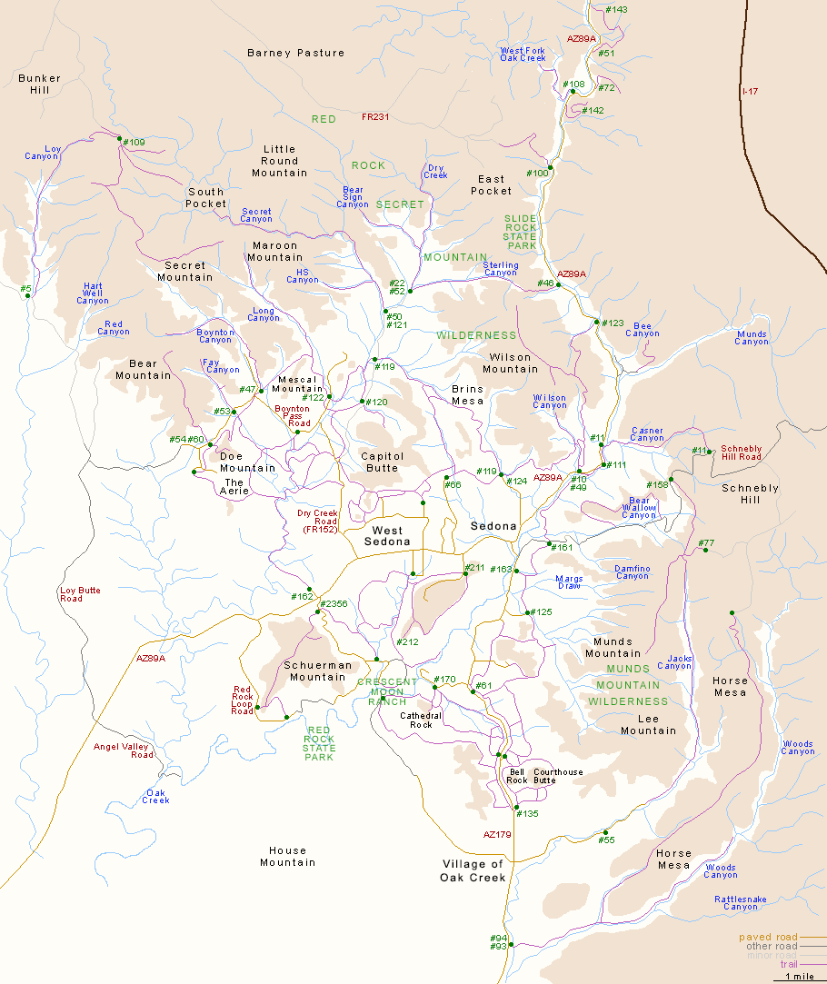
This map illustrates the main trailheads, canyons, mountains and roads around Sedona. The trails (in green) are indicated by their official number; for identification, see the Sedona hiking index page. ![]() |
| Back to Top | |
Arizona | California | Colorado | Idaho | Nevada | New Mexico | Oregon | Texas | Utah | Wyoming | Slot Canyons | Travelogue | SOUTHWEST |
|