Victoria Mine Trail, Organ Pipe Cactus National Monument
Arizona > Organ Pipe Cactus National Monument > Victoria Mine Trail
Victoria Mine Trail
Fairly level route over dry washes and undulating, cactus-covered hills to the site of a 19th century gold and silver mine, where various relics can be seen including iron equipment, stone cabins and tailings piles. Good, long distance views along the way
Length: 2.2 miles
Elevation change: 100 feet
Difficulty: Easy
Type: One way. Continuation hikes possible north towards Martinez Mine, Senita Basin and the Puerto Blanco Drive, or west to Lost Cabin Mine
Usage: Low
Season: Fall to spring; rather hot in summer
Trailhead: On the south side of the Organ Pipe Cactus campground
Rating (1-5): ★★★★★

Although large in area, Organ Pipe Cactus National Monument has few maintained trails, and cross-country hiking is not generally recommended owing to the abundant spiky plants, the extreme temperatures and the rough terrain. Of the five main paths, easiest reached is the 2.2 mile route across a cactus-covered plain to the foothills of the Sonoyta Mountains and the site of Victoria Mine, a center for sporadic gold and silver excavations in the late 19th and early 20th centuries.
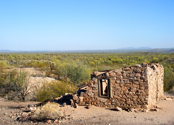
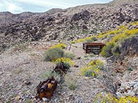
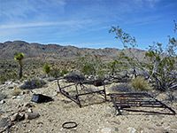
Ruined stone buildings, rusting pieces of iron equipment and sealed-off mine shafts can be seen, but perhaps the main attractions of the hike are the abundant Sonoran Desert plants en route, and the expansive views across Sonoyta Valley into Mexico. Lesser used paths continue further up the mountains to two other mines (Martinez and Lost Cabin) - locations that may also be accessed via the road to nearby Senita Basin, which has recently been reopened after a closure due to problems with illegal immigration, the international border being just 4 miles south. Victoria Mine is listed on the National Register of Historic Places, as one of the oldest prospecting sites in southwest Arizona.
Organ Pipe Cactus National Monument map
Topographic map of the Victoria Mine Trail
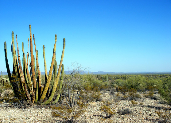
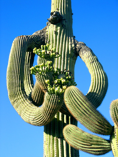
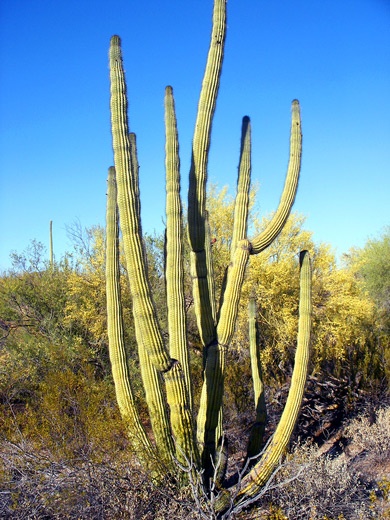
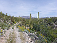
The Victoria Mine Trail, which is not signposted from the highway, starts from the far side of the national monument campground, reached by a short road south of the visitor center. The path has a small parking area, enough for half a dozen cars, and a register; entries here suggest that only 1 or 2 groups make the trip each day during the hot summer months. The trail traverses gently sloping land while staying level overall, apart from several dry wash crossings, passing hillsides covered by numerous examples of all the common types of cactus found in the area (except senita) - saguaro, organ pipe, cholla, opuntia, echinocereus and mammillaria - mixed with palo verde trees, ocotillo plants and other shrubs. Terrain along the first part of the route is fairly flat and open, becoming a little more overgrown and undulating towards the end, and crossed by several deeper dry washes, though as most is either along ridges or alluvial fans, the hike affords fine, long distance views south and east across the Sonoyta Valley, to the Ajo Mountains and other far away ranges across the border in Mexico.
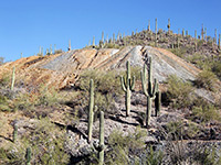
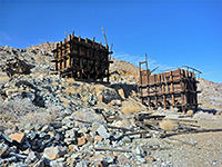
As the trail approaches the edge of the mineralized granite slopes of the Sonoyta Mountains, it joins a disused vehicle track (once the main travel route between Sonoyta and Ajo) from Senita Basin, and heads south along here for another 0.4 miles to the old mine. The scattered relics include several ruined buildings, a stone stairway, concrete foundations, rusty machinery, tailings piles and at least six shafts, now fenced off and for extra security capped with a roof of iron and concrete. Colorful stones from the excavations are scattered all around, and the place is quite scenic, if lacking any single point of interest.
Ruined stone buildings, rusting pieces of iron equipment and sealed-off mine shafts can be seen, but perhaps the main attractions of the hike are the abundant Sonoran Desert plants en route, and the expansive views across Sonoyta Valley into Mexico. Lesser used paths continue further up the mountains to two other mines (Martinez and Lost Cabin) - locations that may also be accessed via the road to nearby Senita Basin, which has recently been reopened after a closure due to problems with illegal immigration, the international border being just 4 miles south. Victoria Mine is listed on the National Register of Historic Places, as one of the oldest prospecting sites in southwest Arizona.
Maps
Organ Pipe Cactus National Monument map
Topographic map of the Victoria Mine Trail
The Trail
The Victoria Mine Trail, which is not signposted from the highway, starts from the far side of the national monument campground, reached by a short road south of the visitor center. The path has a small parking area, enough for half a dozen cars, and a register; entries here suggest that only 1 or 2 groups make the trip each day during the hot summer months. The trail traverses gently sloping land while staying level overall, apart from several dry wash crossings, passing hillsides covered by numerous examples of all the common types of cactus found in the area (except senita) - saguaro, organ pipe, cholla, opuntia, echinocereus and mammillaria - mixed with palo verde trees, ocotillo plants and other shrubs. Terrain along the first part of the route is fairly flat and open, becoming a little more overgrown and undulating towards the end, and crossed by several deeper dry washes, though as most is either along ridges or alluvial fans, the hike affords fine, long distance views south and east across the Sonoyta Valley, to the Ajo Mountains and other far away ranges across the border in Mexico.
The Mine
As the trail approaches the edge of the mineralized granite slopes of the Sonoyta Mountains, it joins a disused vehicle track (once the main travel route between Sonoyta and Ajo) from Senita Basin, and heads south along here for another 0.4 miles to the old mine. The scattered relics include several ruined buildings, a stone stairway, concrete foundations, rusty machinery, tailings piles and at least six shafts, now fenced off and for extra security capped with a roof of iron and concrete. Colorful stones from the excavations are scattered all around, and the place is quite scenic, if lacking any single point of interest.
Victoria Mine Trail - Similar Hikes
All Contents © Copyright The American Southwest | Comments and Questions | Contribute | Affiliate Marketing Disclosure | Site Map