Roosevelt Point, Grand Canyon National Park
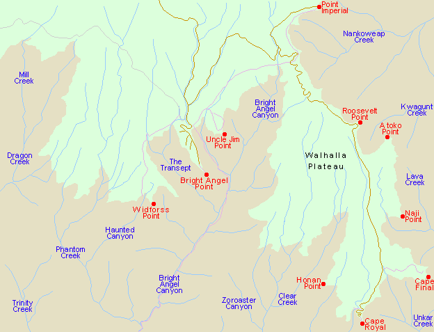
Arizona > Grand Canyon National Park > North Rim > Viewpoints > Roosevelt Point
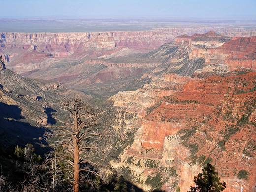
From the small roadside parking area, a short trail leads downhill to several wooden benches at the viewpoint, which is at the upper end of a long, thin ridge that extends 4 miles eastwards, descending several thousand feet in a series of mesas and buttes. The panorama is impressive enough though views are slightly restricted, as the point does not project outwards very far, a few trees rise up in some directions, and the main ridge hides much of the canyon to the north.

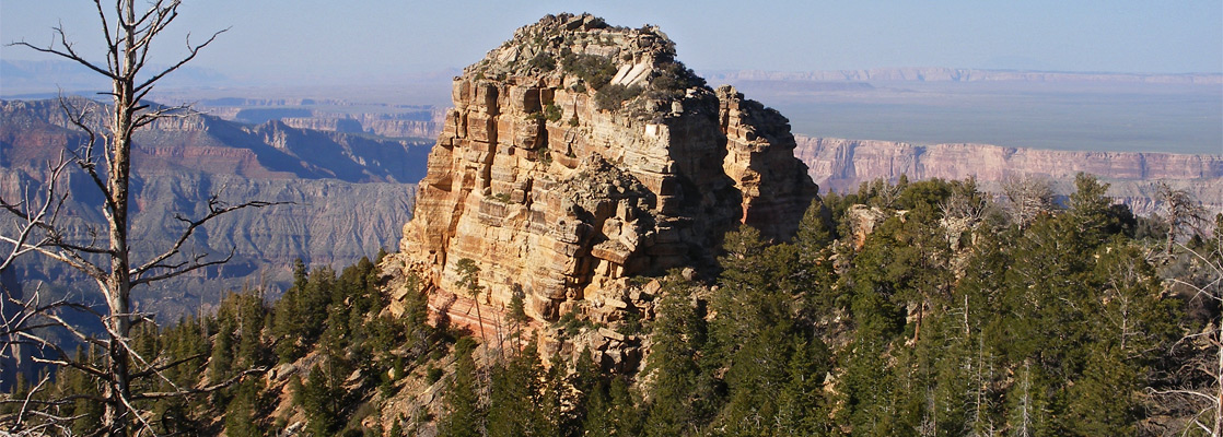
The land to the east of Roosevelt Point rises a little to 8,388 foot Tritle Peak, a isolated slab of white Kaibab limestone, then the ridge angles down steeply towards several red buttes at much lower elevation. The main drainage in view, just south of the ridge, is Kwagunt Creek, which is quite narrow at its upper end but lower down becomes very wide, surrounded by gently sloping hillsides rather than the usual vertical cliffs. Despite the high ridge, a fair amount of the scenery to the north is visible including the furthest section of the Grand Canyon, where the Colorado River forms an unbranched gorge just a mile or so across, cutting into the flat desert plain between the Vermilion and Echo Cliffs.
Next Points
North: Point Imperial
South: Atoko Point
All Contents © Copyright The American Southwest | Comments and Questions | Contribute | Affiliate Marketing Disclosure | Site Map