Lower Fish Creek
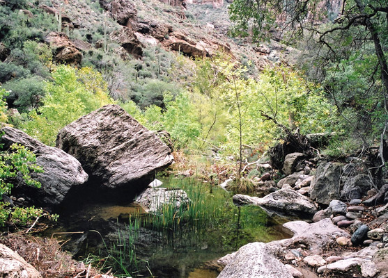
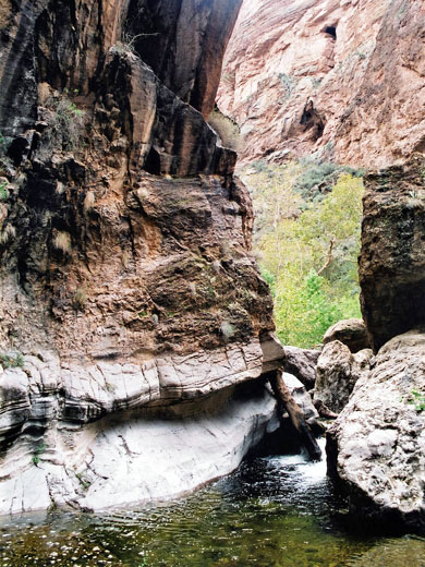
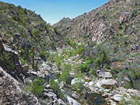
Deep canyon through the Superstition Mountains that holds a permanent stream, forming pretty pools and small cascades, enclosed by steep, volcanic rocks with many saguaro cacti. Reached by the Apache Trail, though the section around the creek is currently closed so the canyon may be inaccessible
Length: 1.5 miles, or longer
Elevation change: 270 feet
Difficulty: Moderate; navigating through often dense vegetation, and wading in the creek
Type: One way, off trail
Usage: Low
Season: All year; best time to visit is during spring, before the weather is too hot
Trailhead: Along the Apache Trail
Rating (1-5): ★★★★★
Elevation change: 270 feet
Difficulty: Moderate; navigating through often dense vegetation, and wading in the creek
Type: One way, off trail
Usage: Low
Season: All year; best time to visit is during spring, before the weather is too hot
Trailhead: Along the Apache Trail
Rating (1-5): ★★★★★

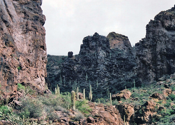
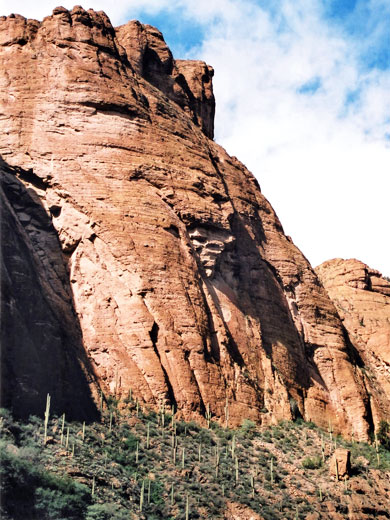
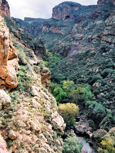
The jagged Superstition Mountains and adjacent ranges, due east of Phoenix in central Arizona, have many steep, narrowish canyons amongst great expanses of sharp, eroded, igneous rock with several peaks over 4,000 feet and a dense covering of saguaro cacti. One particularly fine canyon is formed by Fish Creek, a lengthy drainage that flows from the center of the mountains in a north-westerly direction towards the Salt River, joining it just below Apache Lake.
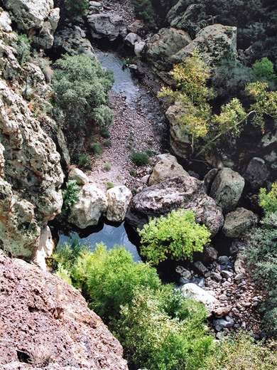
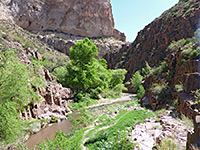
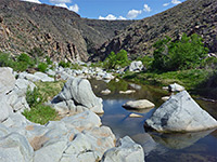
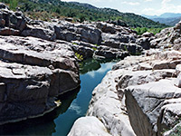
Fish Creek crosses AZ 88, the Apache Trail, 2 miles east of the point where the surface becomes unpaved, and about 25 miles from Apache Junction; there is no signpost but it is easily recognised as the road descends steeply along the edge of a deep ravine, and crosses the streamway on quite a high bridge. However, as of 2019, this section of the road is closed 'indefinitely', due to landslips following a wildfire. From this point, about one third of the creek is downstream (north) and can be explored by scrambling down and walking along the canyon floor, which has flowing water at certain times each year, usually during spring and after the flash floods of late summer. Pools, boulders and dense vegetation provide regular obstacles and this hike is somewhat strenuous. The lower section may also be reached by FR 80, a side road that links the Apache Trail with Horse Mesa Dam at the head of Apache Lake.
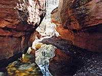
A hike upstream along Fish Creek encounters similar rock and cactus scenery but the surroundings are just a little more rugged and remote. The canyon extends a lot further - for nearly 10 miles, splits several times and meets a few back country trails including TR 110 and TR 112, so rather more time could be spent exploring. From the Apache Trail road bridge, a faint path runs along the south side of the gorge and drops down to water level; the hike ahead then involves walking on pebbles by the stream, around boulders and sometimes passing above sheer cliffs to avoid deep water channels. The rate of progress is slower then might be expected as the rocks are large and quite numerous, and there are some places when a little rock climbing is needed. The undergrowth is thick - a mixture of trees, bushes, reeds and cacti, and wading may be needed at some times of year.
Downstream
Fish Creek crosses AZ 88, the Apache Trail, 2 miles east of the point where the surface becomes unpaved, and about 25 miles from Apache Junction; there is no signpost but it is easily recognised as the road descends steeply along the edge of a deep ravine, and crosses the streamway on quite a high bridge. However, as of 2019, this section of the road is closed 'indefinitely', due to landslips following a wildfire. From this point, about one third of the creek is downstream (north) and can be explored by scrambling down and walking along the canyon floor, which has flowing water at certain times each year, usually during spring and after the flash floods of late summer. Pools, boulders and dense vegetation provide regular obstacles and this hike is somewhat strenuous. The lower section may also be reached by FR 80, a side road that links the Apache Trail with Horse Mesa Dam at the head of Apache Lake.
Upstream
A hike upstream along Fish Creek encounters similar rock and cactus scenery but the surroundings are just a little more rugged and remote. The canyon extends a lot further - for nearly 10 miles, splits several times and meets a few back country trails including TR 110 and TR 112, so rather more time could be spent exploring. From the Apache Trail road bridge, a faint path runs along the south side of the gorge and drops down to water level; the hike ahead then involves walking on pebbles by the stream, around boulders and sometimes passing above sheer cliffs to avoid deep water channels. The rate of progress is slower then might be expected as the rocks are large and quite numerous, and there are some places when a little rock climbing is needed. The undergrowth is thick - a mixture of trees, bushes, reeds and cacti, and wading may be needed at some times of year.
Upper Fish Creek - Similar Hikes
All Contents © Copyright The American Southwest | Comments and Questions | Contribute | Affiliate Marketing Disclosure | Site Map