American Southwest
Home | Categories | National Parks | Hotels | Site Map | Photographs | QTVR | Whats New? | More...
ARIZONA
Index | Introduction | Photographs | QTVR | Driving Distances | Map | Weather | Hotels


Map of Canyon de Chelly National Monument

Sites in Arizona

NPS - Landscapes
Canyon de Chelly
Chiricahua
Grand Canyon
Lake Mead
Organ Pipe
Petrified Forest
Saguaro
Sunset Crater

NPS - Historic Sites
Casa Grande Ruins
Coronado
Montezuma Castle
Pipe Spring
Tonto
Tumacacori
Tuzigoot
Walnut Canyon
Wupatki

Other Places
Apache Trail
Ironwood Forest NM
Meteor Crater
Route 66
Sedona
Sonoran Desert NM
Tonto NF
Vermilion Cliffs NM

Arizona Site Map

Follow americansouthwest.net on Facebook
Site Search

Photograph Search


Canyon de Chelly National Monument > Map

Map of Canyon de Chelly National Monument


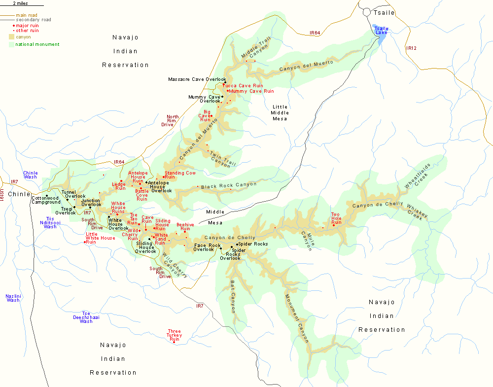
There are two scenic roads in Canyon de Chelly National Monument; Indian Reservation (IR) 7 from Chinle along the south rim of the canyon, and IR 64 along the north rim - of Canyon del Muerto, which is one of four main gorges in the canyon system. Many rough tracks cross the reservation and lead to other canyon overlooks, but travel on these requires a Navajo permit and/or guide.

PDFPDF format map of Canyon de Chelly National Monument, from the National Park Service (444 kb)
Back to Top

All contents © copyright John Crossley | Comments and questions
Arizona California Colorado Nevada New Mexico Texas Utah Wyoming Slot Canyons Travelogue