The American Southwest
Home | Parks | Trails | Plants | Canyons
Maps | Landscapes | Site Map | Whats New? |
More...
Follow americansouthwest.net on Facebook
×
General Pages
Home
Parks
Trails
Plants
Slot Canyons
Maps
Landscapes
Itineraries
Site Map
What's New?
More pages...

States
Arizona
California
Colorado
Idaho
Nevada
New Mexico
Oregon
Texas
Utah
Wyoming


ARIZONA
CALIFORNIA
COLORADO
IDAHO
NEVADA
NEW MEXICO
OREGON
TEXAS
UTAH
WYOMING
COLORADO
MAPS | PARKS | TRAILS | HOTELS

Map of Rocky Mountain National Park


Colorado > Rocky Mountain National Park > Map
Map of Rocky Mountain National Park

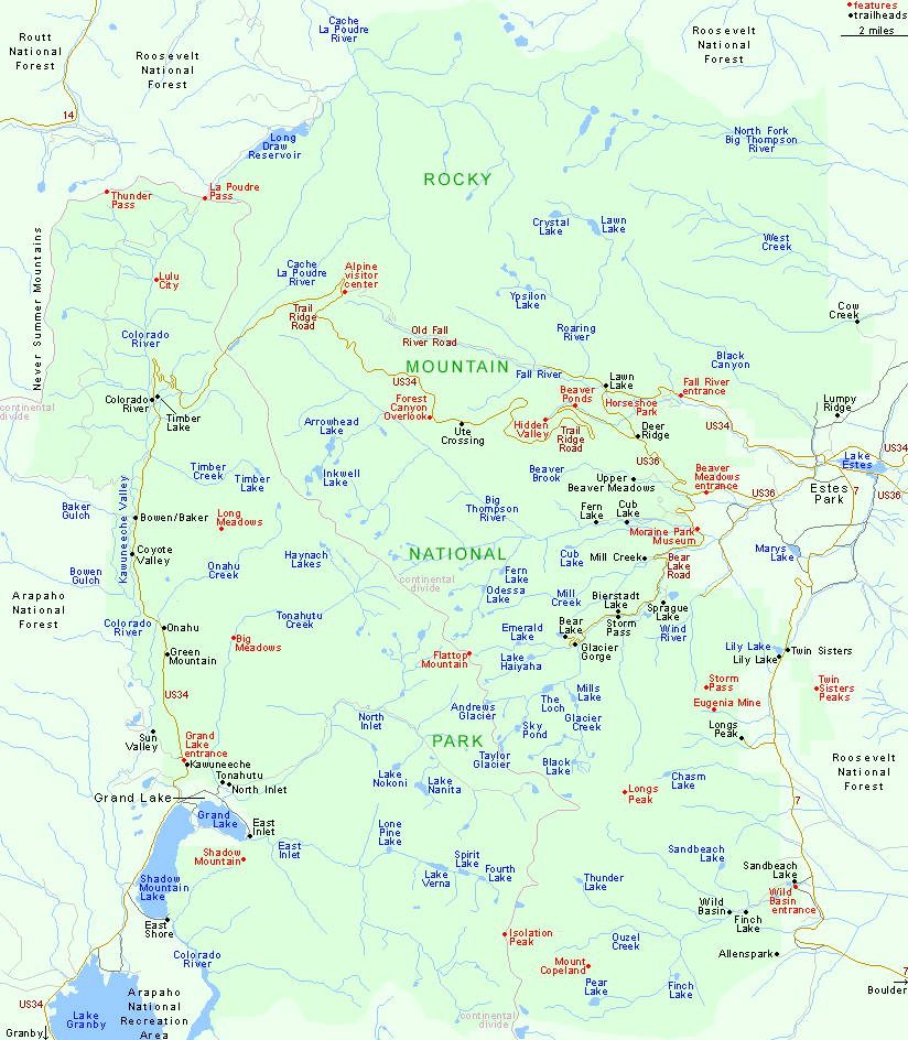
Only one road crosses Rocky Mountain National Park: US 34 between Grand Lake and Estes Park, a scenic journey of 47 miles that has a high point of 12,183 feet along Trail Ridge. Other access routes are US 36, Bear Lake Road and state highway 7, which runs south from Estes Park and passes two side roads, to the Longs Peak and Wild Basin trailheads.

For trail descriptions, see the listings for the east and west of the park.

Map of Arapaho National Recreation Area.

PDFPDF format map of Rocky Mountain National Park, from the National Park Service (2.1 mb)

Back to Top
Arizona | California | Colorado | Idaho | Nevada | New Mexico | Oregon | Texas | Utah | Wyoming | Slot Canyons | Travelogue | SOUTHWEST

All Contents © Copyright The American Southwest | Comments and Questions | Contribute | Affiliate Marketing Disclosure | Site Map