The American Southwest
Home | Parks | Trails | Plants | Canyons
Maps | Landscapes | Site Map | Whats New? |
More...
Follow americansouthwest.net on Facebook
×
General Pages
Home
Parks
Trails
Plants
Slot Canyons
Maps
Landscapes
Itineraries
Site Map
What's New?
More pages...

States
Arizona
California
Colorado
Idaho
Nevada
New Mexico
Oregon
Texas
Utah
Wyoming


ARIZONA
CALIFORNIA
COLORADO
IDAHO
NEVADA
NEW MEXICO
OREGON
TEXAS
UTAH
WYOMING
COLORADO
MAPS | PARKS | TRAILS | HOTELS

Map of Arapaho National Recreation Area


Colorado > Arapaho National Recreation Area > Map
Map of Arapaho National Recreation Area

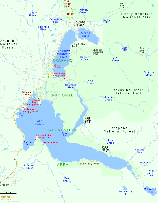
The one highway through Arapaho National Recreation Area is US 34, which heads north from US 40 near Granby and reaches Lake Granby after 6 miles, continuing past Shadow Mountain Lake and the edge of Grand Lake before entering Kawuneeche Valley in Rocky Mountain National Park, alongside the Colorado River.

Map of Rocky Mountain National Park.

Back to Top
Arizona | California | Colorado | Idaho | Nevada | New Mexico | Oregon | Texas | Utah | Wyoming | Slot Canyons | Travelogue | SOUTHWEST

All Contents © Copyright The American Southwest | Comments and Questions | Contribute | Affiliate Marketing Disclosure | Site Map