The American Southwest
Home | Parks | Trails | Plants | Canyons
Maps | Landscapes | Site Map | Whats New? |
More...
Follow americansouthwest.net on Facebook
×
General Pages
Home
Parks
Trails
Plants
Slot Canyons
Maps
Landscapes
Itineraries
Site Map
What's New?
More pages...

States
Arizona
California
Colorado
Idaho
Nevada
New Mexico
Oregon
Texas
Utah
Wyoming


ARIZONA
CALIFORNIA
COLORADO
IDAHO
NEVADA
NEW MEXICO
OREGON
TEXAS
UTAH
WYOMING
CALIFORNIA
MAPS | PARKS | TRAILS | HOTELS

Map of the Salton Sea


California > Salton Sea > Map
Map of the Salton Sea

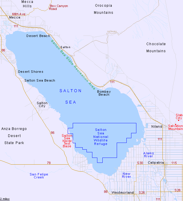
Highway 111 runs along the east side of the Salton Sea between Mecca and Niland, always within sight of the shoreline. On the west side, the busier Highway 86 stays a few miles from the shore, but access to the lake is possible at several small towns like Desert Shores and Salton Sea Beach.

Back to Top
Arizona | California | Colorado | Idaho | Nevada | New Mexico | Oregon | Texas | Utah | Wyoming | Slot Canyons | Travelogue | SOUTHWEST

All Contents © Copyright The American Southwest | Comments and Questions | Contribute | Affiliate Marketing Disclosure | Site Map