The American Southwest
Home | Parks | Trails | Plants | Canyons
Maps | Landscapes | Site Map | Whats New? |
More...
Follow americansouthwest.net on Facebook
×
General Pages
Home
Parks
Trails
Plants
Slot Canyons
Maps
Landscapes
Itineraries
Site Map
What's New?
More pages...

States
Arizona
California
Colorado
Idaho
Nevada
New Mexico
Oregon
Texas
Utah
Wyoming


ARIZONA
CALIFORNIA
COLORADO
IDAHO
NEVADA
NEW MEXICO
OREGON
TEXAS
UTAH
WYOMING
CALIFORNIA
MAPS | PARKS | TRAILS | HOTELS

Map of Point Reyes National Seashore


California > Point Reyes National Seashore > Map
Map of Point Reyes National Seashore

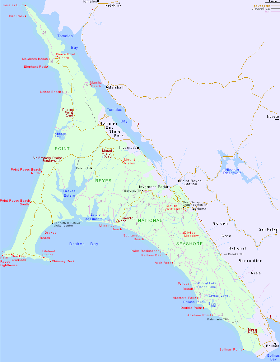
Major trails are identified by a number, corresponding to the description on the trail listings page.

Point Reyes National Seashore is accessed from Hwy 1; the park headquarters in Bear Valley is half way (35 miles) between San Francisco and Bodega Bay. Other approach routes include Sir Francis Drake Blvd from San Rafael, and Novato Blvd/Point Reyes Petaluma Road from Novato.

PDFPDF format maps of Point Reyes National Seashore, from the National Park Service:
Detail map (876 kb); area map (76 kb); north trail map (512 kb); south trail map (688 kb).

Back to Top
Arizona | California | Colorado | Idaho | Nevada | New Mexico | Oregon | Texas | Utah | Wyoming | Slot Canyons | Travelogue | SOUTHWEST

All Contents © Copyright The American Southwest | Comments and Questions | Contribute | Affiliate Marketing Disclosure | Site Map