The American Southwest
Home | Parks | Trails | Plants | Canyons
Maps | Landscapes | Site Map | Whats New? |
More...
Follow americansouthwest.net on Facebook
×
General Pages
Home
Parks
Trails
Plants
Slot Canyons
Maps
Landscapes
Itineraries
Site Map
What's New?
More pages...

States
Arizona
California
Colorado
Idaho
Nevada
New Mexico
Oregon
Texas
Utah
Wyoming


ARIZONA
CALIFORNIA
COLORADO
IDAHO
NEVADA
NEW MEXICO
OREGON
TEXAS
UTAH
WYOMING
CALIFORNIA
MAPS | PARKS | TRAILS | HOTELS

Map of Mono Lake


California > Mono Lake > Map
Map of Mono Lake

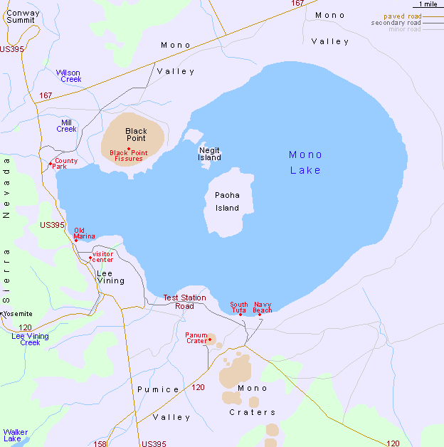
The closest approach to Mono Lake is from US 395 which runs along the west shore, passing several shoreline access points. CA 167 gives good views of the lake from the north, but is separated from the water by several miles of salt flats. The South Tufa formations and Navy Beach are reached by short tracks branching off CA 120, or by the gravel Test Station Road from US 395.
Back to Top
Arizona | California | Colorado | Idaho | Nevada | New Mexico | Oregon | Texas | Utah | Wyoming | Slot Canyons | Travelogue | SOUTHWEST

All Contents © Copyright The American Southwest | Comments and Questions | Contribute | Affiliate Marketing Disclosure | Site Map