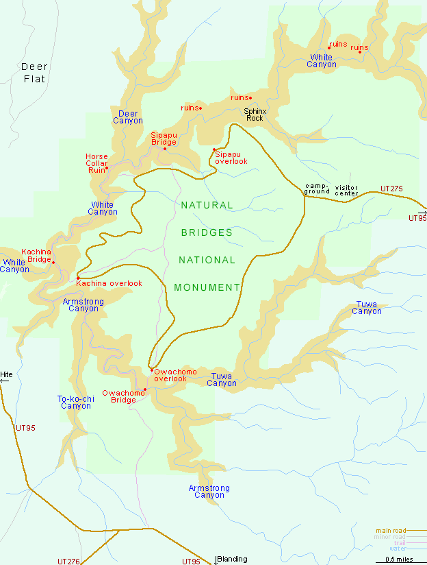
The entrance to Natural Bridges National Monument is 4 miles along UT 275, a short side road branching off UT 95, 30 miles from the junction with US 191 near Blanding. Once past the visitor center and campground, the 9 mile loop drive through the monument becomes one-way (counter-clockwise), as it passes 3 main trailheads and about a dozen viewpoints, of the bridges, an Anasazi cliff dwelling (Horse Collar Ruin), and the branched canyons that encircle the road.
Topographic map for the Natural Bridges loop trail.
All Contents © Copyright The American Southwest | Comments and Questions | Contribute | Affiliate Marketing Disclosure | Site Map