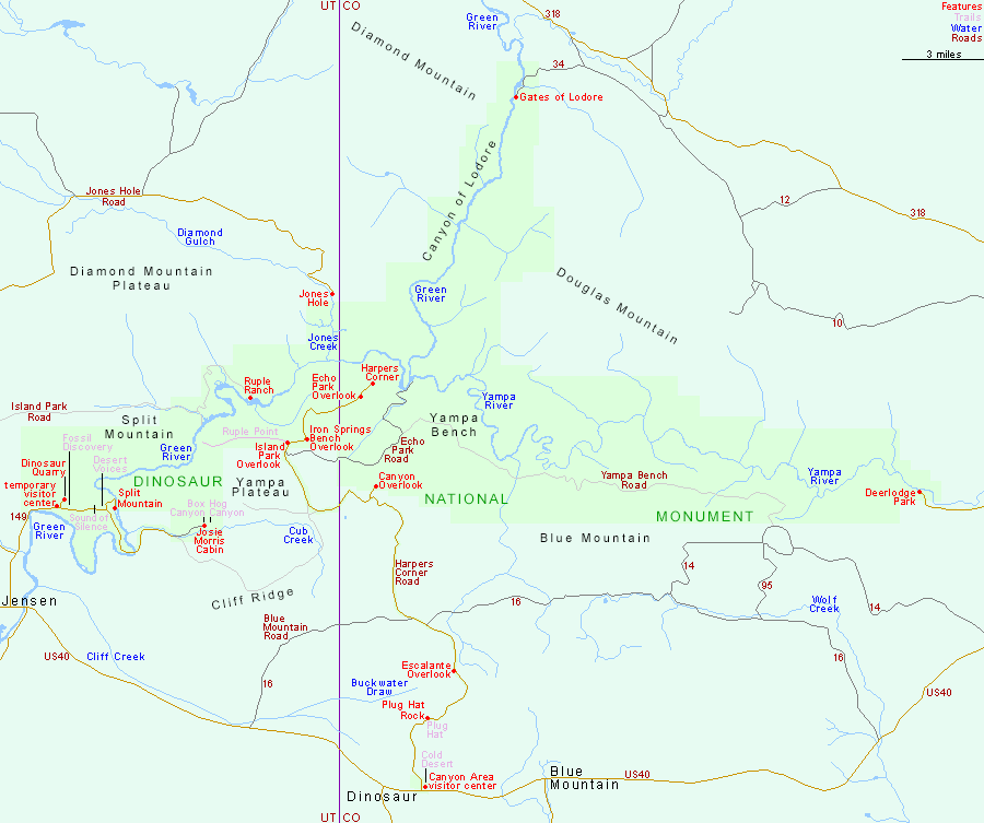
There are five paved roads entering Dinosaur National Monument. The three least used are to Gates of Lodore in the north, Jones Hole in the northwest and Deerlodge Park in the east. Rather more people take the 30 mile Harpers Corner Road, which leads from US 40 near Dinosaur to an overlook of the confluence of the Green and Yampa Rivers, but by far the most used approach is the short road north from Jensen; this passes the main national monument visitor center, the Dinosaur Quarry, and Split Mountain, then crosses the Green River en route to several pictograph panels, a historic cabin, and two shady box canyons.
All Contents © Copyright The American Southwest | Comments and Questions | Contribute | Affiliate Marketing Disclosure | Site Map