UTAH


Map of Capitol Reef National Park

Sites in Utah

NPS Units
Arches
Bryce Canyon
Canyonlands
Capitol Reef
Cedar Breaks
Dinosaur
Glen Canyon
Golden Spike
Hovenweep
Natural Bridges
Timpanogos Cave
Zion

Other Places
Antelope Island
Cedar Mesa
Dead Horse Point
Flaming Gorge
Goblin Valley
Grand Staircase
Kodachrome Basin
Monument Valley
Mount Timpanogos
Red Canyon
Snow Canyon

Utah Site Map

Follow americansouthwest.net on Facebook
Site Search

Photograph Search


Capitol Reef National Park > Park Map

Map of Capitol Reef National Park


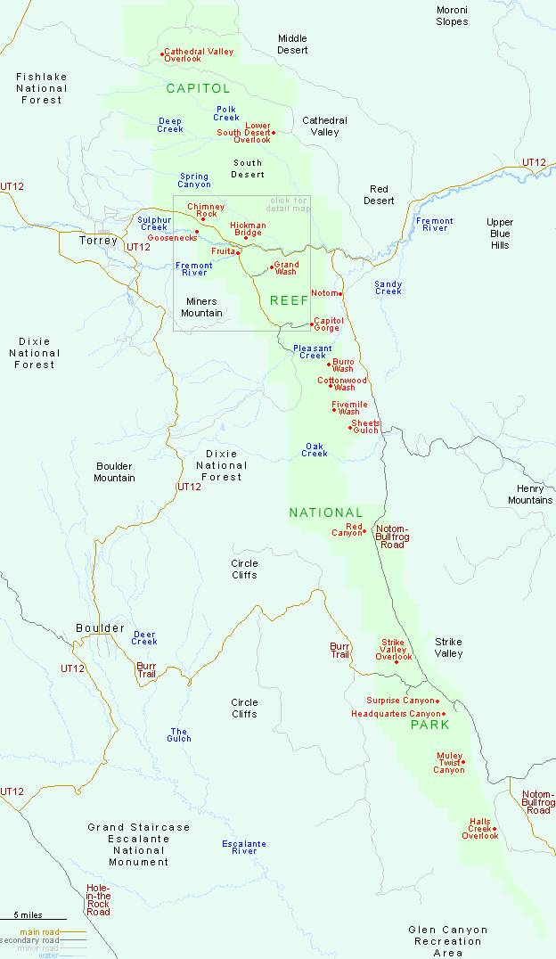
Trail map for Capitol Reef.

PDFPDF format map of Capitol Reef National Park, from the National Park Service (428 kb).

Trail map for Capitol Reef National Park The main access to Capitol Reef National Park is by UT 24, which crosses the park towards the north end, following alongside the Fremont River. Sites to the east may be reached by the mostly unpaved Notom-Bullfrog Road, while the only other paved route to the park is the Burr Trail in the southwest, though this too becomes unpaved as it approaches Capitol Reef.


Back to Top

All Contents © Copyright John Crossley | Comments and Questions | Site Map

Arizona California Colorado Nevada New Mexico Oregon Texas Utah Wyoming Slot Canyons Travelogue