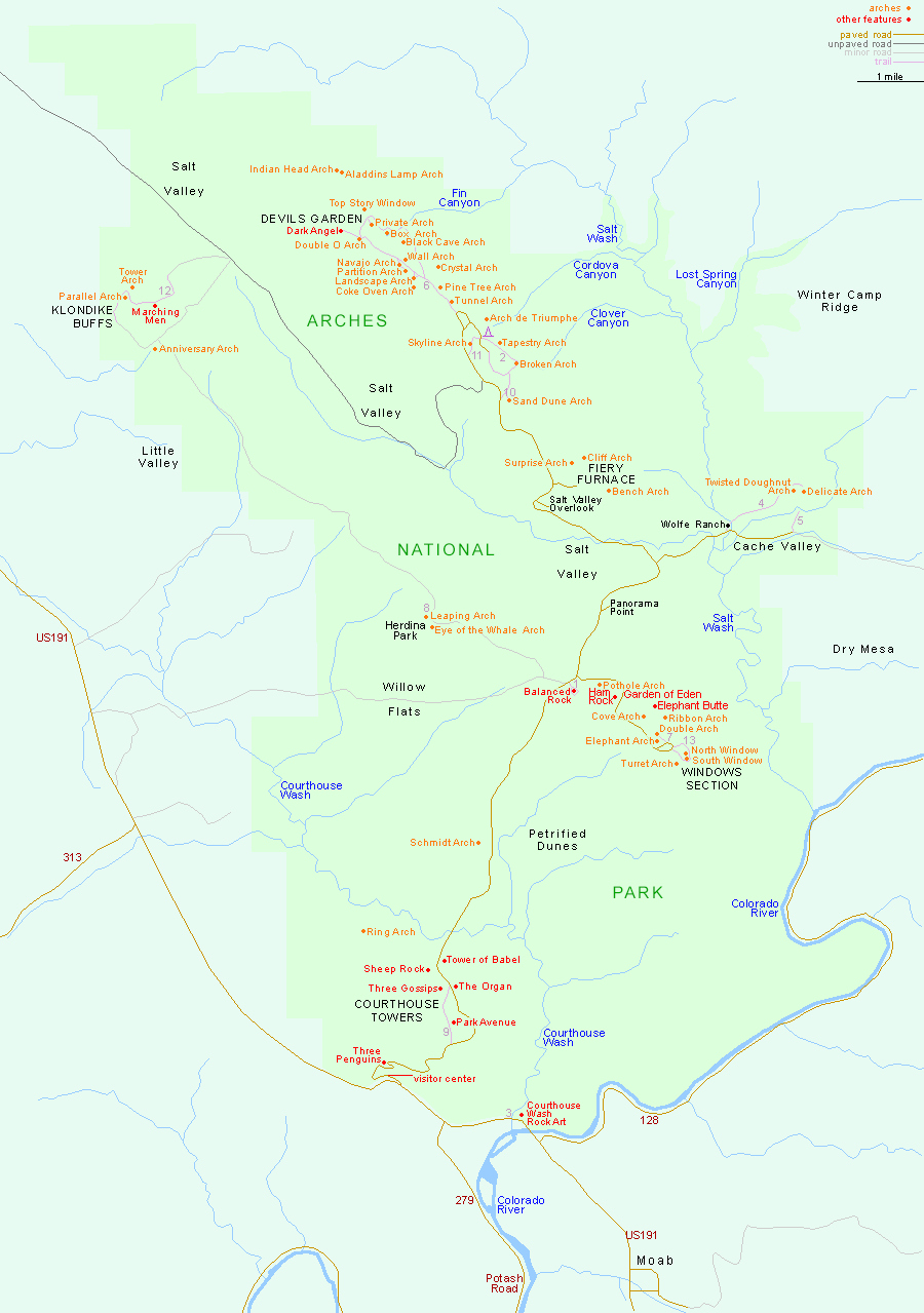
American Southwest
Home | Categories | National Parks | Hotels | Site Map | Photographs | QTVR | Whats New? | More...
UTAH
Index | Introduction | Photographs | QTVR | Driving Distances | Map | Weather | Hotels


Map of Arches National Park

Sites in Utah

NPS Units
Arches
Bryce Canyon
Canyonlands
Capitol Reef
Cedar Breaks
Dinosaur
Glen Canyon
Hovenweep
Natural Bridges
Zion

Other Places
Dead Horse Point
Flaming Gorge
Goblin Valley
Grand Staircase
Kodachrome Basin
Monument Valley
Mount Timpanogos
Red Canyon
Snow Canyon

Utah Site Map

Site Search


Arches National Park > Map

Arches National Park - Map

The entrance to Arches National Park on US 191 is 26 miles south of interstate 70 and 5 miles north of Moab, Utah.

PDFPDF format map of Arches National Park, from the National Park Service (444 kb).


Back to Top

All contents © copyright John Crossley | Comments and questions
Arizona California Colorado Nevada New Mexico Texas Utah Wyoming Slot Canyons Travelogue