Highlights:
The larger, eastern section of Saguaro National Park, generally higher in elevation than the west, though still with a sizeable area of desert lowlands. Plenty of trails, some suitable for backpacking
Seasons:
All year; very hot in summer, though some paths climb to the cooler mountains

Seventeen miles east of the center of Tucson, the Rincon Mountains section of Saguaro National Park is the larger and more remote of the two halves of the preserve, and includes an extensive mountainous area with hills as high as 8,664 feet (Mica Mountain). The western edge lies adjacent to the town suburbs, bordered in part by streets of the Tucson grid system, and some nearby areas of desert with plentiful saguaro are steadily being cleared, replaced by new trailer parks and luxury gated estates, as the town continues to expand eastwards.
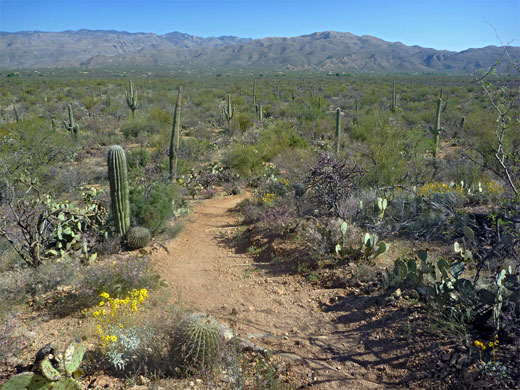
The cacti here are as large but grow slightly less dense than those at Tucson Mountain in the west, with more intervening bushes and other vegetation so the overall effect is not quite so dramatic. Faced with a choice between the two, the west is preferable for a short visit, though the east offers many more opportunities for extended hiking, and is the only region where backpacking is permitted.
The cacti here are as large but grow slightly less dense than those at Tucson Mountain in the west, with more intervening bushes and other vegetation so the overall effect is not quite so dramatic. Faced with a choice between the two, the west is preferable for a short visit, though the east offers many more opportunities for extended hiking, and is the only region where backpacking is permitted.
Saguaro East Table of Contents
Location
Map of the Rincon Mountain district.
Photographs
All Saguaro NP photographs.
Exploration of the Park
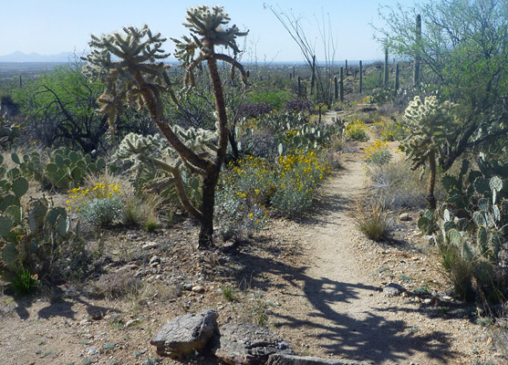
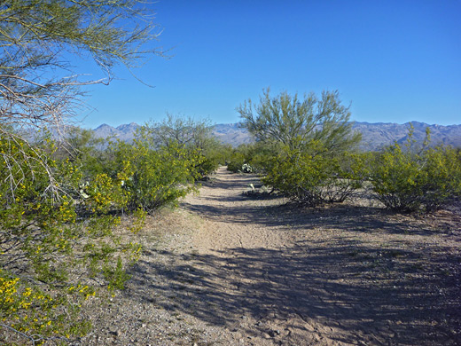
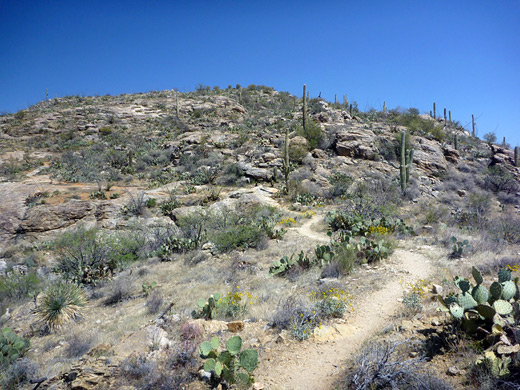
From the park entrance at the junction of Freeman Road with the Old Spanish Trail, a paved one-way road (the 8 mile Cactus Forest Drive) loops over undulating land and gives a good impression of the landscape, especially the southern section which climbs a little and passes over foothills of the west end of Tanque Verde Ridge, where the saguaro are especially plentiful since they prefer gently sloping ground with better drainage. Several short foot paths along this drive allow for a closer view of the scenery; one is the Desert Ecology trail which has interpretative notices explaining aspects of desert life, although it is located on a flat sandy area without many saguaros.
There is also a longer hike across the middle of the loop (the Cactus Forest Trail) that winds for 5.5 miles through the desert, across washes and over low hills. The Cactus Forest Drive was completely resurfaced in the summer of 2006 and now has improved parking areas and 12 new roadside exhibits, though it remains a slow journey; a complete curcuit takes around 25 minutes. Along the way are two short spur roads to picnic areas/trailheads - Javelina (paved) and Mica View (unpaved). A network of trails cross the lowest slopes of Tanque Verde Ridge in the northwest corner, through grasslands and riparian areas as well as cactus groves.
Backcountry of the Rincon Mountains
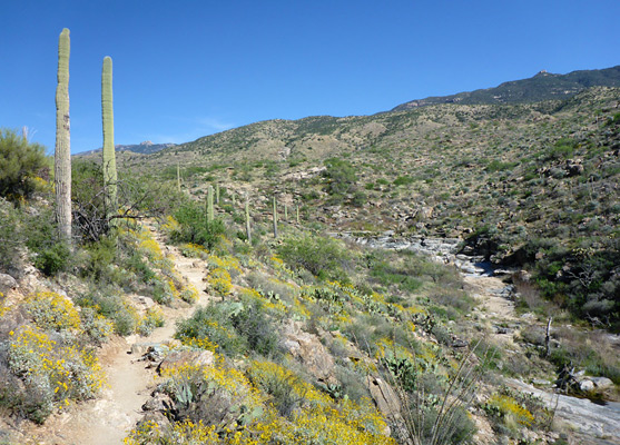
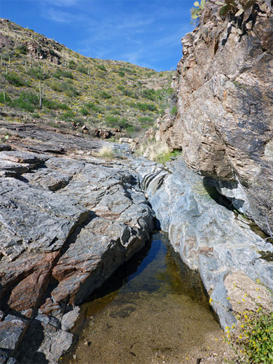
Cacti do not grow at the higher elevations in the east which make up the majority of the Rincon Mountains district - instead grassland, bushes and eventually fir and pine trees are found. Apart from the Cactus Forest Drive, the short paths at the western edge and several other roads that border the west side (Camino Loma Alta, Broadway Blvd, Speedway Blvd), most of the eastern half of Saguaro National Park is accessible only by a network of long paths, most popular being the Tanque Verde Ridge Trail, and to explore the area fully needs at least one night spent at one of the park's six back-country campsites. The Coronado National Forest borders the park to the north, east and southeast, and this too has many possibilities for exploration.
Camping in the Rincon Mountain District
A forest of saguaro is truly a unique sight and it is especially striking at sunset; everyone should try to camp for a night in such a place. Although there are no campsites accessible to cars in either half of the park, the saguaro cacti are similarly widespread across many other areas of Arizona where (free) camping is possible, such as along side roads off I-10 southeast of Tucson, around US 93 northwest of Congress or in the Tonto National Forest, northeast of Phoenix. The closest location to the Rincon Mountain district is along Pistol Hill Road, ten miles southeast.
Trails of Saguaro East
All trails in the Rincon Mountain region
Featured Saguaro Trails
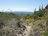
Douglas Spring Trail
★★★★★
★★★★★
8.8 miles, 3,550 feet
Long path ascending steadily past different types of vegetation, passing several small streams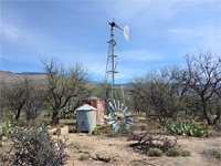
Hope Camp Trail
★★★★★
★★★★★
2.8 miles, level
Old vehicle track across open terrain, past many cacti, to the remains of two cattle stations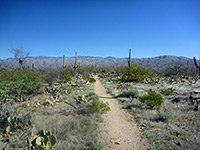
Loma Verde/Squeeze Pen Trails
★★★★★
★★★★★
3 miles, 120 feet
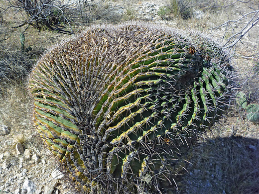
Loop through gentle terrain of small washes and low plateaus, past flourishing cacti including many giant saguaro and ferocacti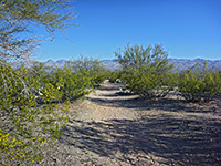
Mica View Trail
★★★★★
★★★★★
1 miles, 40 feet
Wide, level path through open terrain with saguaro and bushes; views of the Santa Catalina Mountains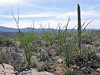
Ridge View Trail
★★★★★
★★★★★
1.1 miles, 330 feet
Easy route to a small hill; unobstructed views over Rincon Valley and Tanque Verde Ridge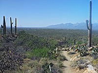
Tanque Verde Ridge Trail
★★★★★
★★★★★
11 miles, 3900 feet
Main route into the high elevation backcountry of Saguaro National Park, climbing steadily through several vegetation zonesAll Contents © Copyright The American Southwest | Comments and Questions | Contribute | Affiliate Marketing Disclosure | Site Map