ARIZONA


Map of Lake Mead National Recreation Area


Sites in Arizona

NPS - Landscapes
Canyon de Chelly
Chiricahua
Grand Canyon
Lake Mead
Organ Pipe
Petrified Forest
Saguaro
Sunset Crater

NPS - Historic Sites
Casa Grande Ruins
Coronado
Montezuma Castle
Navajo
Pipe Spring
Tonto
Tumacacori
Tuzigoot
Walnut Canyon
Wupatki

Other Places
Apache Trail
Ironwood Forest NM
Meteor Crater
Route 66
Sedona
Sonoran Desert NM
Tonto NF
Vermilion Cliffs NM

Arizona Site Map

Follow americansouthwest.net on Facebook
Site Search

Photograph Search


Lake Mead National Recreation Area > Map

Map of Lake Mead National Recreation Area


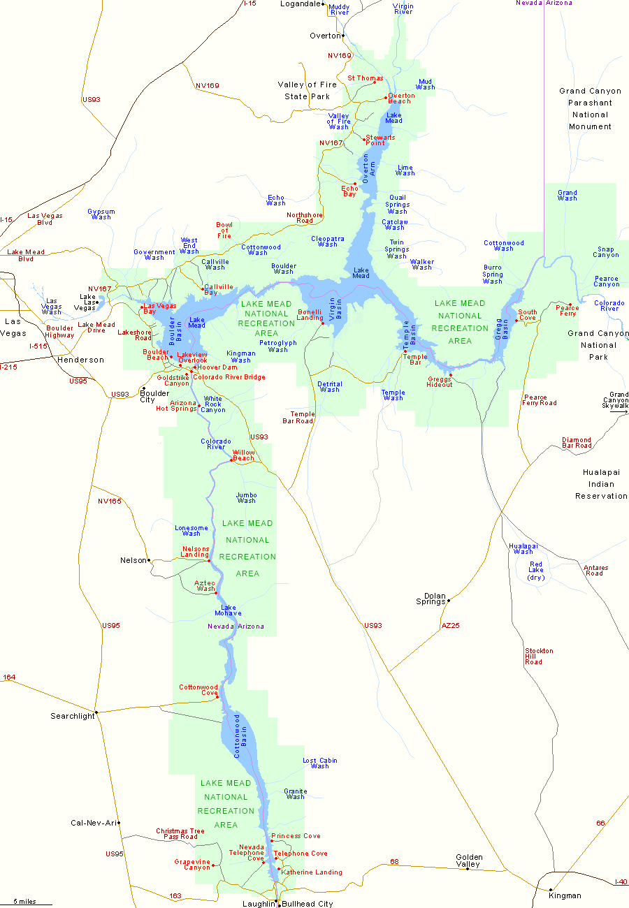
Detail map of the Hoover Dam area.

Although Lake Mead National Recreation Area covers a huge area, from Overton 100 miles south to Davis Dam near Bullhead City, and from Lake Las Vegas 60 miles east to Pearce Ferry, most is rather inaccessible. The main sites are concentrated along the west shore, from Hoover Dam to Callville Bay, though on the south shore, Temple Bar also sees quite a few visitors, who come mainly for boating and fishing.

PDFPDF format map of Lake Mead National Recreation Area, from the National Park Service (792 kb)
Back to Top

All Contents © Copyright John Crossley | Comments and Questions | Site Map

Arizona California Colorado Nevada New Mexico Oregon Texas Utah Wyoming Slot Canyons Travelogue