The American Southwest
Home | Parks | Trails | Plants | Canyons
Maps | Landscapes | Site Map | Whats New? |
More...
Follow americansouthwest.net on Facebook
×
General Pages
Home
Parks
Trails
Plants
Slot Canyons
Maps
Landscapes
Itineraries
Site Map
What's New?
More pages...

States
Arizona
California
Colorado
Idaho
Nevada
New Mexico
Oregon
Texas
Utah
Wyoming


ARIZONA
CALIFORNIA
COLORADO
IDAHO
NEVADA
NEW MEXICO
OREGON
TEXAS
UTAH
WYOMING
TEXAS
MAPS | PARKS | TRAILS | HOTELS

Map of Guadalupe Mountains National Park


Texas > Guadalupe Mountains National Park > Map
Map of Guadalupe Mountains National Park

The main entrance to Guadalupe Mountains National Park (Pine Spring Canyon) is along US 62/180, 110 miles from El Paso and 55 miles from Carlsbad, New Mexico. Although only 7.5 miles distant, the north park entrance in Dog Canyon is 102 miles away by road. Other access points are at Frijole Ranch, McKittrick Canyon and Williams Ranch, this latter reached by a 7 mile 4WD track.

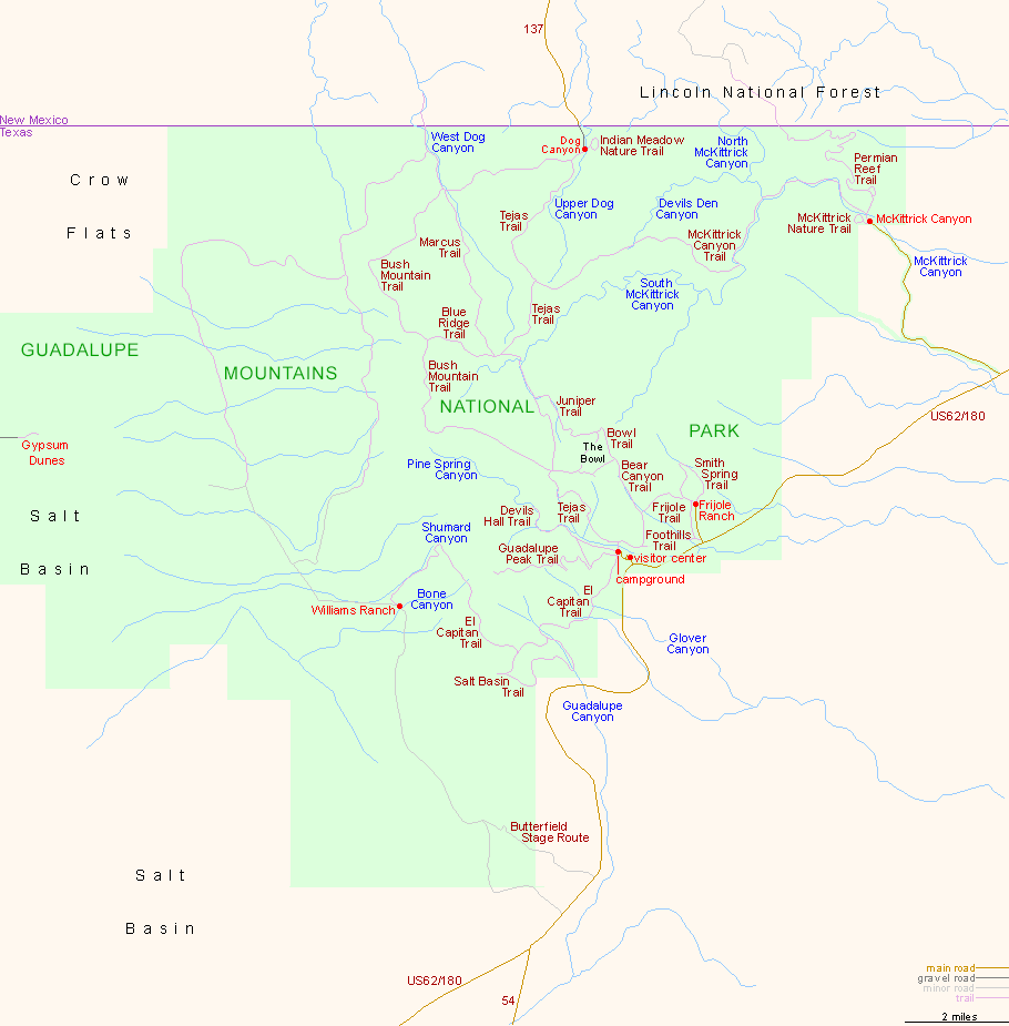
For trail descriptions, see the Guadalupe Mountains hiking index.

PDF format maps of Guadalupe Mountains National Park, from the National Park Service:
PDFOverview area map (472 kb)
Detailed park map (604 kb)

Back to Top
Arizona | California | Colorado | Idaho | Nevada | New Mexico | Oregon | Texas | Utah | Wyoming | Slot Canyons | Travelogue | SOUTHWEST

All Contents © Copyright The American Southwest | Comments and Questions | Contribute | Affiliate Marketing Disclosure | Site Map