Highlights:
Small state park along the Pacific coast, containing a wind-swept promontory above 200 foot cliffs, with spectacular views of sea stacks, isolated coves and distant beaches. Park also contains a historic lifeboat station
Nearby towns:
Bandon, 27 miles
Management:
Location:
Seasons:
All year
Rating (1-5):
★★★★★

Port Orford Heads is part of the Southwest Oregon itinerary
Port Orford is one of the few significant towns reached by US 101 along the south Oregon coast, and sits just inland from a wind swept promontory, lined by steep, 200 foot cliffs sheltering several inaccessible coves, and interrupting a generally sandy section of the shoreline; beaches and estuarine habitats stretch 6 miles north to Cape Blanco, while another beach curves southeast towards the next hilly area, Humbug Mountain.
The promontory is contained within Port Orford Heads State Park, a small and little visited preserve, free to enter, that also protects a historic lifeboat station that was in operation from 1934 to 1970. This includes a museum, outside exhibits, a ranger residence, several outbuildings and the boat house, still holding the 36 foot vessel, all situated in a clearing in the middle of a patch of woodland (also home to a small herd of blacktail deer), without any sea views. But short paths lead to ocean overlooks, and while there is no access to the shore due to the steep cliffs, unlike the geographically similar Cape Arago State Park, the place is a good location for far reaching views up and down the coast and of the dramatic offshore rocks, well worth visiting for an hour or two.
The promontory is contained within Port Orford Heads State Park, a small and little visited preserve, free to enter, that also protects a historic lifeboat station that was in operation from 1934 to 1970. This includes a museum, outside exhibits, a ranger residence, several outbuildings and the boat house, still holding the 36 foot vessel, all situated in a clearing in the middle of a patch of woodland (also home to a small herd of blacktail deer), without any sea views. But short paths lead to ocean overlooks, and while there is no access to the shore due to the steep cliffs, unlike the geographically similar Cape Arago State Park, the place is a good location for far reaching views up and down the coast and of the dramatic offshore rocks, well worth visiting for an hour or two.
Port Orford Heads Table of Contents
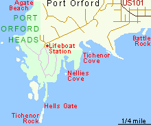
Map of Port Orford Heads State Park
Tours of the Oregon Coast
Day trips to the coast, from Portland.
Photographs
10 views of the state park.
The State Park
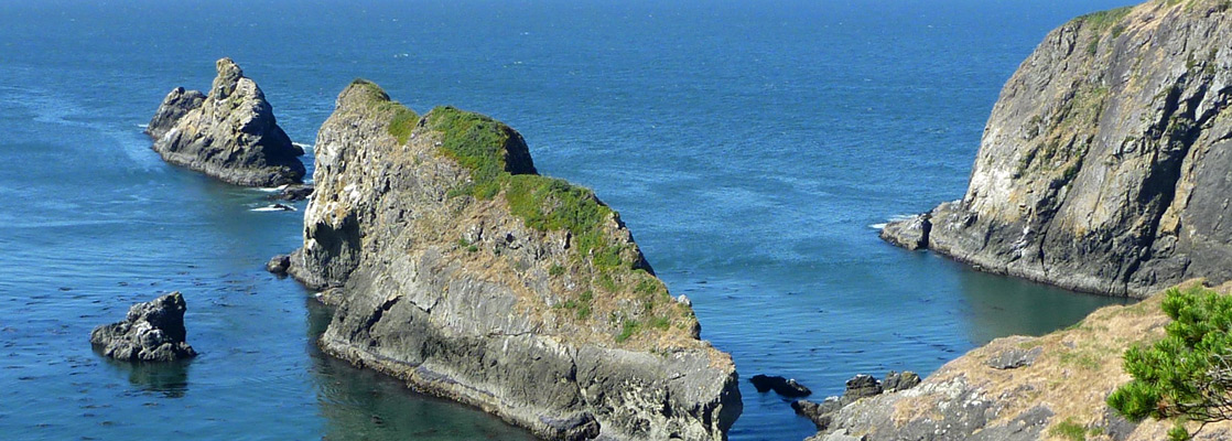
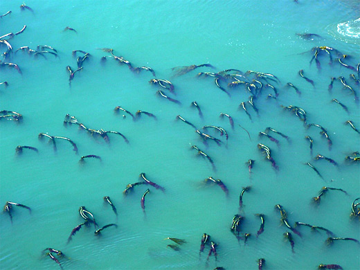
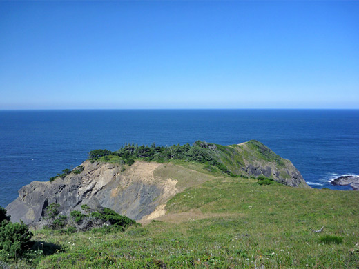
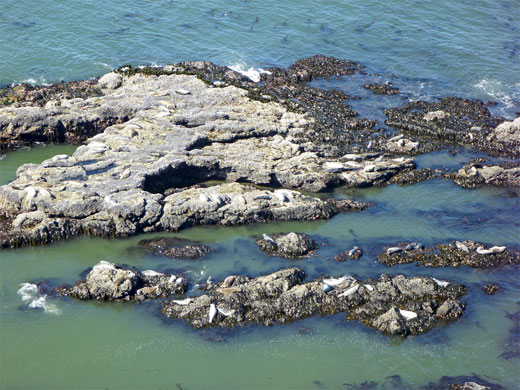
The day use state park is signed from US 101 in Port Orford town center, accessed by 9th Street and later Coast Guard Road, an undulating route passing houses while climbing to the forested top of the promontory, ending at a parking area next to the lifeboat station. A 1.2 mile trail loops around the perimeter of the peninsula and links with two short spurs to overlooks; first (Headland Trail) is northwest, descending part of the way down a sloping, grassy ridge bearing clumps of stunted, wind-blown trees. This has views of an isolated beach below, on the north side, the much longer Agate Beach beyond, and more of the coast all the way to distant Cape Blanco. The land falls away equally precipitously to the southwest, where the cliffs plunge down to hidden coves and jagged sea stacks, all surrounded by deep, turquoise-blue water and pounded by fierce waves. The other spur trail is due south, leading to a more restricted viewpoint, partly enclosed by bushes - once the site of the lifeboat station's lookout tower. The best views are from further round the loop, right at the south edge of the peninsula, where a section of the cliffs projects south forming a long narrow ridge, then a gap (Hells Gate), and then a detached segment of the same stratum (Tichenor Rock). This can only be seen properly by hiking off trail a short distance, down a wooded slope to the very edge of the cliffs.
Nellies Cove and Battle Rock
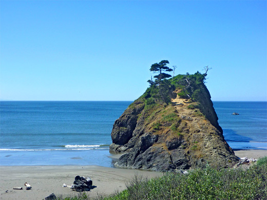
Back on the path, the final overlook is of Nellies Cove, a sheltered inlet 200 feet below, location of the remains of the lifeboat launch, not publicly accessible. Again the land drops down very steeply, to a deep water bay between near vertical cliffs. To the east, the next parts of the shoreline (Tichenor Cove and Graveyard Point) are privately owned, but public beaches, and Port Orford Harbor, begin just beyond. The best feature is Battle Rock, an isolated, steep sided rocky remnant topped by a few trees, bordered by sandy beaches on both sides. The sands extend a long way southeast, towards Humbug Mountain, while several other rocks project above the waves a little way out to sea. This part of the coast is easily explored starting from several parking areas just off US 101.
All Contents © Copyright The American Southwest | Comments and Questions | Contribute | Affiliate Marketing Disclosure | Site Map